Jewels of Malaga
Montejaque, the Serranía de Ronda village built amongst huge limestone rocks
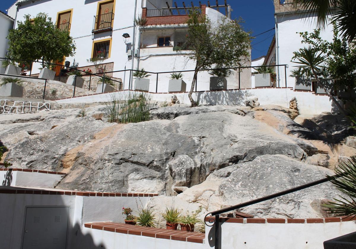
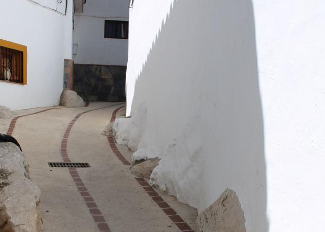
The Barrio Nazarí is a hectic labyrinth of streets and alleyways that over the centuries has grown to incorporate rocks of all sizes to create a truly spectacular neighbourhood

Montejaque
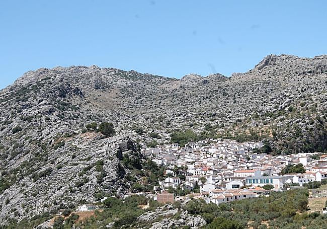
A large part of its municipal borders are set within the natural park of the Sierra de Grazalema, there's a hiking trail for people who don't suffer from vertigo next to a dam that never managed to become a proper reservoir and it also has one of the most spectacular caves in Andalucía. Montejaque is one of the villages to the west of Malaga province that can boast some of the best scenic and adrenaline experiences. From the Cueva del Hundidero cave system to the Llanos de Líbar mountain plains and Los Caballeros dam, now with a vertiginous via ferrata that opened just a few weeks ago. Still, not even all these attractions can eclipse one of the architectural jewels of the Serranía de Ronda. It is one of those villages that long ago made a pact with the limestone rock on which it stands and which it has absorbed to form part of its own streets, paths, houses and gardens.
This peculiarity, which can be seen to a greater or lesser extent in other villages in the surrounding area - for example, in neighbouring Benaoján - can best be seen in the so-called Barrio Nazarí, a network of streets that climb up behind the town hall, next to the main village square (Plaza de la Constitución) and a stone's throw from the church of Santiago El Mayor.
To see how effectively the village has merged with the local geology, it's best to head up to the Escarihuela shrine to the Virgin Mary
This is the starting point of an intense, intriguing trail, where the stones of this mountain range are just another element of interest - some appear more discreetly and others really stand out. The rockface is almost seamlessly integrated into the old village quarter, where not only the whiteness of the façades or the old tiles get noticed. It is a labyrinth where you have to let yourself be led, always upwards, from the main square itself.
The path then leads to the castle viewpoint, which actually shows one of the many karsts that Montejaque can boast of, formed centuries ago by the limestone bedrock being eroded by dissolution, creating ridges, towers, fissures, caves and underground streams and channels.
This natural balcony viewpoint, which forms the crossover point from village to mountain, is your goal. But you should not be in a hurry to reach it - just enjoy the presence of these stones. Many of them are to be found in the more winding and narrow streets, but there is one in particular that allows one of the few open spaces in this old quarter to show off these great chunks of rock. The Barrio Nazarí is certainly one of the places you should visit if you come to this village in the Serranía de Ronda.
Shrine of the Virgen de la Escarihuela
In the height of summer hiking trips should be done early morning or late afternoon to avoid too much exposure to the sun. In addition to the Barrio Nazarí, it is a good idea to go up to the shrine of the Virgen de la Escarihuela, located on the right just before the village entrance coming from Benaoján. From the municipal cemetery it is a climb of about 800 metres to reach this chapel. From up there, or during the climb, you will be able to get a good view that clearly shows Montejaque's alliance with the many rocks surrounding it.
The limestone rock also plays a leading role in other landscapes around Montejaque. A good example is the geological curiosity of Llanos de Líbar, one of the jewels of the Sierra de Grazalema Natural Park. This impressive area, which is located at an altitude of about 1,000 metres above sea level, is a rocky setting that Montejaque shares with Benaoján and Cortes de la Frontera.
Bird-watching paradise
There is a path climbing up from the village itself (and a track for vehicle access). Thanks to this you soon enter more limestone territory where you can see some spectacular, geological phenomena, particularly the polje (a large flat plain or depression surrounded by walls or towers of karsts). The hiking trails and track pass through the middle of the polje - a bird-watching paradise.
The limestone rock is also fundamental to understanding the cave and underground streams made up of the aforementioned Cueva del Hundidero and Presa de los Caballeros. The former has a cave mouth made to impress any visitor at more than fifty metres high. The second, with more than a century of history, never managed to dam water properly because the limestone allowed the water to drain away, escaping into the underground channels formed by natural erosion and the dissolving of the bedrock.
Both geological features are fully accessible. The cave can be reached by a steep path climbing down to the tall entrance to the cave and the dam can be reached via a vertiginous, but safe-to-walk, path. From there you can take on an even more demanding challenge, a walk on a suspended, Tibetan rope bridge across the empty dam. This latter adventure is only suitable for those who are used to Spain's Via Ferrata climbing routes and are carrying the right technical and safety equipment, along with previous experience.