Weather
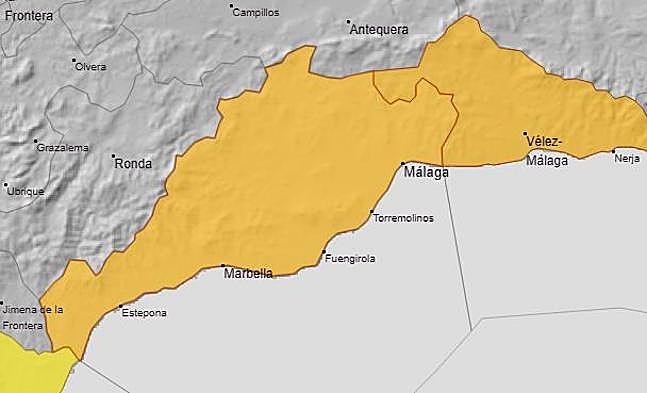
Aemet upgrades weather alert to amber for heavy rain and thunderstorms in Malaga and on Costa del Sol today
In the areas of the province affected, there is the possibility of downpours of more than 30mm in one hour and an accumulation of 60mm in 12 hours

Malaga
The situation of uncertainty about the location of the latest storms to hit Spain is becoming clearer. It has led the state weather agency to activate amber warnings for heavy rain and thunderstorms this Thursday 12 December in parts of Malaga province, due to downpours of more than 30mm in one hour, and 60mm in 12 hours. Yesterday, Aemet initially activated a yellow alert for the Axarquía but now it has been extended and upgraded to Malaga city, the western Costa del Sol and Guadalhorce valley, where the largest amount of rain is expected.
This will happen when after yesterday, Wednesday, the first episode was experienced, especially in coastal areas of the Axarquía region. Although the rainfall was not particularly intense, the day became a showcase of winter weather phenomena. In addition to the showers, there was light snowfall at the high altitudes of the Sierra de Tejeda, Almijara and Alhama, and the winter cold was particularly noticeable.
To top it all off, a new sea swell swept along the coast in front of Benalmádena, making it five such phenomena since the end of October.
Temperatures
Starting with temperatures, the minimum on the Malaga Airport thermometer (which is the statistical reference for Aemet) was only 3.5C yesterday, at 8am in the morning. At 2pm it was still below 15 degrees, so the feeling of cold was evident for most of the people of Malaga throughout the day. As for rainfall, there were only a few showers, still not very significant: 12mm in Torre del Mar (until 3pm); 7.2 in La Araña; 7.1 at the La Viñuela reservoir (which is the best news of the day, because it will help to support water reserves). As well as 5.9mm in the Benamargosa river; 5.3 in El Trapiche and 5mm in Santón Pitar, in Los Montes de Málaga.
Related news
-
Ignacio Lillo / Eugenio Cabezas
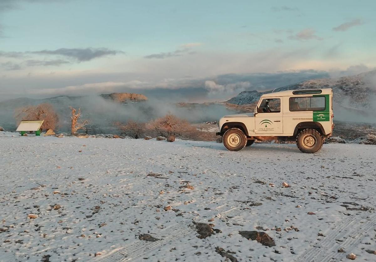
The Aemet forecast also gave a certain probability of snowfall at the highest altitudes of the province, and it has come true. The Plan Infoca technicians who were yesterday working on preventive tasks in the mountains of Alfarnate, in the upper Axarquía, witnessed the beautiful image of the first flakes in this cold end of autumn in Malaga. From Vélez-Málaga and the Axarquía coast, the peak of La Maroma (2,069 metres above sea level) and other high enclaves in the Sierras of Tejeda, Almijara and Alhama are already visible with a thin blanket, like a white hat over the area. It is not the first time that it has snowed in this enclave so far this autumn: it already did so on 27 October, during the first of the two snow storms that have affected the province.
The good news is that it is raining again in Malaga province. The bad news is that the heaviest rainfall is falling in the sea and, at most, on the coastal strip, so it will hardly make any difference to the reservoirs. If anything, it will collaterally affect the reservoir of La Concepción near Marbella, as it is the closest to the coastal strip of all the reservoirs in the province.
This is the forecast offered by Aemet, although it is a complex situation to model and we will have to be alert to possible changes, as a variation of a few kilometres could mean that the centre of the storm makes landfall. In addition, there is an important discrepancy between the two main weather models: the European and the American. The head of Aemet in Malaga, Jesús Riesco, explained that this latest phenomenon is known as an isolated low or isolated cold storm (BFA) and, therefore, it will not be a Dana, as were the two previous weather episodes.
The BFA will move "retrograde", from east to west, and with the unstable easterly flow in Alborán it will give rise to the showers. "Where it will rain most is at sea," Riesco stresses. Although on land it will also rain in many places, and it may be locally heavy in some places on the coast on Thursday, which is when the heaviest intensities are expected. Inland, only light showers are expected.