Weather
Aemet extends warnings for heavy rain and thunderstorms to Costa del Sol and the whole of Malaga province
Spain's state weather agency (Aemet) is forecasting downpours of up to 15mm in one hour in some areas and the alerts are in place from midnight tonight until Thursday evening


Malaga
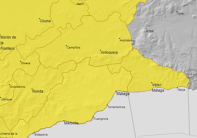
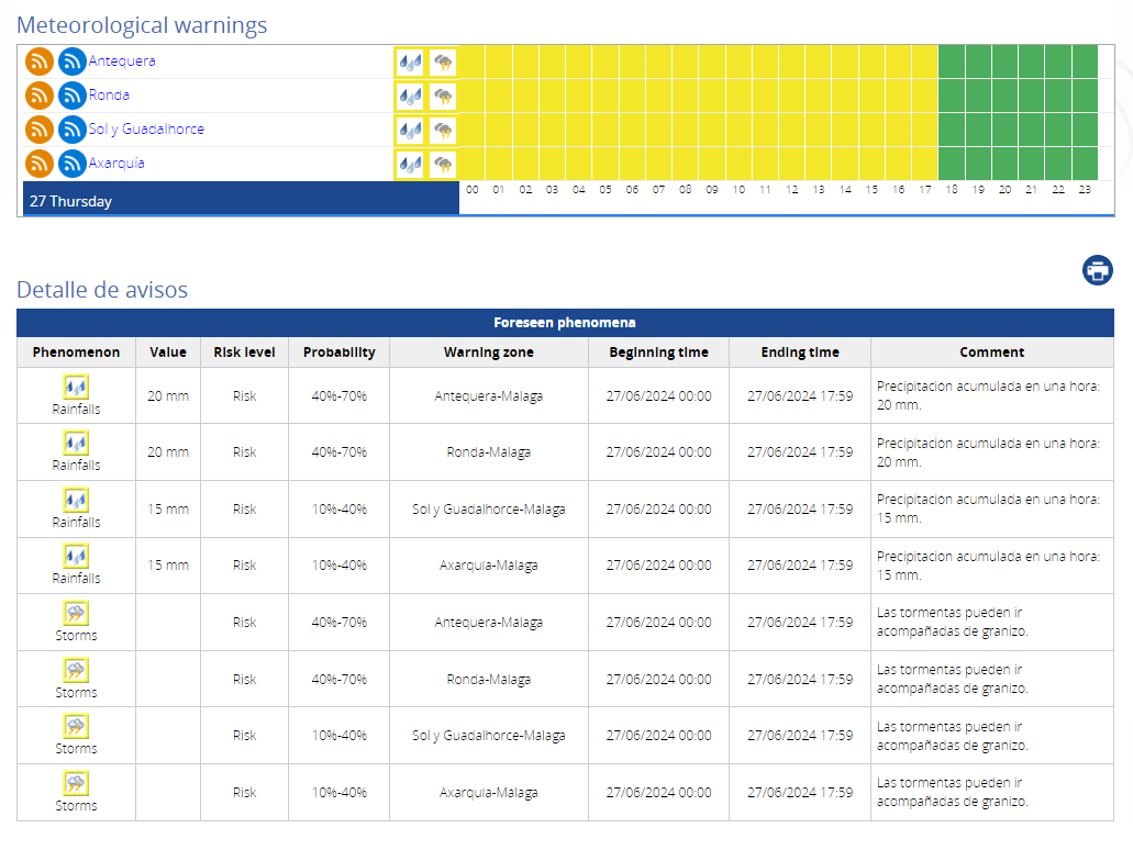
Until yesterday it was only the Ronda and Antequera areas that were issued with yellow weather alerts for heavy rain and thunderstorms, but Spain's state weather agency (Aemet) has now chosen to extend the warning to the entire province of Malaga. Therefore, from midnight this Wednesday to Thursday, and for a good part of tomorrow, in addition to the two aforementioned regions, Malaga city, the Costa del Sol, the Guadalhorce valley and Axarquía areas will also be on alert.
However, it must be pointed out that for these latter areas, the risk of the aforementioned weather warning happening is very low, between 10 to 40%. In these areas it is most likely that there will be, at most, occasional low-intensity showers. On Friday it could also rain in inland areas, and it will be more likely in Ronda and Antequera.
On Thursday, when the heaviest downpours are expected, there may be accumulated rainfall of up to 15mm in an hour. These may be accompanied by thunderstorms and hail. The most likely period is from midnight (Wednesday to Thursday) until 6pm on 27 June. Accumulated rainfall, according to the weather forecast models, may reach 30mm in a few hours.
If this forecast rainfall happens, depending on the intensity (which is not expected to be particularly damaging), it will offer some emergency irrigation at the start of summer for fruit trees, crops and market garden produce, which are in season.
The cause of this instability will be a 'Dana' (high level depression) that affected the weather in Galicia in the north of Spain yesterday and over the next few days will move along the Atlantic coast of Portugal to the south, and on Thursday will be located in the Gulf of Cadiz. From there, bands of precipitation are likely to reach Malaga province, although there is still much uncertainty, as the director of the Aemet Meteorological Centre in Malaga, Jesús Riesco, explained.
If it happens, the European weather model forecasts some drought relief for the Malaga countryside, especially in the Ronda area, where a possible accumulation of up to 35mm is expected; and around 20mm in the Vega de Antequera, according to data provided by José Luis Escudero, an expert in Malaga meteorology who is monitoring this phenomenon minute-by-minute.
In 1974, specifically on 14 June, a Dana left a downpour of 74mm in Malaga city. This is the closest precedent in time to the phenomenon that could occur this week, and for which Spain's state meteorological agency (Aemet) has issued a special warning at national level, given the risk of "heavy storms" of rain and hail occurring this week across large parts of the mainland.