Hiking
Wild horses, vertiginous peaks and springs on Malaga mountain route
The Axarquía and the Sierra Norte de Málaga share these mountains, where unusual places such as the San Jorge wetland or the Malnombre cave can be found

Málaga
Some of the highest peaks in the province of Malaga, mysterious caves and wild horses roaming freely near a small wetland on top of a mountain. These are some of the impressive landmarks that can be found along the Arco Calizo Central (central limestone arch), the backbone of the province.
This mountain range extends from the easternmost part of the Axarquía to the Guadalhorce Valley, but is particularly intense in the area between two Villanuevas: Rosario and Trabuco, as well as the villages of Alfarnate and Alfarnatejo, which was christened the 'mountain route' some years ago.
These villages are separated (or united, depending on how you look at it) by a set of limestone mountain ranges. Today there are many approved trails and even several stages of the Gran Senda de Málaga that allow you to venture, almost always facing steep slopes, through a territory that is as abrupt as it is amazing.
Those who travel along the side that corresponds to the region known today as Sierra Norte de Málaga, have a lot to see thanks to the network of paths between Villanueva del Rosario and Villanueva del Trabuco.
The 'Derrumbaero' is an awe-inspiring collection of rocks that fell from the mountains years ago
The Fuente de los Cien Caños, considered the unofficial source of the Guadalhorce Valley, is the best known landmark in this area, but its spectacular nature cannot eclipse the beauty and uniqueness of other sites on the same mountain. The circular route, known as the Sierra de San Jorge, starts from here. It is demanding, like almost all the others in the area, but it offers a spectacular climb, with wide panoramic views and lots of wild nature.
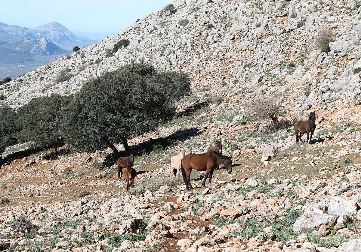
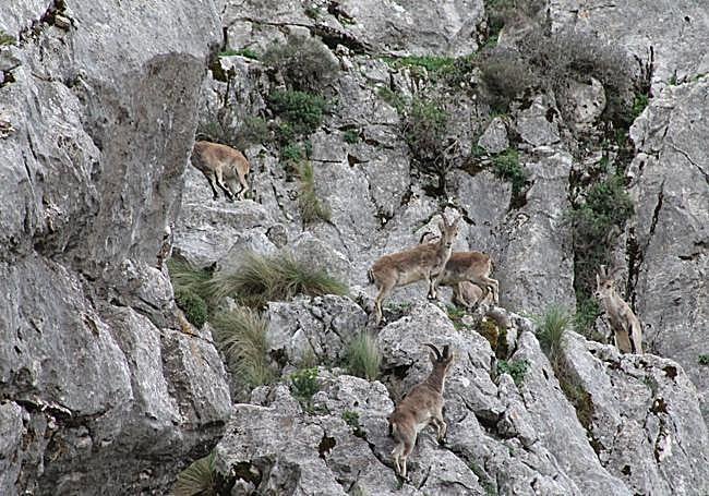
The mountain goat is king, but horses also roam freely around the San Jorge lake, a seasonal wetland located very close to the summit of this limestone mountain range. As inoffensive as they are elusive, they represent one of the curiosities of this mountain range. There are other wild horses in another, higher, eastern sierra, Tejeda, but this one is more accessible.
Villanueva del Rosario also has paths and curious landmarks. There are those who seek out enclaves such as El Chorro (the source of the river Cerezo), viewpoints such as Alto Hondonero or the Chamizo peak, considered the third highest in the province after La Maroma and La Torrecilla.
One of the highlights of this route is the Malnombre cave, which can be reached by a non-approved but very popular path that starts in El Chorro. The cave is easy to see from afar, but until you reach the interior, you will not understand the uniqueness of this mysterious cave.
Those who walk through the Alto Hondonero or want to do other routes in the surrounding area will find the 'Derrumbaero': huge boulders scattered on a steep slope that can seem overwhelming. It is even more overwhelming to think about the moment when these gigantic stones came off the mountain. It was many years ago. Now it is a landscape that is part of the image of these mountains.
On the other side of the sierra, the villages of Alfarnate and Alfarnatejo await, with footpaths through the mountains, but also a winding alternative by road.
Its high plateau, green almost all year round, contrasts with the rugged sierra and another challenging mountain, with landmarks such as the Vilo peak. It is quite a challenge to reach the top of Alfarnate, but it is worth it for the panoramic views. Easier is the Bosque de las Morillas route, with such spectacular places as the Malinfierno pass. Alfarnatejo also has its secrets carved in stone. They are above all its vertiginous cliffs, such as those of Doña Ana, Bermejo and Sabar.