Weather
Storm Herminia leaves almost 40mm of rain in Malaga province as yellow 'risk' alerts remain in place on the coast
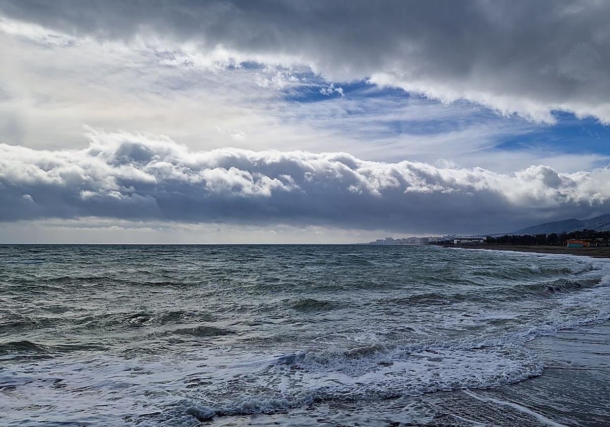
The Costa del Sol could register wind speeds of 50 to 60km/h (force 7) and waves of 2 to 3 metres this Tuesday

Malaga
Some much-needed amounts of rain accumulated yesterday, as storm Herminia passed through parts of the inland areas to west of Malaga province. According to data collected by the Junta de Andalucía's Hidrosur network, more than 38mm fell in Los Reales de Sierra Bermeja, to the north of Estepona, between Sunday night and Monday, marking the record of the last few days. The highest figures were followed by those in the Las Golondrinas measuring station, in Tolox, with 27mm, and in Gaucín, with 25.
In comparison to the last couple of days, the situation today is expected to be similar, although less intense. Rainfall will continue, especially in the Serranía de Ronda area and the westernmost part of the Costa del Sol, as it did on Monday. From midday onwards, Malaga city might also see some showers.
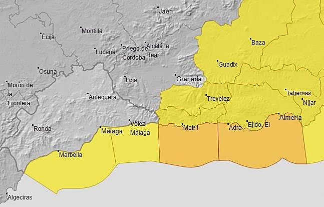
In addition, a yellow warning remains in place: "Offshore winds from the west with gusts of 50 to 60 km/h (force 7)", most likely until 3pm, warns Aemet.


As for the following days, on Wednesday, there is a very high probability of showers, especially from midday until nightfall, with the possibility of thunderstorms in the Serranía and the westernmost area.
This will be the last blow of a storm that, for the moment, is leaving much ado about nothing in the province, which is nothing compared to its consequences in other areas. From Thursday onwards, what will be noticeable is a new drop in temperatures, particularly the minimum ones (a decrease of up to 9C on Saturday), which will last through next weekend.
Weather station data
Data from other weather stations have been compiled by José Luis Escudero, a local meteorologist who is head of the SUR blog 'Tormentas y Rayos': both official sources such as Hidrosur and Aemet and unofficial amateur networks (such as Meteoclimatic and Wunderground), have recorded up to 34mm in El Juanar; 22mm in the river Genal, near the village of Jubrique; and over 20mm in Algatocín, Istán, Casares, Ojén and Parauta.
The downpours have also benefited the La Concepción reservoir near Marbella, which supplies a large part of the Costa del Sol, where the diversion dams (such as Guadalmina and Guadalmansa) have already received around 15mm, which will directly increase the water reserves.
According to the Aemet forecast, it is expected that, over the next few days, the downpours that Serranía de Ronda and La Concepción have witnessed will spread to Malaga and the rest of the province.
But the most outstanding features of storm Herminia are the strong winds and coastal phenomena. Yesterday, Poniente (westerly) gusts were expected to reach 80km/h in Ronda and other high points, with occasional speeds up to 90km/h.
So far, Marbella has seen the strongest gusts in Andalucía, where a maximum wind speed of 65km/h was measured at 6pm, followed by Fuente de Piedra with 66km/h and Gaucín with 62km/h.
A yellow warning will also be in force along the Malaga coast today, as winds from the west and southwest of 50 to 60km/h (force 7) and waves of 2 to 3 metres are expected.
Between yesterday and today, waves have been rather low on the main beaches of the Costa del Sol, with little height and no incidents reported. In reality, westerly storms are not usually as damaging as easterly storms.