Hiking in Malaga
A breathtaking hike through some of the Costa del Sol's most stunning scenery
This itinerary follows a relatively short dirt track along the Maro cliffs and takes in Nerja's iconic Balcón de Europa

Malaga
-
Route data
Comarca: Axarquía
Municipality: Nerja
Difficulty level: Low. Except for a small climb at the beginning and another on the way back from the tower, this path is practically flat and runs along a dirt track. In summer, avoid the middle of the day, as there is hardly any shade along the route.
Type of route: Circular
Approximate duration: 40 minutes
Length: 2 kilometres
Minimum altitude: 97 metres
Maximum altitude: 159 metres
Nearby places of interest: Torre de Maro, Balcón de Europa, Maro village, Nerja museum, Maro cliffs and Nerja cave.
-
How to get to the starting point
The starting point for this route is on the N-340 road. Turn off this road at kilometre 297 in the direction of Almería, at Torre de Maro signpost. After leaving the road, you will have to look for a place to park the car on the side of the road.
-
Route description
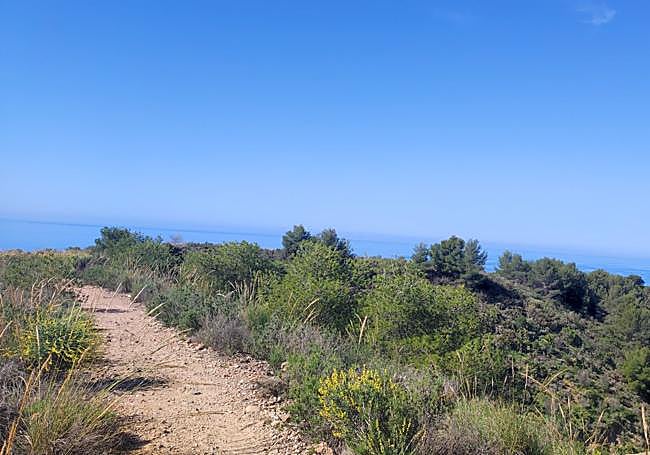
1This popular path leads to one of the watchtowers in the Maro Cliffs area. This is the westernmost watchtower in the protected area. Once you have parked your vehicle, you will have to walk a few metres along a dirt track that initially runs parallel to the N-340, although after an initial climb, it turns off to the south. This is the leftmost lane (there is a sign for the protected area), as the one you see on the right, slightly downhill, will be the way back.
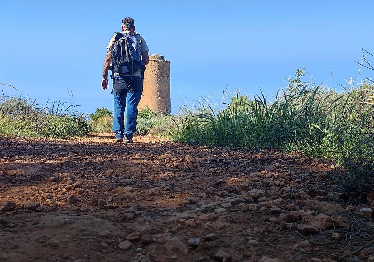
2After climbing a couple of hundred metres, you reach the highest point of the route. From this point onwards the route becomes flat or even descends slightly. At the same time the path narrows, although it is still relatively easy to walk. After a few more metres from the highest point, you will see the Torre de Maro, one of the historic jewels of this natural site that Nerja shares with Almuñécar in Granada province.
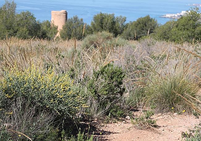
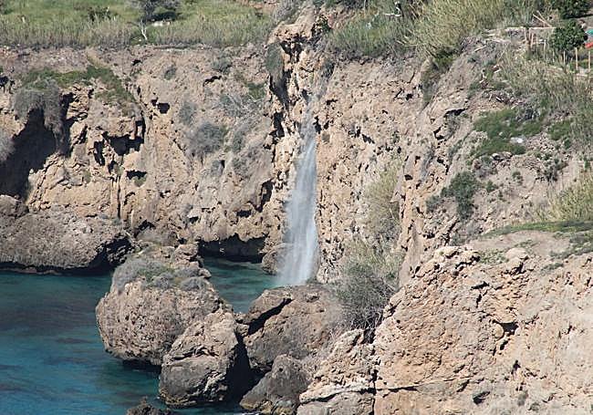
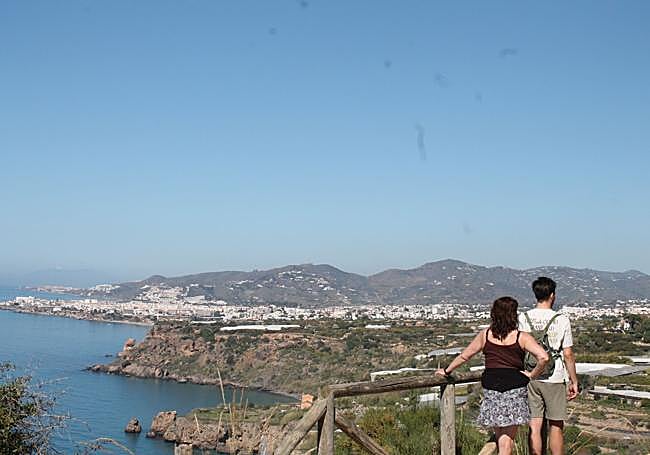
3 The Maro Tower, in addition to being a historic construction (built in the 16th century), is an excellent viewpoint over the easternmost natural area in Malaga province. From the surroundings of this watchtower, which is protected by a wooden fence, you can see much of the rugged coastline of Nerja. To the west you can see from the famous and seasonal Maro waterfall to the town centre of Nerja, including its iconic Balcón de Europa. To the west you can also see Maro beach, while to the east you can see the Alberquillas and the Torre de Papel.
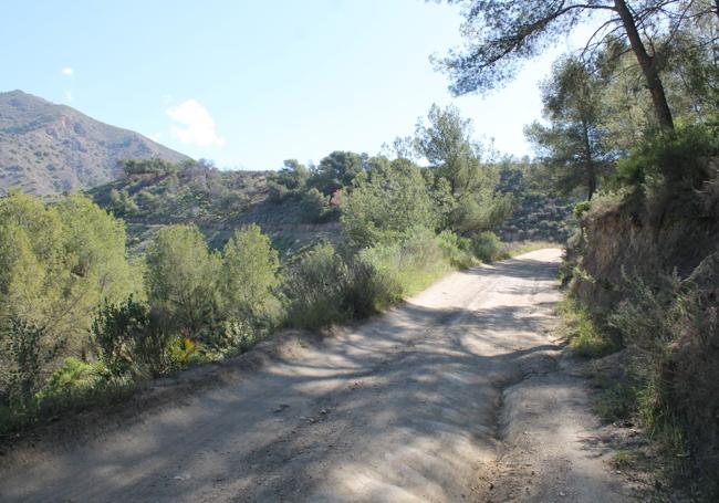
4After enjoying the views, you can return along a different path from the one you took on the way out, with a little more shade. To do this, you will have to look for a clearly descending path on the west side of the tower. This is probably the most technically complicated section, as it is about 30 metres in a length of approximately 100 metres. With care (good shoes are essential), you will descend along this narrow path under a pine forest until you reach a wide, slightly descending dirt track.

5From the wide, descending lane, it is only 900 metres to the north to reach the starting point of this route, i.e. next to the only area where vehicles can be parked.
Flora and fauna
In this protected area, you can see palmetto, matagallos, rosemary, thyme, lavender and myrtle and pine trees among other plants. At certain times of the day you may spot mountain goats, which even decide to go down to the beach at dusk.
Other mammals that live in this area include wild boar, foxes and genets. As for birds, you might spot a peregrine falcon, a yellow-legged gull or a robin. There's also the sealife, which is one of the reasons why this stretch of Andalusian coastline is a protected nature reserve.