Weather
Aemet warns of return of extreme heat with temperatures hitting over 40C this week in Spain
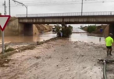
After a few days of heavy rain and flooding the north of the country, the mercury will soar in many parts of the mainland - according to the state weather agency

Madrid
The 'Dana' weather depression and subsequent storm that devastated parts of Aragón, Catalonia and other areas of northeastern Spain has just departed the scene. After a weekend in which rain and storms have been the main protagonists, leaving floods and destruction in many provinces, instability will give way to a week marked mostly by heat.
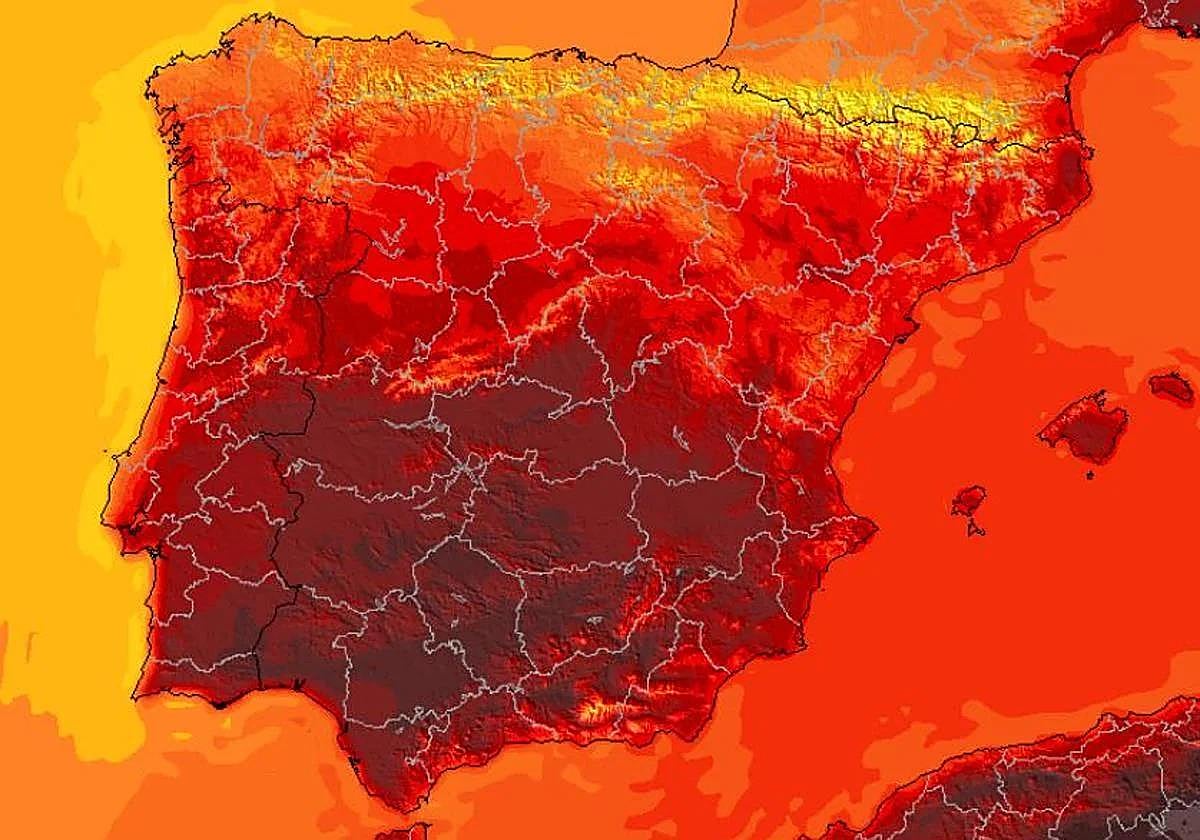
According to the state meteorological agency (Aemet) in its latest forecast, over the next few days we will experience a new «rise in temperatures» in a large part of the Spanish mainland. The values for the beginning of the week «will be above the normal average for this time of year« and only the western third will be spared from this extreme heat .

In contrast to previous days, precipitation will be scarce these days, although we could still see some storms in mountainous areas of the country. In the rest of Spain, the anticyclone will dominate, leaving dry and stable weather in most of the country.
Llegamos a la canícula, período comprendido por la segunda quincena de julio y primera de agosto que, habitualmente, es el más cálido del año en nuestro país.
— AEMET (@AEMET_Esp) July 11, 2025
→ ¿Qué esperamos para la canícula de 2025? 🤔
Predicción para las próximas tres semanas 👉https://t.co/Pui3hr2a0W
The extreme heat is back: the areas of Spain with more than 40C
The extreme heat of summer returns to Spain, coinciding with the start of the heatwave, with a new «rise in the thermometers» after a few days of thermal relief due to the dana. According to the Aemet, it will be a hot week, with temperatures between one and three degrees Celsius above normal in many parts of the Spanish mainland.
In the coming days, we will again see the dreaded 40C in some parts of the country throughout the week and only in the Cantabrian and the Ebro Valley will be spared these high temperatures due to a front that will lower the values.
During this Monday, temperatures will reach 32 to 34C in the northern plateau and the Ebro Valley, while in the centre and south of the Spanish mainland they will remain above 35C. The warmest area will once again be the Guadalquivir Valley, where over the next few days we could see temperatures above 40C.
El tiempo en España durante la semana que viene: las temperaturas volverán a marcar 40 ºC en estas regiones.
— Meteored | tiempo.com (@MeteoredES) July 13, 2025
🗞️ Detalles con Duncan Wingen. https://t.co/DVq22zSMUz
Tuesday will be an even warmer day, with rising thermometers in most parts of the country. Values of 40 to 42C will be recorded in the Tagus, Guadiana and Guadalquivir valleys, while minimum temperatures will also be very high, over 20 to 22C in many places.
It will continue to rain in some parts of Spain
Although it will be a rather dry start to the week, on Monday and Tuesday we will still have plenty of «abundant cloudiness» in the Cantabrian Sea and Pyrenees. We will see weak showers in parts of the Basque Country and Pyrenees, as well as in the Iberian System , where we will have locally heavy precipitation, although it will be of a somewhat more isolated nature.
From Wednesday onwards, the atmosphere will stabilise even more, leaving a much drier and more stable day in most of Spain. We only expect some rain in the Iberian System and inland Catalonia in the afternoon and on Thursday in lower Aragon and parts of Catalonia.