Weather
Aemet warns of arrival of polar air mass in Spain bringing storms and lower temperatures to these areas
Despite the end of the first heatwave of summer, much of the country will continue to be affected by sweltering temperatures with amber and yellow weather alerts activated

Patricia Marcos
Madrid
Spain has bid farewell to June and, with it, the first heatwave of the year. The high temperatures, which reached a maximum of 46C, made it a record-breaking month with an average temperature of 23.6C, eight tenths of a degree higher than June 2017, which held the record for the month, until now, as reported by Spain's state meteorological agency (Aemet).
🧵Junio de 2025 ha pulverizado récords.
— AEMET (@AEMET_Esp) July 1, 2025
→ Temperatura media de 23.6 °C. Supera por 0.8 °C al anterior junio más cálido: el de 2017.
→ Su carácter ha sido extremadamente cálido. Supera en nada menos que 3.5 °C el promedio del período 1991-2020. pic.twitter.com/D3JpHBfFar
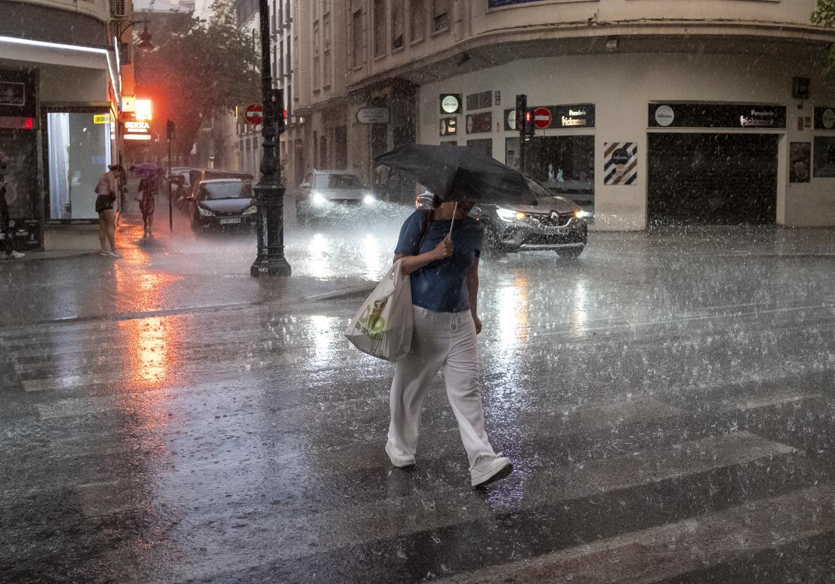
However, July has also started with sweltering temperatures and this will continue to be the case over the next few days throughout the country, except in the north, where a polar air mass will cause the mercury to drop.
This Wednesday, according to the Aemet, «the approach of a trough in height associated with a front that will affect the north of the peninsula« is expected and will move towards the northeast of the peninsula. This 'tongue' of cold air at high atmospheric levels will cause the unstable weather of previous days to continue, with storms and rain in some areas of the north and interior of the country.
Storms in these areas of Spain
The approach this Wednesday of a weather trough at altitude, associated with a polar front, will leave « thunderstorms in mountains of the northern half and surrounding areas, being possible in points of the northern plateau, northern half of the southern plateau and Sierra Nevada«, said Aemet. In fact, more than 20mm could fall in an hour in these areas.
On Thursday, the passage of a front will consolidate and affect the northern half of the Spanish mainland. In the northern third of the country, «overcast skies and locally persistent light rainfall» are forecast. In addition, there will be probable showers and thunderstorms in the northern half of Spain. «Heavy showers are not ruled out in the Iberian Peninsula, the Cantabrian mountain range and the Pyrenees, as well as in neighbouring areas», Aemet has pointed out.
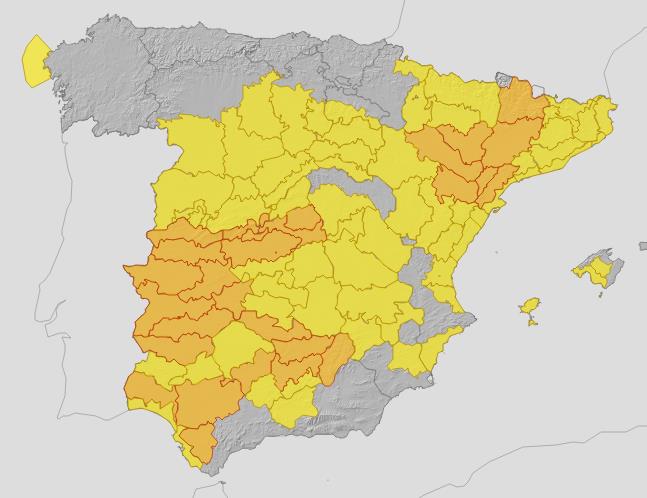
01/07 11:37 Avisos activos pasado mañana en España por vientos, costeros y temperaturas máximas. Nivel máximo de aviso: naranja.
— AEMET (@AEMET_Esp) July 1, 2025
Actualizaciones en https://t.co/BLdoSsO2Qv pic.twitter.com/oNZBPiIT3b
The instability will continue on Friday, with «a front located over the northern peninsular, moving northeastwards« which will again trigger light rainfall in the northern third, as well as showers and thunderstorms, again, in the northern half of the country.
Temperatures falling in the north
Despite the end of the heatwave today, Spain will continue to be affected by sweltering temperatures that will keep much of the country under yellow and amber warnings except Galicia, Asturias, Cantabria and La Rioja.
Therefore, in the south of the northern plateau, the north-east of the Spanish mainland and the southern half of the country there will be highs of 34-36C and even higher. Temperatures may exceed 40 degrees in the Guadalquivir, Tagus and Guadiana valleys, Extremadura and northeastern depressions. Temperatures will reach 42C in Cordoba on Thursday, and it will be above 40 degrees in other provinces such as Ciudad Real, Lérida, Toledo, Badajoz, Cáceres, Seville and Zaragoza.
The exception will be the Cantabrian and Atlantic slopes, where temperatures will be «markedly lower» due to the passing of the trough and the front on Wednesday. On Thursday, temperatures will also drop in the southwest third of Spain and to a lesser extent in the eastern third, recovering in the north. On Friday there will be a decrease «in the west of the mainland, more pronounced in the north of the northern plateau».
As for the minimum temperatures, they are not expected to fall below 20 degrees in the Ebro valley, Mediterranean coasts and in the southern half of the country, except in the south-eastern mountain ranges.
Looking ahead to the end of this week and the beginning of next week, temperatures will drop across the board throughout Spain due to the entry of polar air between 6 and 8 July, leaving temperatures well below average in the north of the mainland.