Weather
Spain's state weather agency activates alerts for entire coastline of Costa del Sol on Tuesday
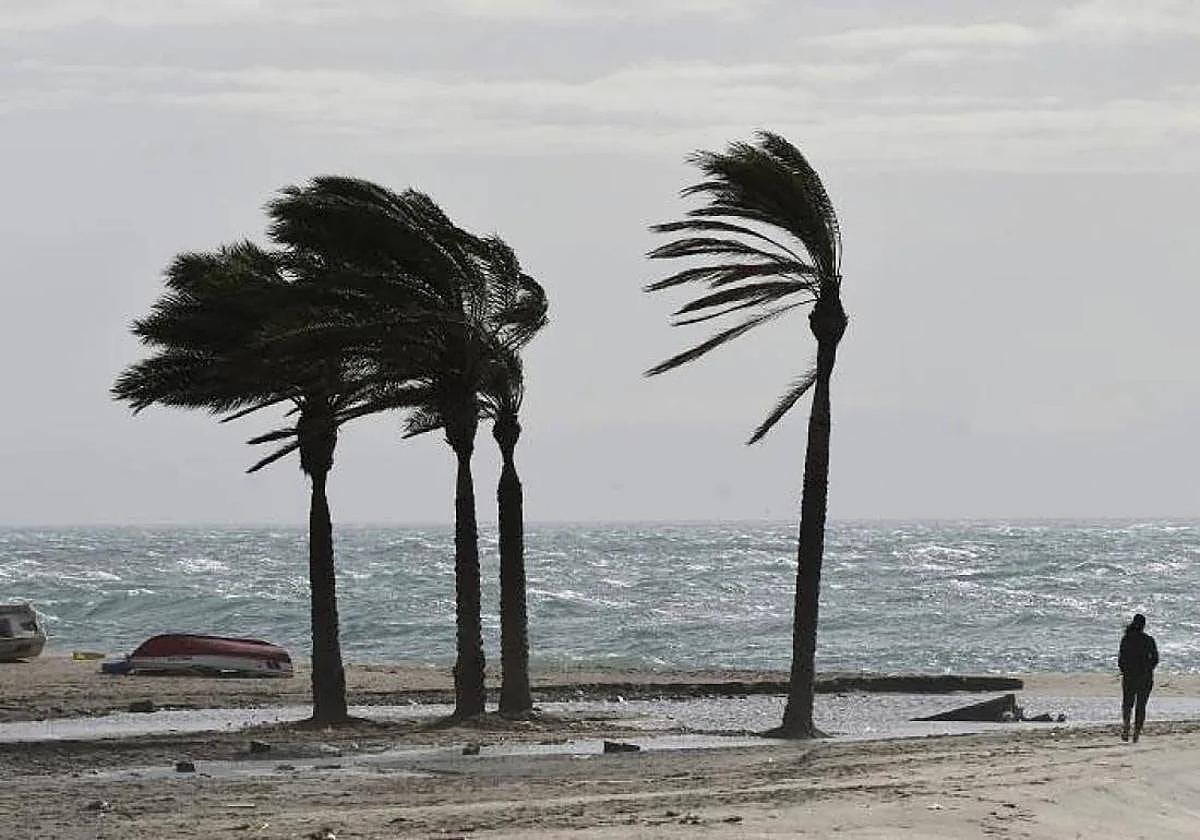
Aemet forecasts wind speeds of 50 to 60 km/h (force 7) and waves of 2 to 3 metres along the whole coast of Malaga province

Malaga
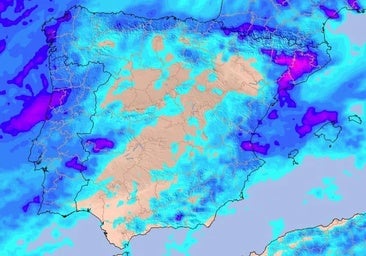
The approach of a deep trough threatens to bring an episode of torrential rain and storms to Spain's Mediterranean area. For the moment, the state meteorological agency (Aemet) has activated a red weather warning in Tarragona, although this phenomenon will also affect the Valencia region, Huesca and Teruel (Aragon). In the rest of the country, a weather front will leave cloudy skies over most of the Spanish mainland this Monday, with medium and high clouds and low cloudiness on the northern coast of the Alboran Sea area. Malaga province the Costa del Sol does not escape this adverse weather dominated by instability. For now, the state body has activated a warning for coastal phenomena along the entire coastline of the province, from Manilva in the west to the Axarquia coast in the east.
Related story
The yellow warning will be in force from 12 noon on Tuesday for wind from the west and southwest with gusts of 50 to 60 km/h (force 7) and waves of 2 to 3 metres.
In addition to the strong gusts, local Malaga meteorology expert José Luis Escudero points to the arrival tomorrow, Tuesday, of the 'terral' wind. "However, the good news is that this time it will not be accompanied by high temperatures," he said. Aemet forecasts highs of 30C and lows of 23 in Malaga city, the capital of the Costa del Sol.
From Monday until Wednesday, unstable weather is expected in the east of the Spanish mainland, the Pyrenees and the Balearic Islands, with locally very heavy thundershowers accompanied by hail and very strong gusts of wind, according to the forecast by Aemet spokesman Rubén del Campo, who predicts that from Thursday onwards temperatures will rise throughout the country.