Hiking in Malaga
A hike through a valley of subtropical fruit in the Malaga town that claims to have 'the best climate in Europe'
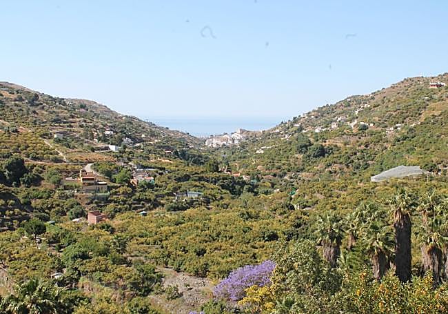
This circular Camino de los Caserones route starts in the upper part of Torrox Pueblo and passes traditional dry stone walls, the river of the same name and what was an old village in the 15th century

Torrox
A circular route through the valley of the Torrox river in the east of Malaga province, between subtropical fruit plantations - especially avocados - and rural properties that centuries ago made up one of the five villages that once existed in the area.
-
Route data
Area: Axarquía
Municipality: Torrox
Difficulty level: Medium. Although it has few slopes and the entire route runs along a wide track, As there are no signposts to guide you it is advisable to carry a physical map or use your mobile phone to help you find your way around some of the key points along the route.
Type of route: Circular
Approximate duration: Two hours
Length: 6.5 kilometres.
Minimum altitude: 155 metres
Maximum altitude: 260 metres
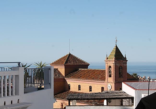
Nearby places of interest: Torox old town, Calle Nerja, Nuestra Señora de la Encarnación church, old convent of Nuestra Señora de las Nieves, beaches and promenade of Torrox Costa, Caviclum Roman ruins, Torrox lighthouse and Las Ánimas bridge.
-
How to get to the starting point
The starting point for this route is in the upper part of Torrox Pueblo , relatively far from the old town, although you could start there and then follow the historical route of Almanzor. If you want to do it from the highest part of the village, you can start from the Rincón de Francisco Gumersindo , where there are the ruins of an old mill. In front of it, there is a roundabout and just after it, the route along the Camino de Granada begins.
-
Route description
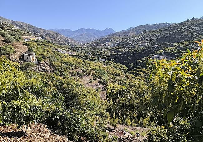
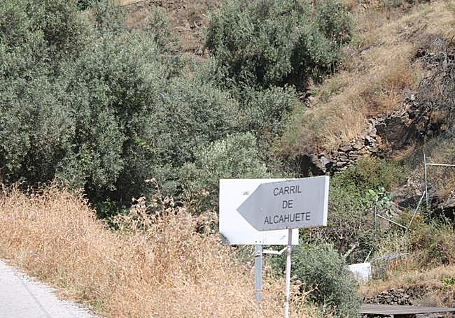
1On the Camino de Granada, signposted next to the roundabout near the Rincón de Francisco Gumersindo, this route leads away from the town centre and along a tarmac track into the Torrox river valley, where subtropical crops, especially avocado trees, predominate. After the first hundred metres, you come to a fork where you take the path to the left (the Alcahuete path). The one on the right will be the one you will return to. It could also be done the other way round, although the first option is more advisable, as it affords panoramic views from the first few metres.
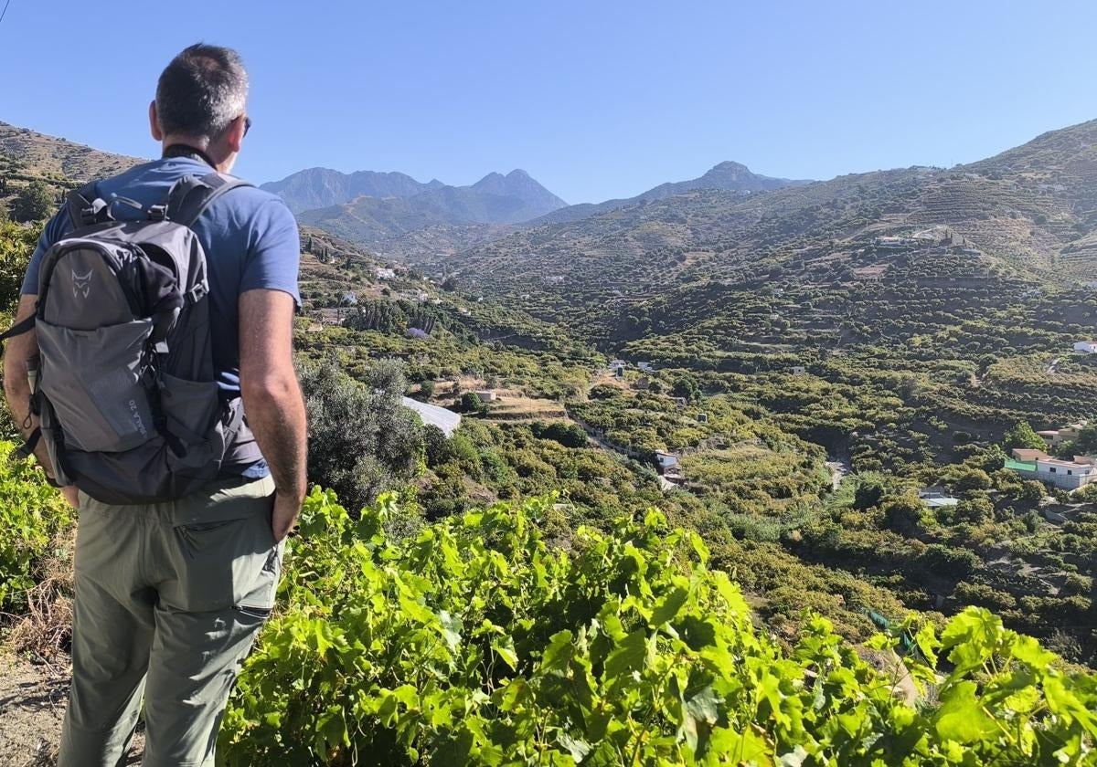
2The first kilometre and a half is clearly uphill, although the slopes are not very steep. In any case, these first few metres are made easier by the panoramic views of this subtropical valley. To the north, you can see the Almijara mountain range, while to the south you can see the upper part of Torrox Pueblo (from where you set off) against the backdrop of the Mediterranean.
3The first part of the route heads towards the highest section, which offers the best panoramic views of the valley. After just over three kilometres from the start, keep an eye out for a turning to the left onto a track that descends in search of the Torrox riverbed. This junction is right here. Descend a few metres to the east and south until you reach the river. You do not have to cross it, however, as the path to take is the one just before it on the right.
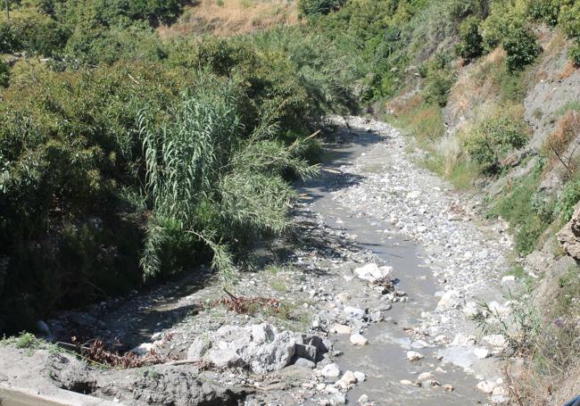
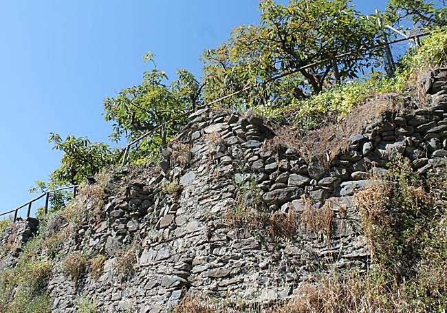
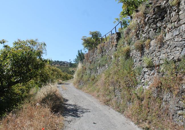
4Although the first few metres of this path run parallel to the river, you gradually lose sight of it. Here the route, despite being through the same valley, is very different from the first part, as you are closer to the avocado and other subtropical trees and, above all, because you pass right next to numerous 'balates', the traditional dry stone walls that are so characteristic of the Axarquía. This ancestral system for retaining the soil and preventing erosion forms a fundamental part of the agricultural landscape of this eastern part of Malaga province.
5The last stretch of this route is practically flat, except for a final slight ascent to the starting point of this route - if you started at the Rincón de Francisco Gumersindo. In any case, we recommend a visit to Torrox old town, which has colourful streets and squares .
Flora and fauna
On this route through the Torrox valley the predominant crop is the avocado. However, the surrounding area also preserves vineyards, almond and olive trees, which have formed a fundamental part of the agriculture of this area of the Axarquía for centuries. It is in this vegetation that the most diverse fauna can be seen today, with reptiles, birds and small mammals. When the River Torrox carries water, some amphibians can be seen in the surrounding area.