Hiking in Malaga
A hike along a section of old railway track that was intended to link Malaga and Granada
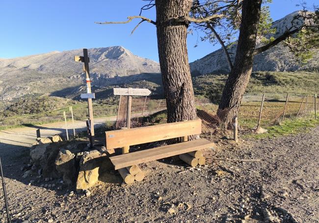
Village of Guaro-Boquete de Zafarraya: The route runs along part of what will be the next Vía Verde green way of the Axarquía

Malaga
This linear hiking route is one of the stages that belong to the GR-7-E4, that is, the great European route that links the Strait of Gibraltar with the Peloponnese. In this case, it is a path that starts in the Guaro, Periana on the eastern side of Malaga province, with the Boquete de Zafarraya, on the border between the provinces of Malaga and Granada.
-
Route data
Area: Axarquía, Malaga province
Municipalities: Periana and Alcaucín
Difficulty level: Medium. Although it is relatively well signposted and most of it is not physically demanding (only in the first third), its length and the fact that it is linear must be taken into account. Therefore, it should be remembered that if you return along the same path, it would be just over 15 kilometres. The route can be done both on foot and by bicycle.
Type of route: Linear
Approximate duration: 2 hours and 15 minutes (one way)
Length: 7.8 kilometres (one way).
Minimum altitude: 698 metres
Maximum altitude: 950 metres
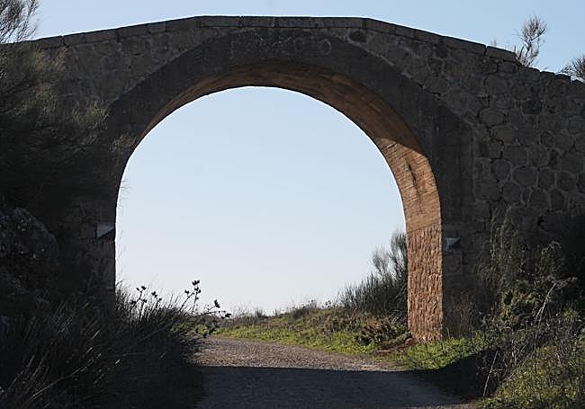
Nearby places of interest: The source of the river Guaro (dry for many months of the year), the Aguadero bridge, the stone railway tunnel, the Boquete de Zafarraya, the polje de Zafarraya (in the province of Granada), Carrión fountain and farmhouse (private) or the Baños de Vilo (Periana).
-
How to get to the starting point
To start this route you should go toGuaro, a hamlet which belongs to the municipality of Periana in the Axarquía. It is a small rural hamlet, but has some wide streets where you can park your car. Once you have parked your car, look for the exit to the east on the MA-156 road.
-
Route description
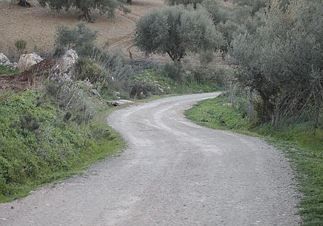
1Leave Guaro on the MA-156. Despite its name, it is not a road in this section, but rather a wide lane, partially asphalted for the first few metres, and an earth track a little later. There may be a few vehicles using the track as it has long been used as a means of communication between the villages and hamlets of this part of the upper Axarquía. The beginning of this route, which converges with a section of the Gran Senda de Málaga, is clearly uphill, with some steep slopes, but not too steep for people used to hiking.
2After about two and a half kilometres of walking, or around a third of the total route, you reach a crossroads where you must take the road on the left or to the east. It is here that you take a wide, flat track, along which, for several decades in the 20th century, the train used to pass, linking the provinces of Malaga and Granada, although it never actually connected the two cities. This route is proposed to be the future Vía Verde in the upper Axarquía.
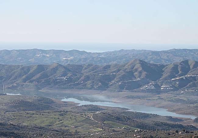
3Along this wide track you will pass some important landmarks of this section of the GR-7-E4, such as the Carrión farmhouse, which is still home to an old fountain, and the Aguadero bridge, which was built over the old railway line. At the same time, from the first kilometre along this part of the route, you can enjoy excellent panoramic views of the Axarquía. From here you will not only be able to see many towns and villages in the area, but also sites such as La Viñuela reservoir and some of the highest peaks of the nearby mountain ranges. You'll also be able to see the Mediterranean Sea and in this section you will be almost 1000 metres above sea level.
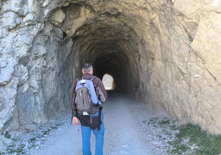
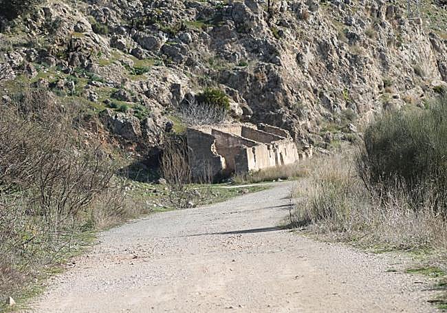
4A little over six kilometres from the starting point, you will pass the old farmhouse of Las Puertas. Shortly afterwards, you will pass through a stone tunnel, dug more than a century ago for the train that used to connect Vélez-Málaga with the town of Ventas de Zafarraya in Granada province. Until the 1960s it was possible to travel from Vélez to Ventas de Zafarraya thanks by train.
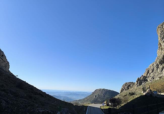
5Once through the tunnel, there are just a few metres left to reach what is known as the Boquete de Zafarraya, a natural mountain pass that forms the border between the provinces of Malaga and Granada. It is also where the municipalities of Alcaucín and Ventas de Zafarraya meet. It should also be noted that in this rocky area there is a cave that is famous for the discovery of what is known as the 'Zafarraya jawbone', the jawbone of a Neanderthal which today can be seen in the Museo de Arqueología de Málaga (Palacio de la Aduana in Malaga city). If you go a few metres further on you reach the Boquete de Zafarraya viewpoint, where there are excellent panoramic views and a panel with information about the landscape. After enjoying these images and even taking a stroll through the streets of this Granada village, it is time to return along the same route to Guaro.
Wildlife
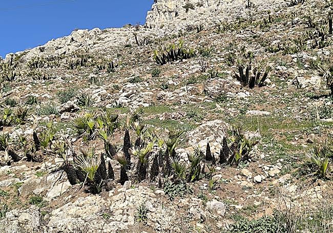
There is an abundance of wildlife along the route. In the first few metres there are traditional crops such as olive and almond trees, and you may see birds such as partridges and quails. However, after passing the halfway point of the route you will walk at the foot of the abrupt Sierra de Alhama. Flying over these limestone rocks you will be able to see griffon vultures and possibly the red-billed chough or the rock thrush. You may also see a herd of mountain goats in the upper part of the sierra. There is also an abundance of fan palm trees, especially in the area around the stone tunnel.