Weather
Aemet activates amber and yellow alerts for high temperatures as new heatwave hits Spain: but how long will it last?
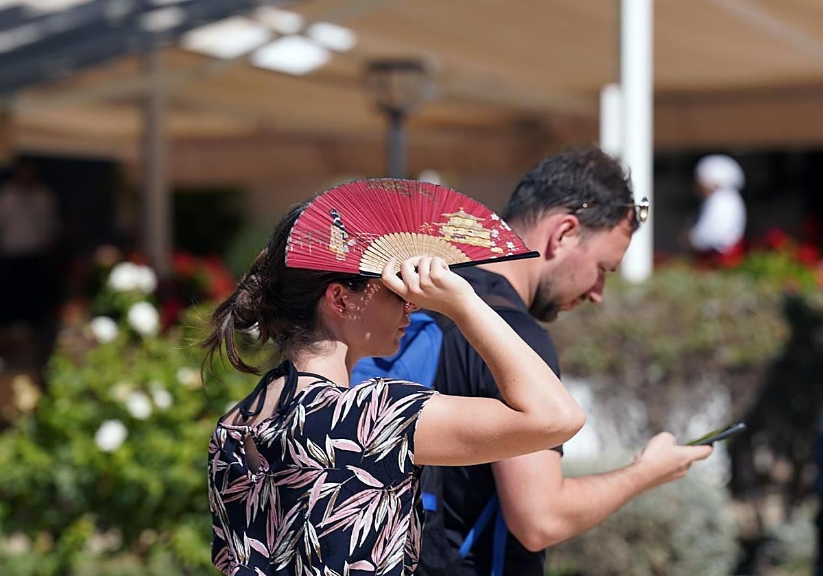
The state weather agency has issued heat warnings in four provinces of the Andalucía region this Monday as the mercury is forecast to soar again this week

Malaga
The new heatwave forecast by the state meteorological agency (Aemet), which will affect the whole of Spain - except for the Cantabrian area and the Canary Islands - is beginning to make its mark in Spain. It will also be felt this week in the Andalucía region and in Malaga province. Aemet is warning of an almost generalised rise in temperatures that will continue, at least until next Sunday 10 August, due to the entry of "a mass of warm, dry air from the African continent" which, together with the "high levels of sunshine at this time of year, will lead to higher temperatures than usual for this time of year", according to Aemet in the latest update on the special warning for this latest heatwave of the summer.
Related story
As far as Malaga province and the Costa del Sol is concerned, Aemet has issued a yellow heat warning for Tuesday 5 August. The warning will affect, from 1pm - 9pm, the Antequera area, where maximum temperatures of up to 39C, "especially in the areas closest to the provinces of Cordoba and Seville", explained José Luis Escudero, local meteorologist and head of the SUR blog 'Tormentas y Rayos' (Storms and Lightning) . Escudero also highlighted the likelihood of higher maximum and minimum temperatures in the province of Malaga, including the coast, from Thursday. However, we will have to wait for a new update on Tuesday or Wednesday to find out what will happen in the province over the coming weekend.
Heat in Andalucía
For its part, the Andalucía region will once again have amber warnings for high temperatures in parts of the provinces of Seville, Jaén, Cordoba and Granada; as well as yellow warnings in areas of Almeria and Huelva. Coastal phenomena will also be present in certain areas of the province of Almeria.
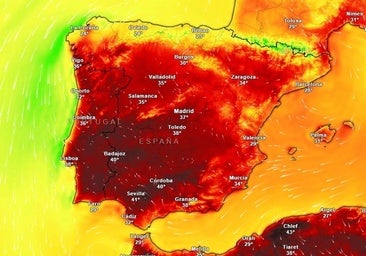
According to the forecast consulted by Europa Press, the amber level warnings will be present from 1pm and 9pm this Monday in the regions of Sierra and Pedroches and the Cordoba countryside, in Cordoba; in the Cuenca del Genil, in Granada; in the areas of Morena and Condado, Cazorla and Segura and the Guadalquivir Valley, in the province of Jaén; and finally, in the countryside of Seville; with maximum temperatures ranging between 40C and 42C.
Additionally, the northern and southern Sierra of Seville; the city and Montes de Jaén area; the Subbética in Córdoba and the Aracena area in Huelva, the thermometers will register maximum temperatures of 38C and 39C. Meanwhile, in the province of Almeria, in the Poniente area and the city, the maximum temperature will be 36C. These warnings will also be in force from 1pm to 9pm.
National weather
In the national forecast, for today, Monday 4 August, "significantly high temperatures are expected over most of the Spanish mainland, with notable rises in some regions", as well as probable very strong gusts of easterly winds in the Strait of Gibraltar.
According to Aemet, maximum temperatures "will rise in the north of the Balearic Islands and the northern half and east of the Spanish mainland, with notable rises expected in the Cantabrian, the upper Ebro and northern Galicia areas. They will fall in the extreme southwest and will remain stable in the rest. The high wil exceed 34-36C practically everywhere in the inland areas of the peninsula, as well as in Rías Baixas and points of Alborán, with temperatures expected to exceed 40-42C in large areas of the southern half of the Atlantic slope and around the Miño".
Meanwhile, minimum temperatures will increase in the northern half of the country, except in the Cantabrian Sea and northeast of Catalonia, where local decreases are expected, and will remain unchanged in the rest of the country. "They will not fall below 20-22C, even above 25 degrees locally, in the Mediterranean and the southern half of the Atlantic coast".