Weather
Aemet issues special alert for arrival of new heatwave in Spain with mercury hitting 40C or more in these areas
The state weather agency has warned of the "abnormally high" temperatures that will hit much of the country in the coming days
Daniel Domínguez
Madrid
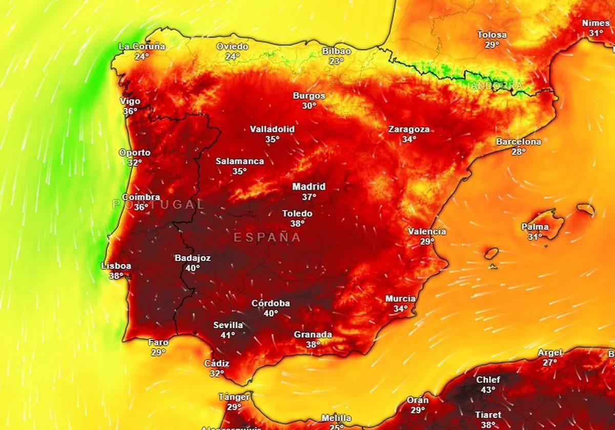
In recent days temperatures have been falling in some areas of Spain, although it has not being experienced equally throughout the country. Some areas are still experiencing highs of over 35C, although this contrasts with other provinces where there is even a threat of heavy rain in the next few hours.
It is a scenario that will increase from this weekend onwards, according to the state meteorological agency (Aemet) through its usual official channels. It has issued a special warning that should be heeded.
AEMET's special warning: when the heatwave will start and which areas will be affected
"From the weekend there will be a slight to moderate rise in temperatures which will become generalised during the following days, giving rise to a probable episode of heatwave", reads the press statement issued by the meteorological body, which puts the probability of this heatwave coinciding with the beginning of the month of August at 70%.
The areas affected, mainly the south-western quadrant and central mainland areas, due to an air mass coming from Africa. "This, together with the high depression in most of the country, will cause higher thermal values than usual for this time of year to be recorded in the aforementioned areas," Aemet pointed out.
Although Aemet forecasts the start of this heatwave on Sunday 3 August, it points out that the day on which the highest temperatures will be recorded will be Monday 4 August.
⚠️AVISO ESPECIAL | Ola de calor.
— AEMET (@AEMET_Esp) July 31, 2025
🌡️ A partir del domingo, 3 de agosto, las temperaturas serán muy altas en amplias zonas de la Península.
→ El episodio durará por lo menos hasta el martes 5, aunque podrá prolongarse en la mitad sur.
+ info 👉https://t.co/48Lsr8QC4f pic.twitter.com/2fcbiZ8gff
"On Sunday 3 August, highs will already exceed 38C across the southwest quadrant, reaching 40 - 42C in the Guadiana and Guadalquivir valleys. The peak day of the heatwave is expected to be Monday 4 August, when the thermal rises will continue and extend to the inland areas of the Cantabrian coast, where they could be locally noticeable. On this day values close to 40C will also be recorded in the Tagus and Minho valleys, and it is very likely to exceed 42C in the area of the Guadiana and Guadalquivir," said Aemet.
Although the agency itself indicates that Monday could be the peak of the heatwave, during Tuesday 5 August "in the central and inland areas of the south there will continue to be abnormally warm values across the board, with maximum temperatures similar to or locally higher than on Monday".
High temperatures will not only be felt during the day. "Although the rise in minimum temperatures will not be so widespread and marked, it will be enough for night-time temperatures to be significant over the next few days. In fact, the mercury is not expected to drop below 23 - 25C in large areas of the centre and south of the Spanish mainland, mainly on Monday and Tuesday," Aemet warns.
For Wednesday 6 Aemet, a slight drop in temperatures is forecast, although Aemet does not dare to state this categorically, as it depends on whether or not the air mass of African origin persists.