Weather
Aemet warns of dramatic change to weather in Spain: heavy rain is forecast in these areas
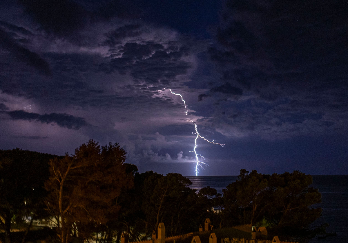
The state agency has said the formation of storms may be accompanied by "very strong gusts of wind and hail", while other parts of the country will continue to bask in temperatures of 35C
Virginia López Esplá
Madrid
Summer continues in Spain as evidenced by crowded beaches and popular tourist destinations. However, during the last few weeks the country has suffered several changes in the weather caused, for example, by troughs and Dana weather depressions that have left significant rainfall while in other areas the thermometers have exceeded 40C.
Despite the relatively stable weather in recent days, storms are set to return to Spain in a new change of trend in the weather, the state weather agency (Aemet) has warned. However, rain will not be the only protagonist in Spain as the heat will continue to remind us of the season we are in.
⛈️En las próximas 24 horas se formarán tormentas de nuevo en el este de la Península.
— AEMET (@AEMET_Esp) August 22, 2024
Localmente pueden dejar chubascos intensos. También es probable que vayan acompañadas de rachas muy fuertes de viento y de granizo.
🔗https://t.co/BLdoSsO2Qv pic.twitter.com/647igMc2fN
A change of trend in Spain
Aemet has reported that in "he next 24 hours storms will form again in the east of the Spanish mainland". In addition, the Aemet warns that the rain may be intense and "are also likely to be accompanied by very strong gusts of wind and hail".
Some of the areas where the state agency has activated warnings for rain and storms are Huesca and Teruel (Aragon); Albacete and Cuenca (Castile-La Mancha); Barcelona, Girona and Lleida (Catalonia); and the north coast, Valencia and inland Alicante (Valencia), Jaén (Andalucía) and coastal phenomena in the Canary Islands. These storms could be locally severe and accompanied by hail in the Pyrenees, eastern Iberia and eastern La Mancha, without ruling out the south-eastern sierras.
According to weather portal Meteored, the storms could deposit up to 40 to 60mm of rain, with up to 20mm in one hour.
☔ ¿Dónde va a llover este fin de semana en España? El meteorólogo José Antonio Maldonado avisa de un cambio de tiempo.
— Meteored | tiempo.com (@MeteoredES) August 22, 2024
👉 Aquí todos los detalles de las previsión. https://t.co/aJrlyeacrv pic.twitter.com/7gXeFSm4iw
The mercury will exceed 35C in depressions in the northeast, on the southern Atlantic slope and, locally, in low areas in the southeast. The Spanish mainland and the Balearic Islands will not experience too many changes with the temperatures, although in the Canary Islands they will drop sharply in mid- and high-lying areas.
Continued instability over the weekend
This situation of contrasts of instability and heat will continue during the weekend. On Saturday the situation will be similar to that of today (Friday), with the novelty that on this day an Atlantic cold front will enter. On Sunday, the passage of the Atlantic front will leave cloudy skies in the far north and precipitation in the Cantabrian area. There will be showers and thunderstorms from the early hours of the day in Catalonia, northern Aragon, Valencia, southeast peninsular and east of the southern plateau and not ruled out in the Balearic Islands at the end of the day.
As for the temperatures, the Aemet stresses that they could fall across the board, especially in the mid-Ebro and north-east of the northern plateau and even extraordinarily in the upper Ebro. «Even so, it will exceed 35 degrees in large areas of the southern Atlantic slope», warns Aemet, which means that Spain could once again experience thermal contrasts of rain and heat over the next few days.