Aemet puts 14 provinces in Spain on alert for meteotsunamis, storms or high temperatures today
The state agency forecasts the approach of an Atlantic low that will lead to an increase in weather instability, particularly in the north of the Spanish mainland

If the heat has been the star of the last few days, as expected for the season , this Wednesday the weather will take a turn in a large part of Spain, and will put 14 provinces on alert. Malaga will be spared on this occasion (at least according to the current forecasts) although temperatures will rise slightly in the city, with the maximum temperature reaching 33C. The heat will be more oppressive in the Guadalhorce valley, with Álora expected to reach 38C and Coín 37 degrees.
According to the forecast of the state meteorological agency (Aemet), high temperatures are expected again this 23 July in some areas, but there are also weather alerts in place for rain, wind, storms and 'rissagas' (meteotsunamis).
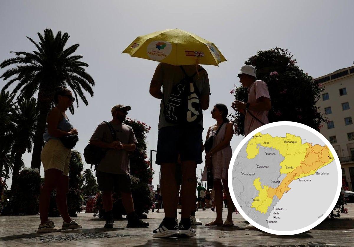
Castellón (Valencia) and Barcelona, Girona and Tarragona (Catalonia) will be at an amber level for rain and storms. Also on alert for these phenomena, but at a yellow level, will be Lérida (Catalonia), the Navarrese Pyrenees (Navarre) and Huesca, Teruel and Zaragoza (Aragon).
Likewise, Vega del Segura (Murcia) and Albacete (Castilla-La Mancha) will be under a high temperature warning. The rest of the provinces with warnings will be Menorca (Balearic Islands), due to sea level fluctuations of 0.7 metres, and Gran Canaria, Lanzarote, La Palma, La Gomera, El Hierro and Tenerife (Canary Islands), due to winds of up to 80 kilometres per hour (km/h).
Aemet forecasts for this Wednesday the approach of an Atlantic low that will leave an increase in instability in the north of the Spanish mainland, with a predominance of cloudy or overcast skies in the far north and northeast quadrant of the country. According to Europa Press, there will be rain and thunderstorms, occasionally accompanied by hail and with the probability of being heavy, even locally very heavy, in large areas of Catalonia, the Pyrenees, the north of the Valencia region and the extreme east of the Iberian system.
There will also be weak showers in the north of Galicia and the Cantabrian area, with occasional showers possible in other regions of the north-eastern quadrant and the far east of the Iberian Peninsula.
Likewise, there will be partly cloudy skies in the south of the country and with intervals of medium and high clouds in the rest of the mainland and the Balearic Islands. In the Canary Islands, cloudy skies are expected in the northeast, with probable light rainfall and partly cloudy or clear skies in the south.
On the other hand, morning fog banks are likely in the extreme north and in the inland areas in the east of the peninsula, as well as coastal fog in northern Alboran. In addition, weak haze is possible in Alborán itself, southeastern Spain and the Balearic Islands.
Changes in temperatures
With regard to maximum temperatures, they will increase in Mediterranean regions, remain unchanged in the Canary Islands and fall in the rest, more markedly in the northern half of the peninsula, even notably in central northern regions. Temperatures are expected to exceed 36cC in areas of the Guadalquivir valley and in the inland southeast.
As for minimum temperatures, they will rise slightly, remaining above 20-22C in the Mediterranean area and in the Guadalquivir.
Finally, light winds will blow in general, easterly in the Balearic Islands and the far east of the Iberian Peninsula and northerly and westerly in the rest. Moderate winds are forecast in the Strait of Gibraltar and the Cantabrian and Atlantic coasts, with probable strong intervals in Galicia, and with a tendency to increase in the northern half of the peninsula. In the Canary Islands, the trade wind will blow with strong intervals and probable very strong gusts.