Weather
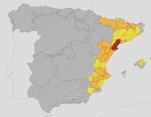
Aemet activates red, amber and yellow alerts and warns of 'very heavy' downpours and risk flooding in these parts of Spain
The state weather agency has warned of torrential rain, hail and strong wind gusts this week before a generalised rise in temperatures from Thursday onwards
C. P. S.
Madrid
From this Monday until Wednesday, unstable weather is expected in the east of the Spanish mainland, the Pyrenees and the Balearic Islands, with locally very heavy thundershowers accompanied by hail and very strong gusts of wind, according to the forecast of the spokesperson for the state meteorological agency (Aemet) Rubén del Campo, who points out that from Thursday onwards there will be a rise in temperatures throughout the country.
This Monday there will be unstable weather in the eastern third of the country, as a result of the passage of a trough, a 'tongue' of cold air circulating in the upper layers of the troposphere. In the area around the troughs, a wind pattern is generated which favours the formation of storm clouds. In addition, these clouds will be fed by the arrival of humid wind from the Mediterranean, which is about 2C warmer than normal in some areas of the coast.
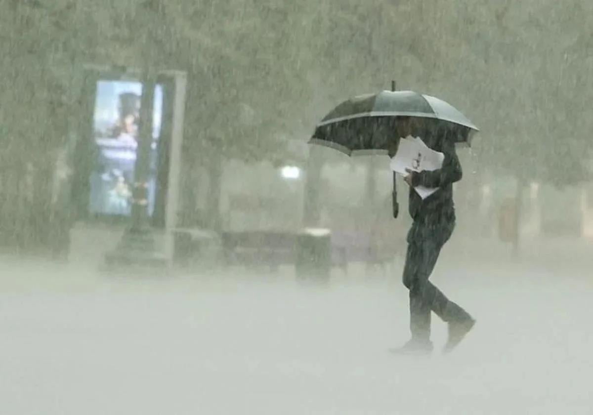
As a result, Del Campo confirmed that from this afternoon there will be "very heavy" downpours in the Pyrenees, southern Catalonia, Teruel, Tarragona, Castellón, southern Valencia and northern Alicante, with accumulated rainfall in an hour that could exceed 30 or 40mm and could cause some flooding or flash flooding of watercourses. In some cases the rain will be persistent and could accumulate more than 60 or 80mm in 12 hours in these areas. The showers may also be accompanied by hail and very strong gusts of wind. It will also rain in the Cantabrian areas, although "not so heavily".
As for temperatures, they will drop in the north and east of the Spanish mainland and remain unchanged in the rest. In addition, a cool atmosphere is expected in the Cantabrian Sea, where temperatures will barely reach 18-20C, while in parts of the Andalucía region, such as Cordoba and Malaga, they will exceed 35C, according to Del Campo.
Looking ahead to Tuesday, very adverse conditions are forecast for the Balearic Islands, where the downpours could reach torrential intensity of more than 60mm in an hour and be persistent with accumulated rainfall of more than 140mm in 12 hours. As a result, the Aemet spokesperson warned that "great caution" should be taken in the archipelago, as wadis and ravines are expected to experience "strong increases" in flow and "very suddenly". In addition, these downpours in the Balearic Islands may be accompanied by hail and very strong gusts of wind.
In the eastern third of the Spanish mainland, today's showers will continue in the early hours of the morning, and in the afternoon storms may be reactivated and locally very strong, as well as being accompanied by hail and intense wind. Likewise, there will be "lighter" rain in the Cantabrian Sea and temperatures will drop, except in parts of the Cantabrian Sea. Temperatures will only reach 30C in the Guadalquivir valley, Costa del Sol and in parts of eastern Andalucía.
As for Wednesday, the Aemet expert predicts that the weather instability will continue in the Balearic Islands, with "very strong" storms that will also affect Catalonia and other parts of the northeast of the mainland, especially in the first half of the day. The storms will subside as the day progresses, although in the afternoon some thunderstorms may form again, which will be locally intense in Catalonia.
On the other hand, a front will arrive in Galicia and will leave abundant rainfall in the west of the region, which will spread to the rest of the Cantabrian areas, without ruling out downpours in the northern plateau. In addition, temperatures will rise in the Cantabrian and Mediterranean regions, with a cool early morning in the interior of the northern half of the region. Some cities such as Vitoria, Soria, Teruel or Burgos will have minimum temperatures of 7-9C. In the afternoon, however, temperatures may reach 34-35C in Seville.
From Thursday onwards, the anticyclone will return, so that rainfall will be restricted to the extreme north of the Spanish and temperatures will rise. Then, the northern third of the country will be affected by the passage of fronts with cloudy skies and rain in Galicia and the Cantabrian regions.
Likewise, temperatures will rise throughout the country and the trend towards a warmer atmosphere will continue in the following days, so that on Friday and towards the weekend, temperatures may exceed 32-34C in central and southern areas and even 36C in the Guadalquivir Valley.
Finally, this Monday in the Canary Islands, Sahara desert sand dust in suspension is expected to give rise to a "calima", with significant reductions in visibility and worsening air quality. In addition, it will be hot and temperatures will exceed 32C in the south of the islands. From Tuesday onwards, the calima will withdraw and temperatures will drop, remaining at "normal" values and with the trade winds blowing with intensity in exposed areas. This will continue over the following days, although temperatures could rise again towards the end of the week, according to the Aemet spokesperson.