Yellow-level weather warning issued in Malaga due to freezing cold and temperatures down to -4ºC
Half of Spain will be covered by alerts this Friday due to snowfall, high winds or coastal phenomena, according to state weather agency Aemet

ISABEL MENDEZ / EUROPA PRESS
Far from going away, the cold will get even worse this weekend. So much so that half of Spain will be at risk this Friday, 27 January due to low temperatures, high winds, snowfall or coastal phenomena, according to Aemet's forecast.
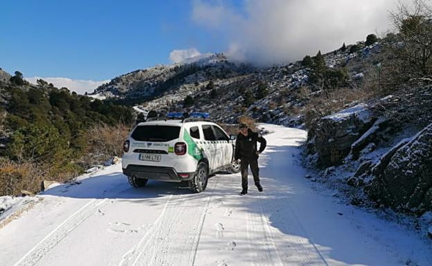
Malaga will not escape on this occasion, and in fact there will be a yellow warning, which will be in force from Thursday night until 10am in the morning in the Antequera region, where the state weather agency expects temperatures of down to -4ºC and possible frosts to be recorded in many inland areas of the province.
Noticia Relacionada
-
 IGNACIO LILLO
In the city the situation will be much more pleasant, and the thermometers will move between the seven degrees that are expected as a minimum and the 16 maximum. Skies will remain clear and no rain is expected. In addition to Malaga province, in Andalucía there will also be a warning for cold weather in Cordoba and Granada, and according to the local weather expert José Luis Escudero, on his Storms and Lightning blog, this Friday "we will feel a lot colder”. And, on Sunday the Levante will blow, so the air will be much more humid and again it will feel icy. "It's going to be hard for the cold to move away, the air mass is installed over the mainland so there are still wintery days ahead," he said.
Rest of Spain
In the rest of Spain, the Asturias will be on alert due to snowfall, the Balearic Islands due to low temperatures and coastal phenomena and Cantabria due to snowfall. In Castilla y León, the snow will put Burgos, León, Palencia, Segovia and Soria on alert. The Catalan provinces of Barcelona will also be at risk, due to cold; Girona, due to waves (amber warning) and cold; and Lleida, due to snowfall and cold. In Galicia, the rough seas will put La Coruña at risk. In addition, snowfall will put Navarra, the Basque province of Álava and La Rioja at risk with yellow warnings.
On Friday cloudy skies will predominate in the northwestern and northern thirds of the mainland, with rainfall in the northeast of Galicia and the Cantabrian area, where they may be locally persistent in mountainous areas.
Rainfall, weak and scattered in general, is also expected in other areas of northern Galicia, the Pyrenees, the upper Ebro, and north of the Northern plateau, and it isn’t ruled out in the surroundings of the Iberian and Central systems.
Likewise, cloudy intervals are expected in the Balearic Islands and Alborán with probable occasional showers, without ruling them out on the coasts of the southeast of the peninsula. In the rest of the country, slightly cloudy skies will predominate in the rest of the Mediterranean area, and the southern half of the mainland, with cloudy intervals in the Béticas.
Snow levels
The snow levels in the Pyrenees will be around 300-500 metres, 600-800 in the western Cantabrian, and 400-600 metres in the rest of the Cantabrian area and Central and Iberian systems. Significant accumulations are expected in the Cantabrian area, north of the Central and Iberian systems and northeast of the North plateau.
In the Canary Islands, there will be cloudy intervals with a probability of light rain during the second half of the day in the north of the higher relief islands. There will probably be morning fog banks in mountainous areas of the northern third of the peninsula.
The temperatures will show an increase in the southwestern half of the mainland, both the maximums and the minimums, and with few changes or slight drops in the rest of the country. Except in the extreme southwest, widespread frosts are expected in areas of the interior of the mainland, more intense in the mountains and becoming strong in the Pyrenees.
The winds will blow from the north and northeast, strong on the coasts of Galicia, and north of the Balearic Islands, and with strong intervals in the western Canary Islands; and there will be very strong gusts from the northwest in the Pyrenees, Central and Iberian systems and the Ebro valley.