The first real rain of spring is on its way to Malaga, but when and how much will fall?
Spain’s state weather agency Aemet forecasts downpours that could be intense throughout the province, starting Thursday
Ignacio Lillo
Malaga
Miércoles, 17 de mayo 2023, 13:22
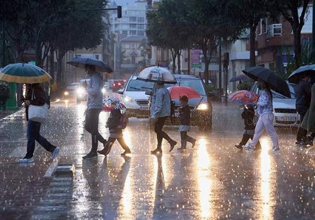
The weather station that José Luis Escudero, the head of SUR’s meteorological blog, has set up on the roof of his house in Malaga city has gone 80 days without registering even a drop of rain. It is true that on Saturday there were some short but intense showers in very specific points of the province such as Nerja, Almayate, Torremolinos, El Palo and Los Montes (where there was a small hailstorm), among others. But the first big rains of spring will begin tomorrow (Thursday, 18 May) and will last at least until next Tuesday, according to the forecast of Spain's state weather agency Aemet.

The rain and storms, which will be strong at times, can occur anywhere in the province, explained the director of the Aemet weather centre in Malaga, Jesús Riesco.
It will be sparked by a depression at high levels, something similar to a ‘Dana’, caused by a pocket of cold air in the middle layers of the atmosphere but it will have some different characteristics.
This Wednesday afternoon there could be scattered showers inland, "but little, if anything" said the meteorologist. But, starting early tomorrow morning, it may be possible to see downpours that in some areas will be intense and accompanied by storms.
According to Riesco, the threat will be present every day and throughout the province, without exception. "It will be the typical spring rains," he said; that is, generally short and isolated showers, so that in very close distances some will receive the rain and others will remain dry.
Up to 40mm
The distribution will also be very uneven, but the amounts will add up over the next six days. Jesús Riesco is confident that at some times there may be strong downpours, of between 15 and 20mm in an hour, especially this Thursday; while the total could reach 40mm. "It will help a bit, both on the land and in the reservoirs, which will not recover a large percentage, although some water will reach them."
The other key thing is the temperature, which is going to drop significantly, from the current very warm values to being even below normal for the month of May. The maximum in Malaga city will stay at around 22C, when it has been at 28 degrees and up to 30 days on days of warm ‘terral’ wind (the average for May is 25). The minimum temperatures will be around the usual for the time of year, about 15 degrees. Meanwhile, inland, for example in Antequera, the daytime temperature will drop from 24 to 20C, and the night will be lower than normal (9-10 degrees).
SUR's José Luis Escudero added that, with the weather models to hand, if any rain falls today it will be late at night and during the early hours of the morning. The expert expects more rain on Thursday, from midday and early afternoon, with the possibility of downpours and storms, especially in the inland areas of the Axarquía, Antequera and Ronda.
Differing weather models
Regarding the quantities, Escudero acknowledges that it is difficult to predict, so "from 2 to 25mm could fall, it depends on where the storm unloads it, within a few kilometres it can either be dry or a lot of water will fall."
For Saturday and Sunday, the weather expert has warned that up to 20mm could fall in Malaga city. In the accumulated total, the European model offers up to 38mm between tomorrow and next Tuesday, while the American model raises it to 58. We will have to see what we end up with.