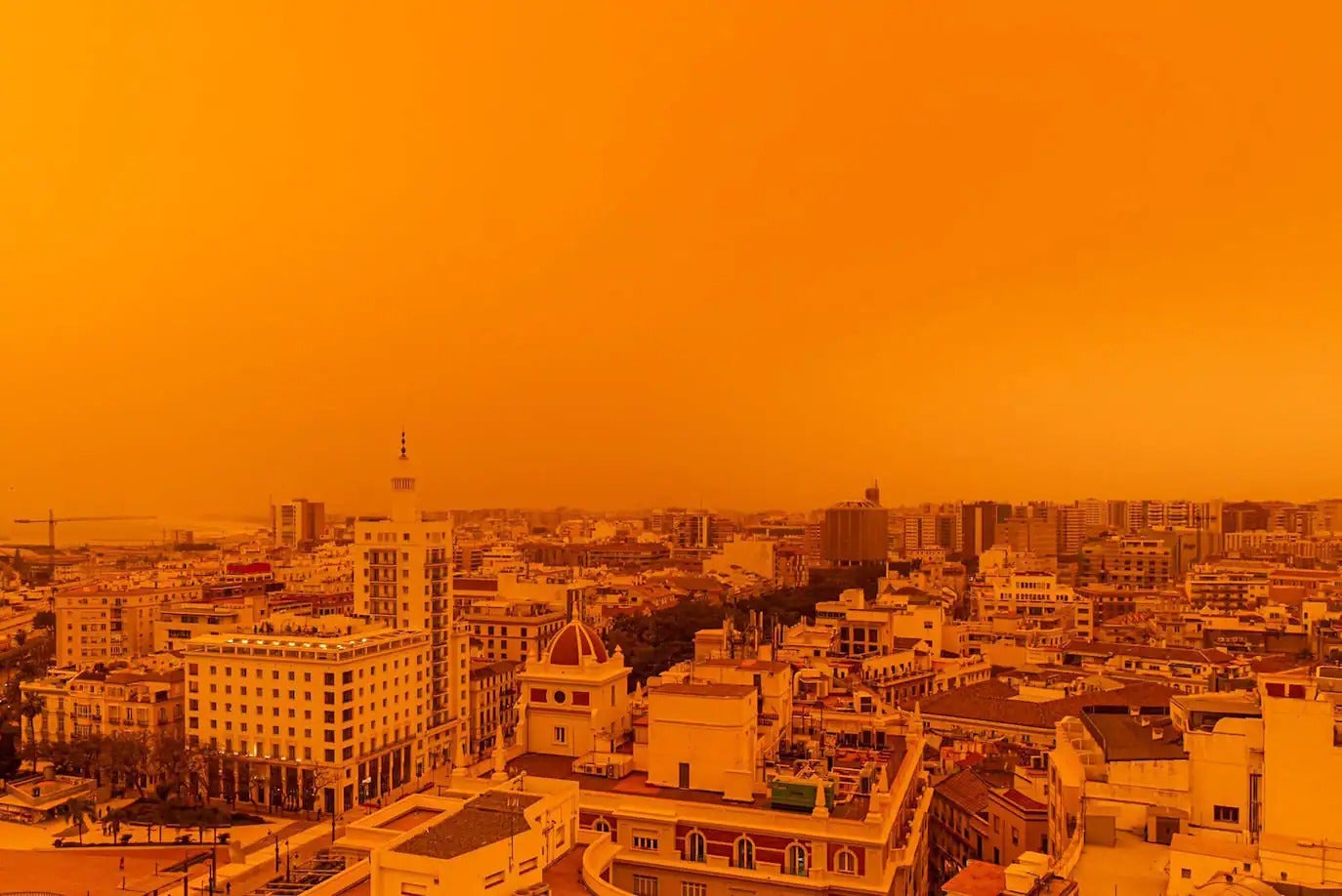
Red rain and thunderstorms forecast for Malaga and the Costa del Sol in the run-up to Holy Week
Spain's state weather agency (Aemet) has predicted the areas that could see most rainfall, which could leave deposit of mud - due to the effect of the 'calima' with Sahara desert sand dust in suspension in the atmosphere
After several days of spring-like conditions, weather instability is on its way back to Malaga province, the culprit being "a 'Dana' (high-level depression) which is already on its way to Cabo de San Vicente", local meteorology expert José Luis Escudero has explained. In the absence of knowing its precise path - given the difficulty of modelling this phenomenon - Spain's state agency (Aemet) has set the probability of experiencing rain and thunderstorms in Malaga city and on the Costa del Sol at 75 per cent from this Wednesday afternoon (20 March) onwards. The possibility of rain in the run-up to Holy Week will remain until midday on Thursday and then, from 12 noon onwards, the likelihood of rainfall on the coast will drop to 10%.
The Eltiempo.es website agrees: "In the coming hours a 'Dana' will break away from the general circulation of the atmosphere and will lead ro rain and thunderstorms in some areas."
In Malaga province, according to Spain's state agency (Aemet), the western strip of the Costa del Sol - particularly Estepona and Marbella, with a 100% probability, the towns of the Guadalhorce valley (including Álora, Pizarra and Coín), the Antequera area and the eastern strip of the coast (from Rincón de la Victoria to Torrox) are the areas where it could rain the most. "This Wednesday the 'Dana' will favour the formation of rain clouds in large areas of the west and centre of the Spanish mainland but, in general, the downpours will be weak and irregular", Aemet added.
Zoom
Rain... and mud?
"We will have stormy showers late on Wednesday night and early Thursday morning in some parts of Malaga province, which could be accompanied by deposits of mud, although it will be nothing comparable to what happened in March 2022", clarified José Luis Escudero in his SUR blog 'Tormentas y Rayos' (Storms and Lightning. He added: "Maximum temperatures will drop throughout the Andalucía region and in the early hours of this Wednesday morning we may have a 'calima' (sand from the Sahara desert in suspension) and even a taro (sea mist)".
From tomorrow (Thursday) onwards, the 'Dana' will move away, dropping in latitude and be located near the Canary Islands. On that day, Aemet forecasts "cloudy skies in Andalucía, partly cloudy due to the suspended dust in the atmosphere, without ruling out occasional rain showers that may be accompanied by thunderstorms and mud deposits, more intense and likely during the early morning, when they could be locally strong".
"As the day progresses things will begin to clear up. Light to moderate easterly winds, increasing to strong easterly with occasional very strong gusts will be experienced along the coast of Almería province and the Strait of Gibraltar", according to the forecast.
In the case of Malaga, "the probability of rain in the province on Friday and Saturday is very low", Escudero pointed out, while at the same time he predicted that the higher temperatures will return: "The maximum will be above average for the time of year throughout Andalucía". In Malaga city, Aemet forecasts that thermometers will reach 26C on Friday. The minimum temperature will also be very high, hovering around 18 degrees.


-kNfG-U101072592324x1-1200x840@Diario%20Sur.jpeg)