Hiking in Malaga
The river route that will thrill you from the outset in Malaga province's Sierra de las Nieves
This hiking trail takes you past four viewpoints and three spectacular dams, packed with flora and fauna

Malaga
This linear hiking route in Malaga province runs between the dams of Molino Caído, Nacimiento del Turón and Hierbabuena. This is the upper basin of the Turón river, in the valley of the same name.
-
Route key info
Main area: Sierra de las Nieves
Municipality: El Burgo
Difficulty level: Medium. Although the route is relatively short, it is necessary to take into account the return journey to the nearest car park.
Type of route: Linear
Approximate duration: 2 hours (one way)
Length: 5.5 km (one way).
Minimum elevation: 555 metres
Maximum elevation: 668 metres
Places of interest nearby: Remains of Miraflores castle, Encarnación church, the dams of Molino Caído, Nacimiento del Turón and Hierbabuena, La Era viewpoint and viewpoints of the three, aforementioned dams, Turón waterfall, the natural monument and lookout point of the Guarda Forestal (forest rangers) and the mountain passes of El Lobo and La Mujer.
-
How to reach the starting point
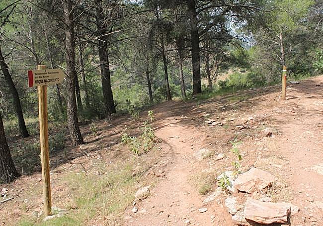
The official trailhead begins at the Molino Caído (fallen mill) dam, but it's important to note that the main access to this enclave will be cut off due to the construction of a suspension bridge in the summer of 2025. An alternative would be to extend the Manolo El Cantaor path, but it might be restricted this summer due to the risk of collapse. The remaining option is to ford the river a few metres below Molino Caído dam. There are large stones and it is relatively easy. However, it's very important to note that this area is closed to traffic from 1 June to 31 October to avoid the risk of forest fires. It is therefore necessary to walk there from the village using the dike path. It is best to park your car on the nearest streets in El Burgo.
-
Route description
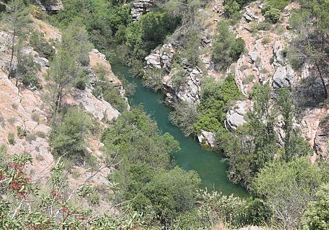
1From the Molino Caído dam, after enjoying its large pool of water, you have to climb up a narrow path that zigzags up to the first of the viewpoints on this walk. Just there you will see a sign describing the route, explaining all the steps to follow. After enjoying the panoramic view from this lookout point, take the narrow path heading north, with the Turón riverbed below and to the left.
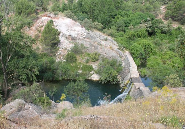
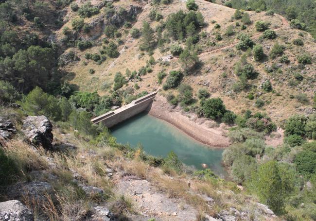
2After about 800 metres from the previous dam's viewpoint, you will reach another spot where you can enjoy more views, La Era, where it's a good idea to stop to take in different views of the Turón valley. The trail then continues along the same narrow footpath with a slight descent - about 200 metres - and a subsequent ascent until you reach a fork in this path a kilometre later. To the left, a descent to the Nacimiento del Turón dam, while to the right the official route continues. It's highly recommended to do the downhill section for a closer look at that dam, although you must then return to the aforementioned fork to continue the trail. There's no other option.
3From the fork, the path will be uphill. This may be the most demanding part of the route, but it's manageable. After half a kilometre you will reach the viewpoint of the Nacimiento del Turón, the river's source. This will be at your feet, providing a beautiful view. The panorama extends across this part of the valley where, in addition to looking down at the river, you can also enjoy views of the geology and vegetation.
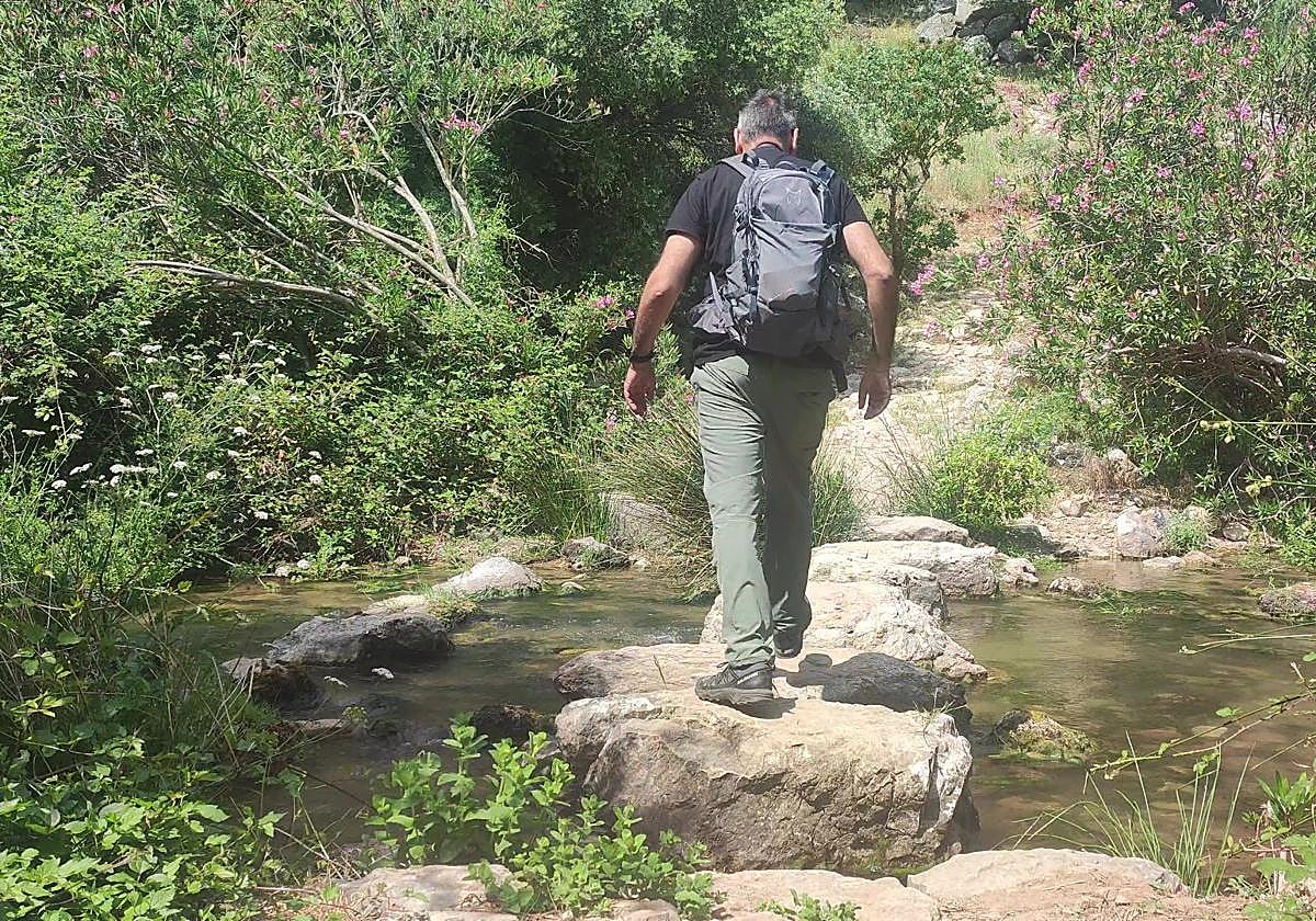
4From the Nacimiento del Turón viewpoint the trail continues along the same narrow path that then starts to descend. At first it affords beautiful views of the river but, as you descend and the footpath approaches the riverbed, the route passes through a splendid example of Mediterranean woodland. This last stretch is practically flat until you reach the Hierbabuena dam. Just before you get to see it (you will first hear the water cascade before you can see it), you have to ford the Turón river at a place prepared for just this purpose with large stones. Then, to the right, a small path leads up to the dam and the pool that has formed at its base.
-k7PF-U200307812870YJI-650x455@Diario%20Sur.jpg)
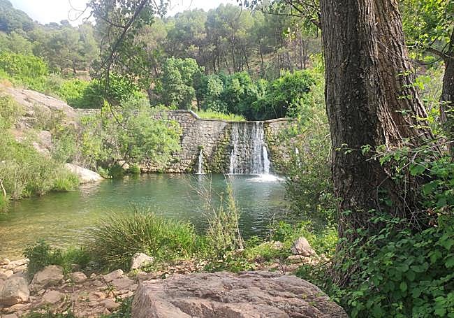
5From the Hierbabuena dam, there is only one more milestone left to finish this linear walk, the viewpoint that affords another beautiful view of the dam and the river. To do this, you have to climb a dirt track with a few steps to reach it. From there, there are only a few metres to go to reach the end of this route, which links up with stage 23 of the Gran Senda de Málaga provincial hiking route that links El Burgo with Ronda. It is therefore a good option to get to El Burgo if you don't want to return by the same route used on the way out.
Flora and fauna
Being primarily a river route, this walk allows you to get to know the biodiversity of the Turón river and its surroundings up close. Among other species, you can see barbel, bream, some snakes and freshwater turtles in the riverbed. With a bit of luck and a lot of stealth, some privileged visitors will even see an elusive otter pass by. Some locals claim that there is a family of otters in the area. As far as birds are concerned, you could see hoopoe, Montagu's harrier, kestrel, swallows, shrikes and a kingfisher or two. The riverside vegetation, very dense in places, is complemented by the groves of trees and Mediterranean scrub that can be seen in this area, which forms part of the Sierra de las Nieves, now both a nature reserve and national park.