Weather
How will the remnants of hurricane Gabrielle affect the weather in Spain today?
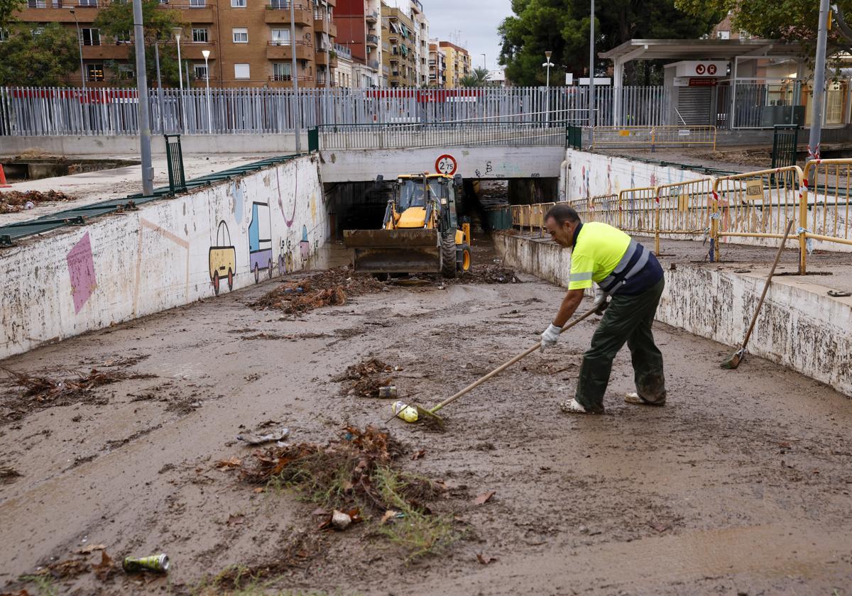
After Monday's flooding and travel chaos, a number of areas of the country remain under a red 'extreme risk' warning today with up to 140mm of rain expected to fall

Malaga
The effects of former hurricane Gabrielle will return to Spain this Tuesday, specifically to the Balearic Islands, Murcia and Valencia regions, where maximum rainfall of 140mm is expected.
In the rest of the country, the provinces that will be under an amber warning for rainfall and storms are Alicante, Valencia, Murcia (Campo de Cartagena and Mazarrón), Mallorca and Ibiza and Formentera. The maximum values of 140mm will be in Valencia and Alicante, while in Ibiza and Formentera there will be accumulated rainfall of 120mm.

The rest of the warnings for rain and storms will be in Castellón, Murcia (Altiplano de Murcia, Northwest Murcia, Vega del Segura and Valle del Guadalentín, Lorca and Águilas) and Menorca. In all these cases, the warning level will be yellow (risk).
More rain
The state weather agency Aemet forecasts for this Tuesday that instability will continue in the central east and southeast of the Spanish mainland and the Balearic Islands, under the influence of a cold trough at high altitude. Therefore, from the early hours of the morning, cloudy or overcast skies will prevail in these areas and there will be rainfall with thunderstorms, with the probability of locally heavy and/or persistent rainfall in the Valencian region, Murcia and the Balearic Islands, as well as locally very heavy rainfall on the coasts of Valencia, Alicante, Cartagena, Mallorca and the Pitiusas Islands.
Related story

In the afternoon there will be abundant cloudiness in the south and southeast halves, with possible scattered showers, which will be more likely in the eastern Pyrenees and will be accompanied by occasional thunderstorms in the mountains of the southeast third. In addition, stable weather is expected in the north-western third of the peninsula, with lightly cloudy skies, as well as low morning clouds in the far north and occasional drizzle in the Cantabrian Sea.
In Malaga province and along the Costa del Sol, umbrellas may be necessary, as the state meteorological agency forecasts cloudy skies, without ruling out the possibility of weak and occasional showers, which will be more likely and intense in the mountainous areas in the afternoon. In Malaga city Aemet puts the probability of showers at 75% in the morning, until 12 noon, falling to 40% until six o'clock in the afternoon and disappearing thereafter.
Temperatures will remain unchanged on the coast, although inland the minimum temperatures are expected to fall and the maximum temperatures to rise, although they will be around 25C in the city and on the coast. Winds will be light and variable, tending east in the afternoon.
In the Canary Islands, cloudy skies are forecast in the northeast, with the possibility of light rainfall in the eastern and midlands of the mountains, as well as intervals of high clouds in the rest of the Canary Islands. In addition, morning fog is expected in the Strait of Gibraltar and regions of the northern and eastern third of the Iberian Peninsula.
Changes in temperatures
As for maximum temperatures, they will be on the rise in most of the Spanish mainland and little change or a decrease is expected in the archipelagos and the southern interior of the Levante. As for minimum temperatures, they will be in decline or with little change. In addition, isolated frosts are expected on the peaks of the Pyrenees.
Finally, north and east winds will blow in the mainland and the Balearic Islands, which will be moderate in the western Cantabrian Sea, with possible strong intervals on the northern coasts of Galicia and with strong intervals in the eastern Mediterranean area. In addition, they will be light and occasionally moderate in the rest of the area. A windy spell is also forecast in the Ebro. As for the Canary Islands, trade winds will blow with possible strong intervals in exposed areas.
Warmer for the rest of the week
However, in Andalucía, as the week progresses, the mercury will rise. According to the regioinal delegate of Aemet, Juan de Dios del Pino, there will be a progressive rise "of about six degrees between now and Sunday", reaching maximums of "33-34C on Sunday, when we are now at 28-29 degrees". Maximum temperatures could exceed 30C from mid-week, with a weekly average temperature of around 30 degrees but rising steadily. The minimum temperatures, meanwhile, "may drop a little this Tuesday and rise on Friday, although they will hardly vary and will oscillate around two degrees".