Weather
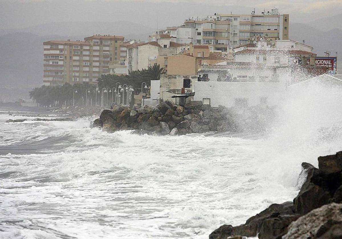
Aemet activates yellow alerts for strong winds and high waves along whole of Costa del Sol
Spain's state weather agency is forecasting gusts of up to 60 kilometres per hour and waves up to three metres high

Malaga
Bathers on the Costa del Sol have been urged to take care as coastal phenomena are going to be the main protagonists as far as the weather is concerned along the whole of the Malaga province coastline today. In fact, Spain's state Meteorological Agency (Aemet) has activated yellow alerts for strong wind and waves along the coast stretching from Manilva to Nerja. The warning, active from 8am, will be maintained until the end of the day.
The weather forecast points to winds from the west and southwest of 50 to 60 km/h (force 7) as well as waves of two to three metres in height for the entire coast of Malaga. The warnings will also affect other parts of the Andalusian Mediterranean coast; specifically Almeria and Granada, where similar gusts of wind and high waves are expected.
For the rest of Malaga province, Aemet expects cloudy or clear skies. Temperatures are expected to fall. The mercury is expected to reach 33C in Vélez-Málaga, 31 degrees in Malaga city and Marbella as well as 28C in Antequera and a maximum of 26 degrees in Ronda. Meanwhile, minimum temperatures will range from 16C in Antequera to 22 degrees in Malaga city.
Meanwhile, according to José Luis Escudero in his SUR blog 'Tormentas y rayos', although today "the terral and the poniente will blow with strong gusts of wind" he does not expect very high temperatures in the usual areas where the warm inland wind enters. "Tomorrow, Friday, they will rise a little, but the wind gusts are not expected to be as strong, and we'll see if the yellow warning for high temperatures is activated", added the Malaga weather forecaster in his latest post.
National forecast
In the forecast for the country Aemet predicts "that an unstable situation will persist in the north of the Spanish mainland and the Balearic Islands under the influence of an Atlantic trough, with cloudy or overcast skies and rainfall, accompanied by storms and locally hail in the northeast peninsula and archipelago, which are expected strong even locally very strong in the east of Catalonia, Mallorca, Menorca and Pyrenean environment, not ruled out occasionally on the eastern Cantabrian coast. In the rest of the northern third of the mainland, rainfall will be occasional", according to the weather forecast consulted by SUR.
"In the afternoon, and except in the Mediterranean, showers and thunderstorms will become less frequent, opening up more and more clearings, at the same time as they will spread, locally with hail, to the east of Teruel and especially to the north of Valencia, where strong or locally very strong intensities are also expected. Stable weather in the rest of the country, with cloudy or clear skies except in the north of the Canary Islands with cloudy skies and possible weak and scattered rainfall in the islands of greater relief, probable mist in Galicia and morning fog banks in high areas of the far north with 'calima' dust in suspension in the Balearic Islands".
Finally, the forecast highlights that temperatures will fall across the board, "notably the maximum temperatures in the central north of the peninsula and in areas of the southern plateau and the northeast, and also excepting the maximum temperatures on the east and southeast coasts of the mainland, where they will rise; exceeding 35C in regions of the extreme southeast. No changes are expected in the Canary Islands. Minimum temperatures will not fall below 20C, locally 25 degrees, in the Mediterranean area".