Worrying Nasa satellite image shows how drought is leaving its mark on Andalucía
The Terra satellite capture was compared to images taken in May last year, which depicted the region as much more green and lush
Isabel Méndez
Malaga
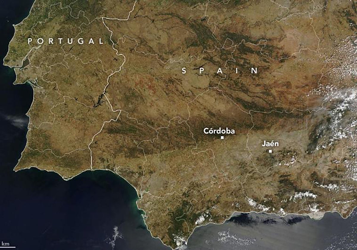
Andalucía's drought crisis can be seen all the way from outer space, according to a worrying satellite image released by Nasa.
The US agency revealed how the region's drought appears to cameras beyond the stratosphere, where the olive-producing territory is stained brown.
The image taken from the Terra satellite was compared to images taken in May last year, which depicted Andalucía as much more green and lush. A year later, the brown tones indicate a serious lack of rainfall.
In another image, the US space agency shows large irregularities in the Normalised Difference Vegetation Index (NDIV), which indicates the health of vegetation.
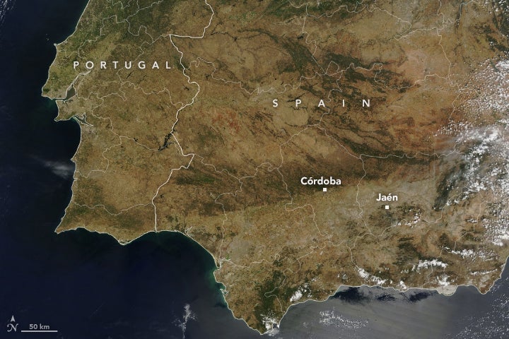
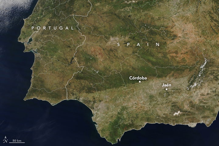
In Spain, a drought turns the world’s largest olive oil producing region brown.
— NASA Earth (@NASAEarth) May 23, 2023
NASA’s Terra satellite shows where green vegetation in May 2022 (left) turned brown by May 2023 (right). The drought dried up reservoirs, parched olive groves, and led to water restrictions. pic.twitter.com/WXeHCZBMc9
Healthy vegetation reflects a more infrared light and less visible light than dead vegetation. The ravages of drought can also be seen here, with half the country coloured brown.
Since the start of the water year on 1 October 2022, Spain has received 28% less rain than expected in mid-May 2023, a situation that is taking a heavy toll on reservoirs and crops.