Weather
New weather change on the way in southern Spain with more rain on the way next week
The state meteorological agency Aemet is forecasting widespread rainfall across the Andalucía region from midday on Monday

Malaga
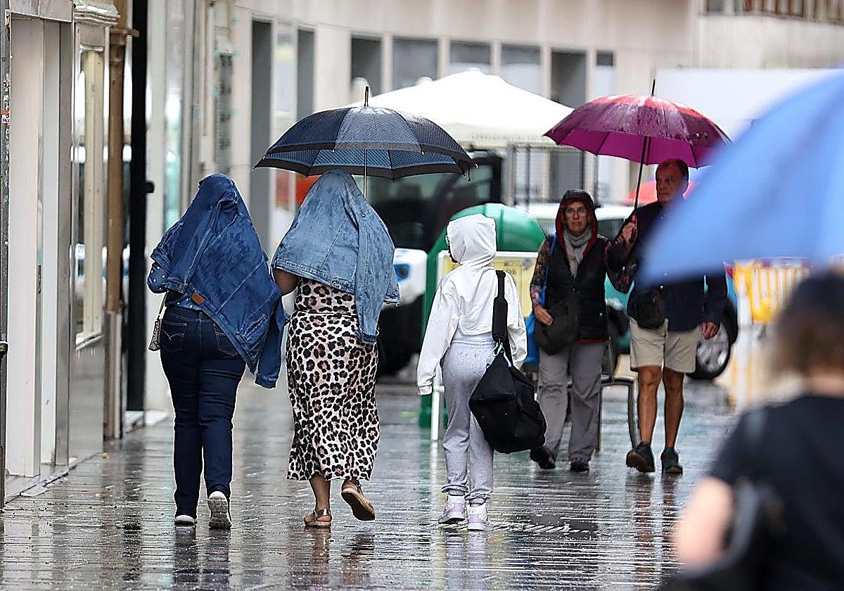
Spain is already facing its first wintery storm this week. The entry of a mass of air of arctic origin has already caused temperatures to plummet this Thursday, when 14 provinces had warnings activated for snow, high waves and wind, according to the forecast of the state meteorological agency (Aemet).
Aemet warns of a "drop in temperatures over the next few days" in Andalucía. "The coolest days in the region will be Friday and Saturday. Temperatures will begin to recover on Sunday. There will be hardly any rainfall this week," the summary published on X reads.
However, new rainfall is expected in the region from midday on Monday, 24 November. The probability of showers will exceed 65% in Cadiz, Cordoba, Jaén and Granada. In Seville, it will stand at 50%, at 45% in Huelva and at 25% in Malaga. Almeria is the only city where no rain is expected. The interior of Jaén and Granada, together with the Sierra de Aracena area in Huelva, are the places most likely to receive rainfall.
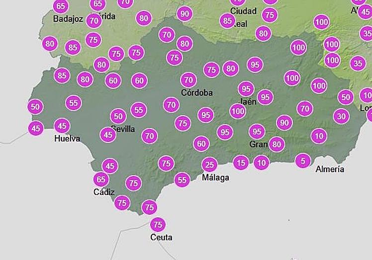
As for temperatures, Cadiz and Almeria (with 20C and 19C, respectively) will be the cities with the highest temperatures on Monday, while Cordoba and Granada will have the lowest values (6C). At the same time, minimum temperatures in Almeria, Malaga and Cadiz will not fall below 13-14C.
On Tuesday, Aemet is increasing the probability of showers to 70% until midday, especially between 6am and 12pm in Jaén, Granada, Cadiz and Cordoba. From 6pm onwards, rainfall probability will drop to below 20%.