Storm Leornardo
University of Granada researchers use georadar to help Grazalema residents return home
Geophysicists map the subsoil to a depth of 12 metres after record rainfall forced the evacuation of the Cadiz village
Inés Gallastegui
Granada
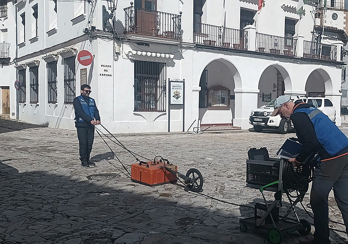
RESEARCHERS from the University of Granada (UGR) have deployed advanced ground-penetrating technology to determine if the village of Grazalema is safe for residents to return.
A team from the Andalusian Institute of Geophysics (IAG) was called in after "extreme" rainfall of 600 litres per square metre caused water to burst through the floors and wall sockets of local homes on 4 February.
Led by Director Inmaculada Serrano and researcher Teresa Teixidó, the team is using electromagnetic pulses and seismic sensors to map the limestone subsoil.
Their goal is to identify "karst" cavities - underground voids created by water - that could threaten the structural stability of the town..
On Thursday 12 February five researchers from the university travelled to Grazalema to make a first approach and determine what methodology and instrumentation they were going to need for the exploration.
On Saturday, already equipped with all their working tools, the work began, interrupted at times by new storms, as the equipment cannot work in the rain.
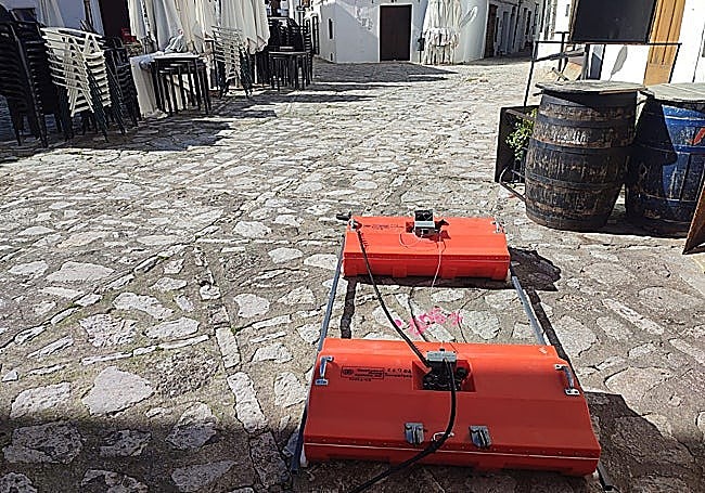
IAG researcher Enrique Carmona explained that in the first phase two georadar antennas were used to explore the karst formations of the subsoil, i.e. the cavities that water creates in the limestone rock of which the Sierra de Grazalema is made.
"The georadar method sends electromagnetic pulses into the ground to capture information about what lies beneath," explained researcher Enrique Carmona.
In addition to radar, scientists conducted a seismic survey using "geophones." By striking the ground and listening to the echo, they can determine the rigidity of the rock and whether the rain has dissolved the limestone into a dangerous "soft" state.
To do this, they used two georradars, one of 200 megahertz, which provides images with very good resolution of the ground up to 6 or 7 metres deep, and another of 100 megahertz, with slightly less resolution but capable of 'reaching' up to 12 metres underground.
Karst formations can be a few metres or several kilometres long, and can be endokarst, i.e. underground, or exokarstic. One of the most spectacular examples of the latter is the Torcal de Antequera.
Seismic survey
As a complement to the georadar images, the UGR scientists carried out a seismic survey from Monday to Wednesday, consisting of hitting the ground and listening to its echo through sensor instruments called geophones.
This method of exploration makes it possible to gather clues about the composition and rigidity of the rocks and the existence of cavities.
While 80% of Grazalema’s 2,000 residents were allowed back on 16 February, many remains displaced. The UGR study focused specifically on the "exclusion zone" in the village centre where the risk of ground collapse is highest.
"We found more karstified areas, but we don't know their state prior to the rains," Carmona noted, adding that the final report will be sent to the Junta de Andalucía shortly.
The regional government will make the final decision on when the remaining residents can safely return to their homes.
Geo-radar, a piece of equipment widely used in civil engineering and archaeology.
Geo-radars are expensive equipment, but those of the Andalusian Institute of Geophysics of the University of Granada are not the only ones in the province. Enrique Carmona explains that they are being used more and more frequently in civil works, when the promoters of a building want to know what is in the subsoil - be it pipes or archaeological remains - before starting the work.