Weather
New weather front will bring rain and warnings for strong winds and rough seas to southern Spain
The week starts with yellow alerts in three Andalusian provinces for gusts of 80 km/h and coastal phenomena

Malaga
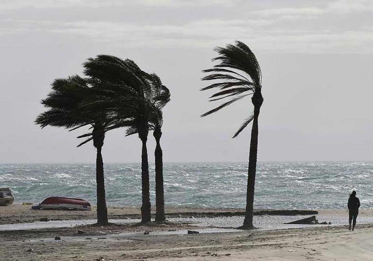
A new change in the weather is on the horizon for the start of the last week of November in the south of Spain. The passage of a front between Monday and Tuesday will leave, according to the state meteorological agency (Aemet), "some rainfall across large areas of Andalucía". Aemet is also activating yellow alerts in the region for both days, albeit for strong maximum gusts of wind and rough seas. The warnings will be activated between 10am and 12noon this Monday and will remain in place until 6am in the morning or 6pm on Tuesday.
As a result, the forecast expects for this Monday 24 November "light rainfall during the second half of the day, more intense and likely in the mountains" as well as "very strong gusts from the west in the eastern third". In fact, Aemet is going to activate yellow warnings, from 10am today (Monday), in Almeria, Granada and Jaén for maximum gusts of up to 70 or 80 km/h and three-metre-high waves.
The yellow warnings for wind will be active in the Almanzora valley and Los Vélez-Almería, Nacimiento area and Campo de Tabernas-Almería and, finally, in Poniente and Almeria city. For its part, in Granada the warning will be activated in Guadix and Baza as well as in Alpujarras-Granada and the Costa Tropical coast of Granada. Finally, in the province of Jaén, westerly winds will affect Cazorla and Segura-Jaén. For its part, the warnings for coastal phenomena will focus on Poniente and Almeria city - Almeria coast as well as on the coast of Granada's Costa Tropical.
For Tuesday, Aemet expects very strong westerly gusts in the eastern third of the Andalucía region during the early hours of the morning. In Almeria and Granada the yellow warnings for wind and waves will expire at 18.00 hours while in the province of Jaén the warning for strong gusts of wind will be deactivated at 6am.
On Tuesday, "cloudy skies accompanied by light to moderate rainfall, more intense and likely in the Betic mountain ranges, with clearings tending to open up from midday onwards". Minimum temperatures with slight changes, occurring at the end of the day; maximum temperatures slightly down or unchanged in the western half, slightly up in the rest.
"Persistent" rainfall
In the national forecast, Aemet expects for this Monday "persistent rainfall on the Cantabrian slope and Galicia, which may be locally heavy in this region and in areas of the eastern Cantabrian Sea". The state agency highlights possible accumulations of persistent rain in areas of the Central System and northern Iberian. It also notes "calima haze with high concentrations in Fuerteventura and Lanzarote and during the first part of the day in Tenerife and Gran Canaria". Finally, Aemet forecasts "a notable rise in minimum temperatures in areas of the southern plateau, locally on the Mediterranean coast and Mallorca. Very strong gusts are likely on Ibiza, the southern and eastern Mediterranean façade, the Iberian and other mountain ranges of the Mediterranean arc".
Looking ahead to Tuesday, persistent rainfall will continue "with locally heavy showers likely in the eastern Cantabrian Sea and northern Navarre which will give rise to significant accumulations". There may also be heavy precipitation in the form of snow in the western Pyrenees. "Very strong gusts are likely in the lower Ebro, north of Castellón, in the eastern Baetic and surrounding areas and Ibiza. During the morning, gusts of 100 km/h are expected in the inland south of Tarragona," Aemet predicts.