Weather
Red alerts for heavy snowfall activated in two northern regions of Spain
A total of 12 regions will be at risk this Monday for snow, rain, waves and strong gusts of wind
Europa Press
Asturias
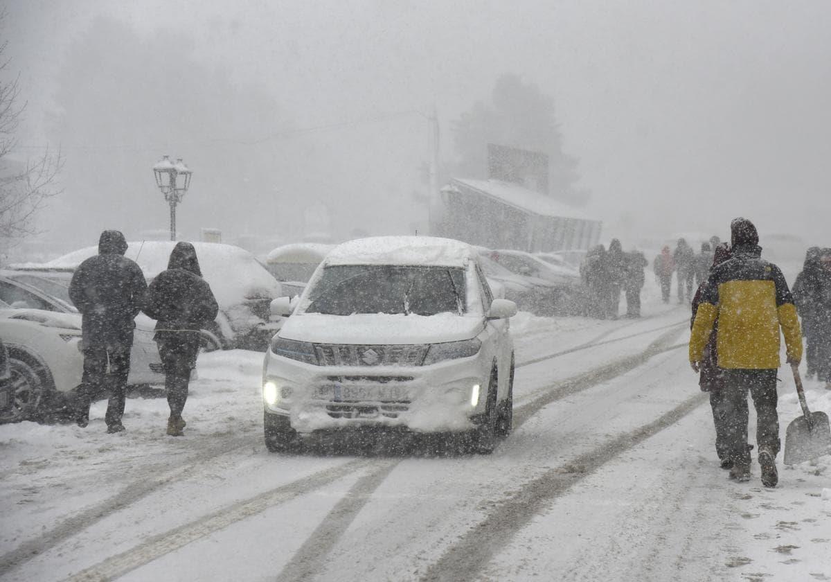
A total of twelve regions of Spain will be at risk this Monday (red/amber or yellow alerts) for snow, rain, waves and strong gusts of wind, especially Asturias and Castilla y León in the north of the country, which will have a red alert for snowfall, according to the forecast of the state weather agency (Aemet).
Snowfall will put Asturias, Palencia and León on red alert (Castilla y León), where snow accumulation in 24 hours is expected to reach 40 centimetres above 1,200 metres. To a lesser extent, snow will affect Huesta and Terual (Aragon), Cantabria, Lérida (Catalonia), Lugo (Galicia), Navarre, Álava (Basque Country), Burgos, Segovia and Soria (Castile and León) and La Rioja, with accumulations that could reach five centimetres in 24 hours.
The rains will affect Asturias, Cantabria, Burgos (Castile and Leon), Barcelona (Catalonia), Majorca and Menorca (Balearic Islands), Navarre and the Basque Country, which will be on yellow alert for downpours that may accumulate up to 40mm in twelve hours.
Strong gusts of wind
The Valencia region, Catalonia, Castile and Leon and the Balearic Islands will be at risk (yellow alert) for wind gusts of up to 80 km/h. In turn, Asturias, the Balearic Islands, Galicia, Murcia and Valencia will be on yellow alert for waves. This phenomenon will activate the orange alert in Cantabria, Catalonia and the Basque Country for waves that could reach six metres high.
In general, the Spanish mainland and the Balearic Islands will remain under the influence of an arctic air mass which, together with the approach of a Mediterranean storm, is expected to leave precipitation in large areas of the northern half of the Peninsula and the Balearic Islands, without being ruled out in Alboran Sea (westernmost part of the Mediterranean) area.
Rainfall will be heavier and more persistent on the Cantabrian coast, the Pyrenees and the north of the Iberian system. There will be moderate snowfall in large areas of the northern half of the peninsula, also possible in the south-eastern mountain ranges. The altitude will be around 700/900 m, rising to 1,000/1,200 m in the western half of the peninsula. Significant accumulations are expected in inland areas in the far north, especially in the Pyrenees and Cantabrian Mountains above 1,200 m. In the Canary Islands, cloudy intervals will prevail, with a low probability of weak and occasional showers in the north of the islands of greater relief.
Temperatures will continue to fall, moderately in the south of the peninsula and the Balearic Islands. Frosts will affect most of the interior of the northern half and the south-eastern quadrant of the peninsula, becoming heavy in the Pyrenees.
Finally, the wind will blow from the north and northwest on the Spanish mainland and the Balearic Islands, which during the first half of the day will have strong intervals and very strong gusts in large areas of the northern and eastern thirds mainland, central mountains and the Balearic Islands. In the Canary Islands, moderate trade winds will also blow with strong intervals.