Weather
Heat intensifies in Malaga province: yellow warning for maximum temperatures of 36C
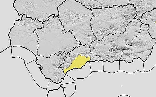
Warnings are active in the Costa del Sol in the Guadalhorce Valley


Málaga
Summer has officially started in Malaga province. Within just a couple of days, there have been warnings for both high minimum and maximum temperatures. If on the night of San Juan Malaga city experienced the first torrid dawn (in meteorology, this means that the minimum temperature does not fall below 24C or 25C), state meteorological agency Aemet has now activated a yellow warning for maximum temperatures of up to 36C this Wednesday.
The warning concerns the Costa del Sol and the Guadalhorce Valley, which include the city, the Guadalhorce area and the western coast. It will remain active from 1pm to 9pm. While Malaga city might experience maximum temperatures of up to 36C, the province will see minimum temperatures dropping. Maximum temperatures will also experience a drop in the northern third of the province, while a rise will be felt in the rest of the territory. Light north-westerly winds and moderate westerly on the coast are also forecast.
According to José Luis Escudero - expert in Malaga meteorology and head of SUR's 'Tormentas y rayos' blog - Malaga province expects two days of the warm 'terral' wind: Wednesday and probably Thursday. "The rise in latitude of the 'dana' (cold drop) and its subsequent reintegration into the general circulation will bring the terral to the province of Malaga," said Escudero.
'Dana' in the northwest
At national level, Aemet has forecast the end of the passage of a 'dana' over the northwest of the Spanish mainland on Wednesday, leaving the Cantabrian Sea, although the exact position of this phenomenon is uncertain. There will be "storms and locally heavy showers with hail and very strong gusts in the early hours of the morning in large areas of the northwest of the plateau, the Cantabrian Sea and Galicia". The forecast also highlights significantly high maximum temperatures in the eastern third of the mainland and the Balearic Islands.
A general drop in maximum temperatures is expected, except locally in Ampurdán, the western Meseta, and the southeast, where temperatures may rise. "Even so, temperatures are expected to exceed 34-36C in the Balearic Islands and valleys in the southeast and northeast of the Peninsula, even reaching 38-40C in the Ebro depression. Minimum temperatures will fall almost everywhere across the Peninsula."
Aemet has also pointed out that "light winds will blow on the mainland and the Balearic Islands, slightly stronger on the west coast in the Cantabrian Sea, westerly in the Strait of Gibraltar and Alborán". It also noted "a predominance of easterlies in the Balearic Islands and the eastern third of the peninsula, tending to the west. The westerly component will predominate in the rest of the Peninsula. In the Canary Islands, trade winds will blow, with strong intervals and very strong gusts in exposed areas".