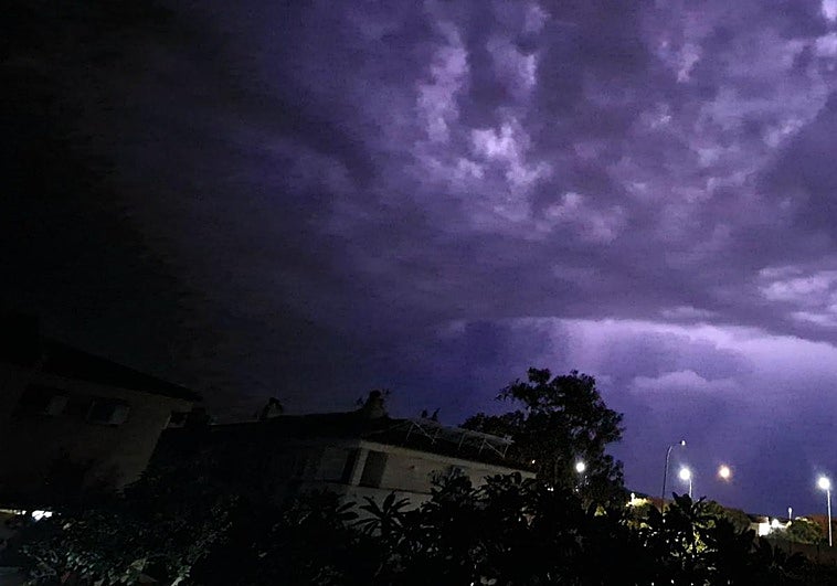
Almost 100% chance of rain in Malaga today, with 27 provinces across Spain under weather alerts
State agency Aemet forecasts occasional showers in the province and along the Costa del Sol that may be accompanied by thunderstorms and deposits of mud
The weather will take a sharp turn this Thursday. Although we are still in August, the sun and bright skies will give way in Malaga, at least during the early part of the morning, to very cloudy skies with occasional showers and thunderstorms. According to the forecast of Spain's state weather agency (Aemet), the rainfall will also leave deposits of mud, without ruling out locally heavy rain in the mountain areas, with the rainfall diminishing during the afternoon. In addition, there will be 'calima' dust from the Sahara desert in suspension in the atmosphere.
However, temperatures will change very little, except for a drop in maximum temperatures in the northern third of the province, and so in Malaga city for example, a minimum of 24C and a maximum of 30 degrees are expected, in line with the values of the last few days. The probability of rain will be 95% until midday, after which it will drop to 10% until six o'clock in the evening, before disappearing. Winds will be light and variable, with a predominance of the south.
Rain will also be the main this 29 August across a large part of Spain as more than half of the country will be under a rain and storm warning, with Teruel and Zaragoza at amber level.
Specifically, according to Europa Press, in Andalucía the warnings for rain and storms will be in Cadiz and Cordoba, as well as in Huesca (Aragon); all provinces of Castilla y Leon except Salamanca; Castilla-La Mancha in its entirety; Sierra de Madrid, Metropolitana and Henares and Sur, Vegas and Oeste (Madrid region); Cantabrian slope of Navarre, centre of Navarre, Navarre Pyrenees, and Ribera del Ebro of Navarre; the whole of the Basque Country; Ribera del Ebro of La Rioja and La Ibérica of La Rioja; and Valencia (Community of Valencia). In addition, Lugo and Ourense (Galicia) will be under a warning only for storms and Almeria (Andalucía) will have an alert activated for coastal phenomena.
Aemet expects an Atlantic trough to be located to the west of the Spanish mainland, which will cause abundant medium and high cloudiness that will move from southwest to northeast, with the probability of showers and occasional thunderstorms that will affect large areas. With a wide margin of uncertainty, the state agency has advanced that these showers may be locally heavy or very heavy and with hail in western Andalusia, areas of the southern plateau, large areas of the interior of the northern half and eastern Cantabrian.
At the same time, they may be locally persistent in central and inland north-eastern areas. They will affect other areas in a weaker and more scattered way, except for the north of Galicia, where cloudy skies and precipitation are expected, and the eastern Mediterranean area, where high clouds are expected. Meanwhile, in the Canary Islands, cloudy intervals are forecast in the north of the islands, without ruling out light rainfall, and light clouds in the south. In addition, the forecast includes a probable weak 'calima' haze in the centre and south of the mainland and Alborán, so the showers may be accompanied by mud. In the interior of the Cantabrian area and inland areas of Levante, the Balearic Islands and the Catalan coast there will be probable morning fog.
Changes in temperatures
With regard to temperatures, Aemet indicates that maximum temperatures will tend to fall, and that they will do so markedly in the interior of the Spanish mainland, with locally notable drops. At the same time, minimum temperatures will rise in the northwest and fall in the centre. However, temperatures could still exceed 34C in parts of eastern Andalucía and northeastern depressions. The provincial capitals with the highest temperatures will be Almeria, Badajoz, Girona and Lleida with 34C; Murcia and Ourense with 33C; and Albacete, Palma and Zaragoza with 32C.
Winds from the south and east will prevail in the Mediterranean area and the eastern third, with strong intervals on the south-eastern coasts. In turn, there will be north and east winds in the Cantabrian Sea and, with strong intervals, on the Galician coast. Elsewhere, winds will be variable, with easterly and southerly components prevailing in central hours and, in the Canary Islands, moderate trade winds with some gusts or strong intervals in exposed areas.
