Province's reservoirs and aquifers lose water despite a May three times wetter than normal
The arrival of summer will be delayed this year in Malaga and on the Costa del Sol, as state weather agency Aemet forecasts that temperatures will be cooler than average until mid-June
Ignacio Lillo / Francisco Jiménez
Malaga
Miércoles, 31 de mayo 2023, 12:07
The recent heavy spring rains have resulted in a contradictory scenario in Malaga province. On a positive note, Spain’s state weather agency Aemet said that the rain gauge at Malaga Airport, which is the one that marks the official rainfall figure for statistical purposes, has collected 64mm during the month of May. That is about three times more than normal for the month (23mm), compared to the reference period 1991-2020.
This will therefore be classified as a "very wet" month within Aemet's climate study records. Of course, as Jesús Riesco, director of the Malaga meteorological centre, pointed out it is not the same for this to happen in May as it would have been in December, when it would have meant going from 100 to 300mm: "That would have saved the year for us" .
Inland the figures have been very patchy with around 30-40mm where rain has fallen, although the distribution of the storms meant they generally avoided the province’s main reservoirs. Additionally the meagre amounts of rain have hardly been enough to make a noticeable difference anyway.
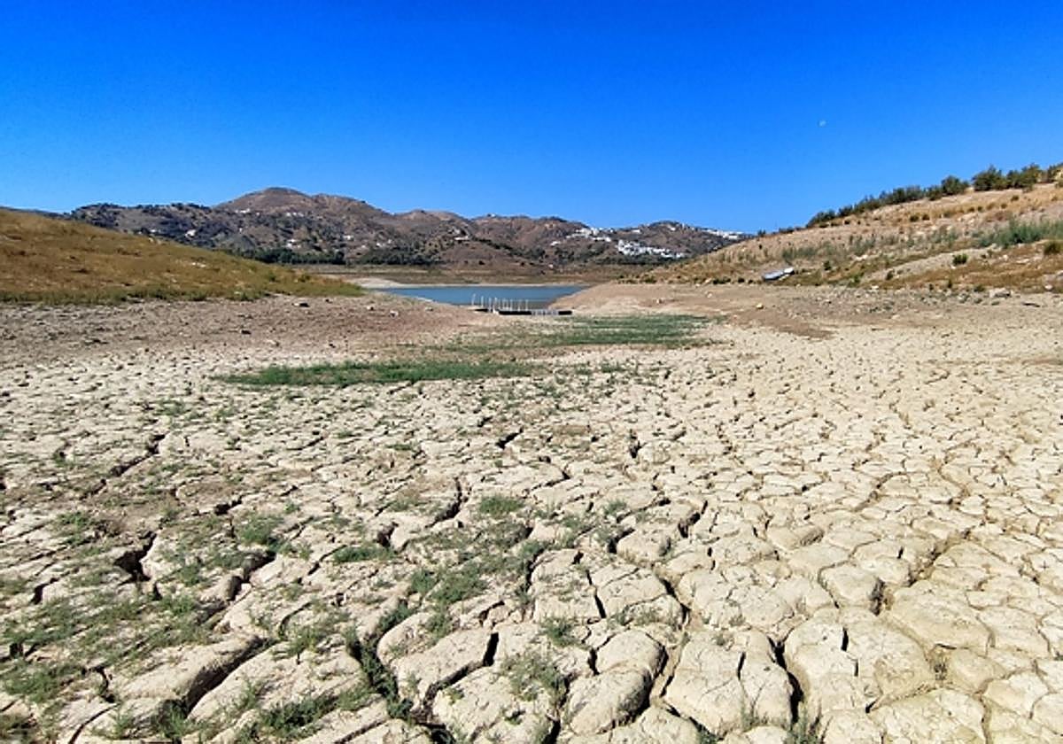
And this has been reflected in the level of Malaga province's reservoirs. The data from the Junta de Andalucía’s Hidrosur network yesterday (30 May) showed 200.4 cubic hectometres of water stored, only 32.8% of the province’s global capacity, after having lost 1.75 Hm3 in the last week (the peak period of the downpours). There are 127 Hm3 fewer stored than on the same date last year.
By area, the one that is best prepared to face the arrival of summer is the Costa del Sol, where the La Concepción reservoir stores 41.4 Hm3, almost 72% of the capacity. To this must be added the resources from the Marbella desalination plant and the Mijas aquifer wells.
Malaga city has stored water in the Guadalhorce system reservoirs, where the Guadalhorce, Conde and Guadalteba total 128 Hm3. Added to this are the lamination reservoirs (their primary function is to contain river floods) of Limonero (regulating the Guadalmedina) and Casasola (Campanillas). Both contain about 15 Hm3. There is also the catchment of the Aljaima dam, which benefits from the flooding of the lower course of the Guadalhorce river.
Unfortunately, once again, the worst situation is in the Axarquía, where the May storms have barely made themselves felt, and have served at best to temporarily slow down the loss of water through usage and evaporation. La Viñuela contains 15.8 Hm3, just 9.6% of its capacity and with a very small usable liquid layer.
Low aquifers
More complex is the analysis of groundwater reserves, although the conclusion is equally negative. "In general, there has been no improvement in the aquifers", is the conclusion of professor of Geology and director of the Centre for Hydrogeology of the University of Malaga (UMA), Bartolomé Andreo. In the province of Almeria there has been a specific improvement because more intense downpours have fallen than here, "but in the Malaga area there does not seem to be a significant, clear and evident benefit to the aquifers."
“In the end, they are still underground reservoirs to which the water has to pass from the surface, through the permeable layers. They require time and a certain amount of rain to fall, both in continuity and intensity, for the water to flow from the ground to the saturated zone. That is, ultimately, more rain, with a higher intensity and for a longer period than actually happened", he added.
Therefore, in most cases they continue the downward trend, perhaps slowed down slightly in some places where the storms have left more rain. No improvement has been seen in the northern area of Antequera, nor Fuente de Piedra. In the Alcornocales, some improvement has been seen, but these are small and more superficial. But in the area most in need, which is the Axarquía, in the aquifers of the Tejeda and Almijara mountains there has been no rise in the level of groundwater detected.
"Not much more rain is expected anymore, so we will need to wait for autumn," concluded the professor.
At least the temperatures have softened and the evaporation rate has dropped a little, as has water stress in the fields, which has been alleviated thanks to the more humid and cooler atmosphere.
Drought Decree
“The rain has improved the situation somewhat, but sady it does not change anything in terms of the Drought Decree, so the planned measures cannot be relaxed.
“Unfortunately, the expectations we had according to the forecasts were much higher. And although in some areas a lot of rain fell, the truth is that in the main reservoirs it has hardly been noticed," said the Malaga delegate of the Ministry of Agriculture and Water, Fernando Fernández. Looking for something positive in the situation, he pointed out that this episode of rainfall "has cooled the environment and lowered temperatures, which is also good for the countryside because it reduces water stress."
However he acknowledged that the outlook is complicated at the gates of summer. Hence, in the next few days, a new meeting of the Commission for Drought Management is scheduled to be called, to assess the situation and analyse the measures that can be adopted, without it being clear if they would be taken before the summer season or later. Will there be restrictions? "Nothing has been decided. At the moment, the situation is being assessed,” said Fernández.
Summer is delayed
As for the weather forecast, during the last day of May and the beginning of June some rain could still fall in inland mountain areas. Until Thursday, what can be expected is isolated, insignificant showers and no storms. But on Friday and Saturday, June 2 and 3, the downpours could be heavier, more frequent, and affect more areas. "In principle, they will be short-term showers, weak and concentrated in a few minutes, which could fall almost at any time of the day," explained the director of the Malaga weather centre, Jesús Riesco.
In the medium term, the meteorologist clarified the scenario saying: “This year it will be slow for summer to arrive, weather instability will continue in Malaga, with temperatures below normal and showers next week and even the following; until after the middle of June the heat will not arrive, it will take time and we’ll have to wait.”
Riesco pointed out that by now the temperatures should already be higher, and if they are around the average today (Wednesday) it is only because of the influence of the warm terral wind, with maximums of 27-28C where it blows. But as of Thursday it will drop again to 23-24 degrees, "clearly below normal for the first days of June", when the monthly average of the maximum is 29 degrees. Inland the trend is the same and in Antequera, for example, June will start with 22-24 degrees, when the average is 29.