Weather forecast
Met Office activates yellow 'risk' warning in Malaga and on Costa del Sol for heavy rain and storms
The state agency weather agency (Aemet) forecasts that the bulk of the rain will fall before noon on Sunday


Malaga
Umbrellas will be needed on Sunday morning in Malaga, at least until noon, according to the forecast of Spain's state weather agency (Aemet), which has activated the yellow 'risk' warning for heavy rains and storms in much of the province.
Related news
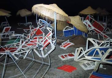
Specifically, the alert will be for the Costa del Sol area - which includes Malaga city and the Guadalhorce valley - and it will remain in force from midnight this Saturday to 3pm on Sunday, as things stand at the moment initially. During that time, the forecast suggests that up to 70mm of rain could fall in 12 hours and 25mm in just 60 minutes.
The probability of rain is 95% until twelve in the morning, while from twelve to six in the afternoon it drops to 35% before rising again to 70% from 6pm until the end of the day.
The general forecast predicts cloudy or overcast skies in the province on 3 September, with showers and storms that may be locally strong and persistent, and that will subside in the afternoon. The winds will blow occasionally strong from the east, decreasing to variable in the afternoon, except on the eastern coast, where they will blow from the west.
Temperatures will drop and the maximum temperatures will be close to 26C while the minimum temperatures will not exceed 20 degrees. The values expected in the Ronda and Antequera areas stand out, where minimum temperatures of 14 and 16C are expected, respectively.
Rain throughout the country
Aemet has issued a new special warning for the rain and storms that are expected in Spain until Monday, indicating that it is likely the 'dana' (depresión aislada en niveles altos), a 'cold drop' depression at high levels of the atmosphere, will be centred in the southeast of the mainland could, in combination with warm sea temperatures, will bring abundant rainfall.
For this reason, there is an amber warning for storms on the islands of Ibiza and Formentera and the autonomous city of Melilla, as well as in the provinces of Tarragona, Alicante, Valencia, Murcia, Madrid and Toledo. The storm warning is yellow in the provinces of Almeria, Cadiz, Granada, Huelva, Jaén, Malaga, Ávila, Burgos, Segovia, Soria, Valladolid, Albacete, Ciudad Real, Cuenca, Guadalajara, Castellón and Barcelona.
Likewise, the provinces of Teruel, Zaragoza and Álava, as well as those in the centre of the mainland, are at risk from high winds, a situation that will also affect most of Catalonia, the entire Valencia region and the Balearic Islands, which also adds a warning for possible coastal phenomena.
Temperatures below normal
The special notice from Aemet has indicated that, throughout the weekend, due to cloudiness and expected rainfall, an autumn atmosphere will predominate, with temperatures below usual for these dates in much of the country.
Aemet expects that this Sunday, as a general trend, rainfall will move throughout the day from southeast to northwest, with the probability of becoming heavy and/or locally persistent in the southeastern and central third of the mainland, as well as other areas of the Levante, without ruling out the northern plateau and nearby areas. In addition, the storms could be accompanied by hail. A 'calima' (Saharan dust in suspension) is not ruled out in the eastern half of the mainland, Melilla and the Balearic Islands, so rainfall could be accompanied by mud, while in the Canary Islands cloudy intervals are expected with probable weak rain in the north of the islands, which will tend to move occasional showers within the most prominent ones.
With possible morning fog banks in mainland mountain areas, the weather agency predicts decreasing minimum temperatures in areas of eastern Andalusia, Melilla and the Canary Islands, increasing in the extreme northwest and the Balearic Islands, and without major changes in the rest.
As of Monday, however, uncertainty about the forecast increases but the most likely thing, according to Aemet, is that the storm will move away to the west in the Atlantic, reducing the amount of rainfall in the east of the mainland and the Balearic Islands, but it is likely that the unstable weather will continue with showers and storms in the western half and central areas.