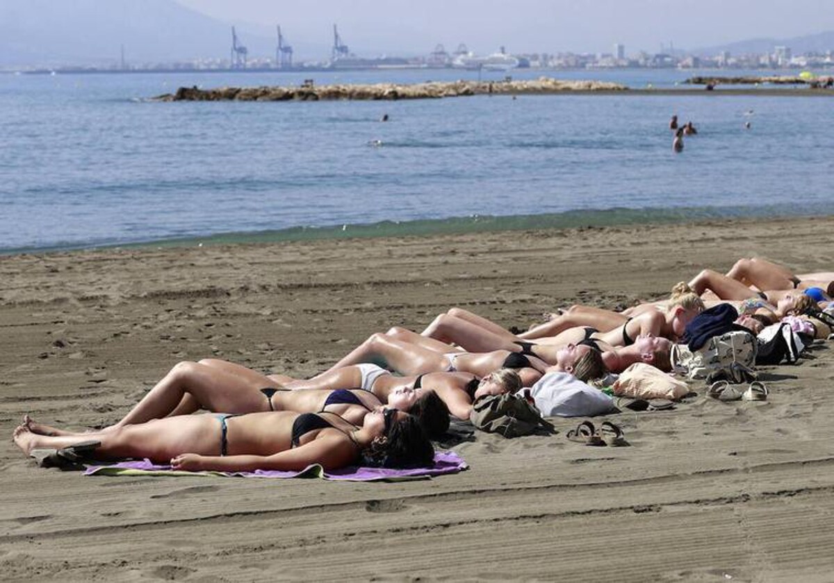
This could be the last opportunity to soak up summer-like temperatures as much-needed rain is on the way for Malaga province
A late blast of heat will see temperatures rise to about 30C on the Costa del Sol this weekend, but then there will be a dramatic drop along with widespread rainfall in Spain
Ignacio Lillo
Malaga
Thursday, 12 October 2023, 10:12
There will be one final blast of heat in Malaga this weekend before a sharp drop in temperatures on Monday that is also expected to bring widespread rainfall across the province.
A local, warm 'terral' wind will sweep across many parts of the province this Saturday 14 October resulting in highs of 30C, but Spain's state weather agency (Aemet) has predicted more autumnal conditions will set in from Monday 16 October onwards.
Jesús Riesco, local director of Aemet, said storms will arrive from the Atlantic causing a dramatic change in temperature. "In the case of inland Antequera the maximum temperature will drop from around 30 to 22 degrees on Monday and it will be a similar situation on the coast," he said.
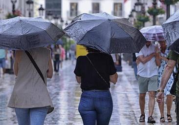
But perhaps the most anticipated effects of the storms will be much-needed rainfall, breaking a dry spell of several months. Showers may start inland in the early hours of Sunday, becoming stronger throughout the province between Monday and Wednesday. Up to 100mm could fall at Malaga Airport between 16-18 October, according to predictions.
Inland areas such as the Sierra de las Nieves and parts of the Guadalhorce and Rio Grande areas can expect 180mm, and about 80mm in the high areas of the Axarquia.
What are the "atmospheric rivers" that will affect the mainland next week?
From 13 October people in Spain can expect a "storm train" to form across a large part of the country which will trigger rainfall. Francisco Martín, an expert at Meteored, pointed out that these Atlantic squalls, on entering the north of the country and at lower latitudes, will interact with other tropical and subtropical lows, causing "atmospheric rivers of humidity".
They are relatively narrow regions in the atmosphere responsible for most of the horizontal transport of water vapour out of the tropics. When they enter in the form of a "storm train", they can generate periods of intense and prolonged rainfall, even flooding. So this weekend may be the last opportunity to soak up summer-like temperatures in Spain.