The Great Axarquía path: 44 kilometres linking eight mountain villages and the coast
Malaga’s provincial authority has created a new walking route that runs through Riogordo, Comares, Cútar, El Borge, Almáchar, Macharaviaya, Moclinejo and Rincón de la Victoria

Malaga’s provincial authority, the Diputación, has created a new walking route to promote active tourism in the small inland villages of the Axarquía and connect them with coastal towns.
The ‘Gran Senda de La Axarquía’, or the GR242, covers 44.4 kilometres passing through the eight localities. The project, with funding of 66,195.84 euros, starts in Riogordo and ends in Rincon de la Victoria, where it joins the Great Malaga Path and Malaga's coastal path.
Announcing the new route on Wednesday 8 February, president of the Diputación and mayor of Rincón de la Victoria, Francisco Salado, stressed that the tourist potential of the Axarquía is "impressive". Salado went on to say, "We have a vast cultural and environmental heritage in the Axarquia, some of which has yet to be exploited,"
Active tourism
Other projects that have either already been developed or are in the pipeline in the eastern area of Malaga province include the ambitious project planned for the La Viñuela reservoir to turn it into a first class destination for active tourism and environmental tourism, the El Saltillo bridge in Canillas de Aceituno and the progress of the coastal path. "All these elements will serve to enhance and diversify the range of active tourism in the region and the municipalities that make it up," Salado said.
The path is approved by the Andalusian Federation and Mountaineering and the area’s muscatel grape heritage is also recognised by the Food and Agricultural Organisation (FAO) of the UN. "The route between these municipalities opens the doors to unique landscapes between the sea and the mountains, making one of the most important agricultural heritages of our province more accessible," said Salado. The new route takes in farmhouses, wineries and a wide range of restaurants.
Four stages
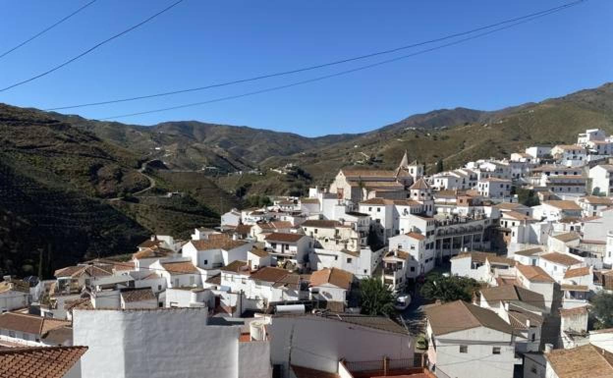
The route is divided into four stages: the first connects Riogordo and Comares, covering over 14 kilometres. This stage starts on the path of the Las Morenas stream in Riogordo and ends at the Puerta del Agua in Comares, which is famous for being home to the longest natural zip wire in Spain as well as its climbing area. The section has a cumulative ascent of 1,039 metres and a descent of 705 metres. The estimated walking time is five and a half hours.
The second stage links Comares, Cútar and El Borge over a distance of 11.3 kilometres. It starts in Calle Calvario in Comares, crosses Cútar and ends in El Borge at the intersection with the MA-3109 road. This section takes in local vineyards, views of the peak of La Maroma mountain, which at 2,064 metres above sea level, is the highest in Malaga province. The section has a cumulative ascent of 398 metres and a descent of 828 metres. The estimated walking time is four hours.
The third stage connects El Borge, Almáchar, Macharaviaya and Moclinejo and is over 11 kilometres long. It starts at Avenida María Zambrano in El Borge, crosses Almáchar, passes through Vallejos - a small hamlet belonging to Machavariaya, and ends at Calle de la Serrana in Moclinejo. It climbs up to Cerro Patarra; one of the highest points in the area.
The route along the crest of the hills that separate Almáchar and El Borge from Moclinejo and Macharaviaya provide excellent views of the Axarquía. The section has a cumulative ascent of 857 metres and a descent of 624 metres and the estimated walking time is four and a half hours.
Coastal path
Finally, the fourth stage links Moclinejo and Rincón de la Victoria, with a route of 7.7 kilometres. It starts at the junction of the MA-3119 local road with the MA-108 in Moclinejo and ends at the junction of the Granadilla stream where it joins up with the great Malaga path (Gran Senda de Málaga) and the Senda Litoral (coastal path) in Rincón de la Victoria.
Along its route there are views of the coast and towns such as the hamlet of El Valdés, which belongs to Moclinejo. The sectionhas a cumulative ascent of 164 metres and a descent of 672 metres and the estimated walking time is two hours and forty minutes.
The Diputación highlighted that this new route is added to the list of other long-distance footpaths in Malaga province, such as the GR249 or Great Malaga Path, GR141 or Great Path of the Serrania de Ronda, the GR243 or Path of the Sierra de las Nieves, the GR245 or Mozarabic Camino de Santiago, the GR 248 or Guadalhorce Great Path, the GR7 or European Long Distance Footpath, and the GR92 or Malaga Coastal Path.