Weather emergency
Weather office activates red warning for 'torrential rains' in Huelva province: regional government urges people to 'avoid travelling'
Andalucía activates level 1 of the flood risk plan in the province: the forecast predicts up to 120mm in 12 hours
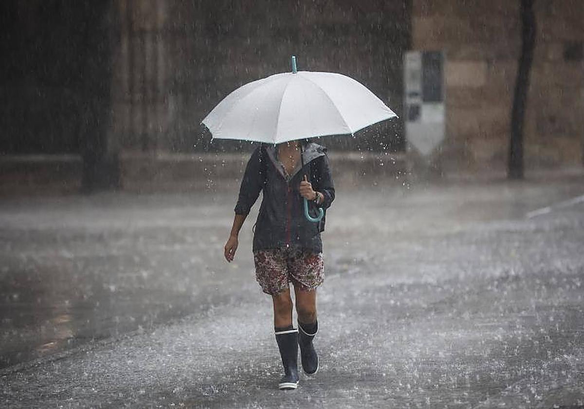
Regional minister of health, the presidency and emergencies of Andalucía Antonio Sanz activated the red warning (extreme risk) for heavy rainfall in the province of Huelva on Wednesday, 29 October. With that, he also activates level 1 of the flood risk plan of Andalucía.
On his X profile, Sanz warns that "torrential rains are expected near Ayamonte". Faced with this emergency, he has asked people to "avoid travelling" and follow the instructions of the 112 services.
Related story

The residents of the coast of Huelva have started to receive the red alert on their mobile phones, asking them to "exercise extreme caution".
The red alert remained active until 2pm on the coast of Huelva due to the possibility of accumulated rainfall of 60mm in one hour. Torrential rain is expected in the area around Ayamonte as well as in the north-east in the coming hours. State meteorological agency Aemet forecast 120mm in 12 hours.
Forecast for Wednesday
Additionally, Aemet activated the amber warning in all areas of the province of Huelva, as well as in the countryside and Sierra Norte and Sur of Seville until 9pm on Wednesday, expecting 80mm in 12 hours. The amber alert is also active until midnight in the Sierra de los Pedroches in Cordoba.
A yellow warning will be active until midnight throughout the province of Cadiz, in Cordoba (Campiña, Sierra and Pedroches), in Malaga (Sol and Guadalhorce, Ronda and Axarquia) and in Granada (Costa, Nevada and Alpujarras).
In addition, a yellow warning for strong winds of up to 70 kilometres per hour is active in the provinces of Cadiz, Huelva and Seville (Campiña and Sierra Norte).There is also a yellow warning for coastal phenomena in the Strait of Gibraltar and the coast of Cadiz and Huelva.
Incidents
The Andalusian emergency services had responded to 80 calls related to incidents by 8.45am on Wednesday, mostly in Seville, where public roads, premises, basements and ground floors had flooded. Of all the reports, 69 were in Seville, five in Cadiz and Huelva each and one in Cordoba. Trees, lampposts and road signs have also been damaged by the heavy rains.
The most striking incident so far today has happened in La Puebla de Guzmán (Huelva), where a wall has collapsed on the HU-5401 road in the direction of Paymogo. Dos Hermanas, Alcalá de Guadaíra, Fuentes de Andalucía, La Puebla de los Infantes, Lebrija, Lora del Río and the city of Seville have received the highest number of warnings, especially between 3.43am and 4.30am. The most affected towns have been Huelva, La Puebla de Guzmán, Almonaster la Real and Los Marines (Huelva province); Jerez de la Frontera, Rota and Sanlúcar de Barrameda (Cadiz); and Santaella (Cordoba).
Eight municipalities have also activated their local emergency plans: five in Seville (Osuna, Utrera, Castilblanco de los Arroyos, Pilas and San Juan de Aznalfarache) and three in Huelva (Cortegana, Castaño del Robledo and Rosal de la Frontera).
112 instructions
In the face of rain and storm warnings, 112 recommends extreme caution and following self-protection guidelines. If you can, avoid travelling. If you cannot, stay informed and check the state of the roads before leaving. Once on the road, follow the indications on information panels and those of local, regional and state authorities. Check social media, official channels and weather forecasts for updates and live information.
When driving in the rain, slow down and increase the safety distance. Never drive through a flooded area. If you have crossed a flooded area for any reason, then you should test the brakes by lightly applying pressure. If you are caught in heavy flooding, be prepared to leave the vehicle immediately as soon as the water rises above the wheel. Do not camp or park near riverbeds, even if they are dry, to avoid being surprised by a sudden flood.
In the countryside and in stormy weather, isolated or solitary trees, stones and metal objects attract lightnings and should be avoided. In coastal areas, you should avoid walking along promenades, breakwater areas and lookout points, as the waves could suddenly sweep you into the sea. At home, in the event of rising water levels, go to the highest floors and avoid basements and garages.
On days with strong gusts of wind, close your doors and windows and remove all furniture and objects (flower pots, awnings, clotheslines, chairs, etc.) that could fall on the street and cause an accident. On public roads, stay close to walls and fences and away from cornices or trees that could fall. Extreme precautions should be taken if you are next to buildings under construction or in poor conditions.
If a strong wind surprises you during a car journey, do not stay inside the vehicle. Instead, look for a safe place where you can take shelter. In the event of any emergency situation, call 112, which is free and available 24 hours a day, 365 days a year.