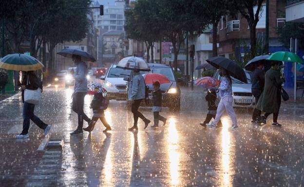
A 'train of weather fronts' set to bring rain to the south of Spain this week
The Aemet weather agency forecasts showers arriving in Malaga province from Tuesday onwards
EUROPA PRESS
MADRID.
A 'train of Atlantic weather fronts' moving from across Spain from west to east will bring clouds and rain to part of the country this Monday, 14 November, according to the Meteored portal - especially in the north where temperatures will drop and there will be strong gusts of wind.
Spain's Aemet weather agency is also forecasting plenty of cloud today and rain in Cantabria, spreading to the Meseta Norte, the west of the Meseta Sur and the Central system, the upper Ebro, north of the Iberian system and the western Pyrenees. In the south and south east of the country, there will be cloudy intervals.
Towards the end of the day a new front will bring rain to Galicia, where the wind will be strong on the coast and in the north. In La Coruña and Pontevedra a yellow weather warning has been issued for strong winds and high seas.
Malaga province
People in Malaga should not have to reach for their umbrellas this Monday. However, instability will grow in the province as the week progresses. Aemet forecasts the possibility of rain in Malaga city on Wednesday at 100%. In inland areas such as Ronda and Antequera area, the showers could arrive tomorrow, Tuesday, with a high probability of 100%. And the experts are point outing that in the middle of the week we will be affected by new, more active frontal systems that could distribute rain from the northwest to the southeast. In addition, between Thursday and Friday there is the possibility that the entry of cold air in the middle layers of the atmosphere will bring heavier rain. In Malaga, the Aemet forecast foresees a 25% chance of showers on Thursday and a 65% chance for Friday. Good weather is expected again over the weekend.
Calima in the Canaries
Returning to today, the Canary Islands there will be cloudy intervals and possible calima (dust from the Sahara desert), while in the Balearics skies will be cloudy and a strong probability of rain and storms.
The snow level this Monday will range from 1,800/2,000 metres on the western Cantabrian mountains, rising to 2,200 metres in the Pyrenees.
Meanwhile, temperatures will rise slightly west of the Canaries and in the Mediterranean area, but will drop noticeably in the rest of the country. There could be some frost in the Pyrenees.
Winds will be predominantly from the south-west on the peninsula and in the Balearics, but from the west in Cantabria and Galicia then turning south-west and becoming stronger with gusts of over 70 kph.
There will also be a westerly wind in the Strait of Gibraltar and Alboran, while in the Canary Islands winds are expected to be from the east but turning north-east in the eastern islands and north-west in the western islands.