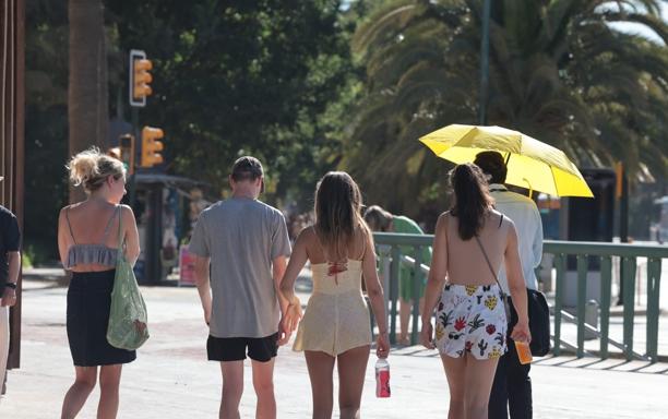
Spain's heatwave will last until at least Friday and there could be more Saharan dust on the way
Experts say the hot weather may affect much of the country into next week and many places can expect temperatures above 40C
EUROPA PRESS
Madrid
Tuesday, 14 June 2022, 10:03
The State weather agency (Aemet) has said the heatwave which is affecting much of Spain this week will last “at least” until Friday 17 June, with temperatures much higher than usual for this time of year almost everywhere except Galicia, the western coast of Cantabria and some places on the Mediterranean coast.
In fact, Aemet believes the heat could continue into next week, especially on the eastern side of the country. The southerly wind is also expected to bring airborne dust from the Sahara desert, known as a ‘calima’, which could reduce visibility in some areas.
The situation has been exacerbated by a mass of very hot air coming into Spain from north Africa.
Temperatures will continue to rise today, Tuesday, and could well reach 35C or more in the north and south-east of the península and in the Balearics, especially in Cantabria and the upper Ebro region.
In central Spain and in the south of the country temperatures are likely to be over 40C, particularly in the Tajo, Guadiana and Guadalquivir valleys, where they could reach 42C.
The forecast for Wednesday and Thursday is not quite as certain, although it is likely that temperatures will continue to rise in northern Spain. However, in some parts of Andalucía it could start to cool slightly from Thursday.
Scattered storms and hailstones
On Friday, the forecast is for temperatures to drop considerably in western areas but remain high in the east.
Over the next few days, Aemet says, there could be scattered storms in some inland areas of Spain, especially in the afternoons and evenings, which may even be accompanied by hailstones and strong gusty winds, although the rainfall is not expected to be heavy.
In the places where these storms occur, the temperatures will drop temporarily and may not rise as high as they would otherwise have done.
