Weather
Aemet warns of 'unstable weather' and plummeting temperatures due to arrival of polar air in Spain
The Spanish mainland will be affected by a new drop in the mercury over the next few days, which will leave near-winter lows and even snow and hail in some areas

Madrid
The month of May has begun marked by rain and thunderstorms, which last weekend left yellow and amber weather warnings across a large part of Spain. And they will not cease for this new week: a new cold weather front will continue to leave precipitation from Monday onwards, as well as plummeting temperatures in a large part of the country.
According to the state weather agency (Aemet) , «unstable weather» will be the main feature during the week from 5 to 11 May. The rainfall of recent days will continue, with less probability on Tuesday and Wednesday, although on Thursday it will be reactivated in a strong way on the Spanish mainland and in the Balearic Islands, and may even leave some episodes of hail.
⛈️ Semana del 5 al 11 de mayo con tiempo inestable: los chubascos acabarán por llegar a la práctica totalidad del territorio. Serán más abundantes en el norte y oeste de la Península.
— AEMET (@AEMET_Esp) May 4, 2025
🌡️⏬ Las temperaturas serán bajas para la época del año. Nevará y helará en zonas de montaña. pic.twitter.com/of0CnIYi8h
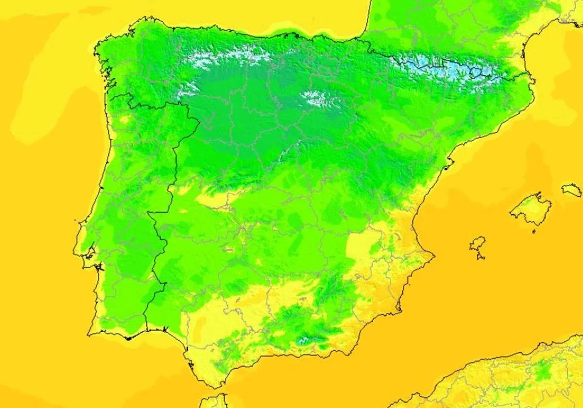
Along with this, we will have «low temperatures for the time of year». Everything suggests that the arrival of these polar winds, from northern Europe, will cause a very significant drop in thermometers in many areas of the country. In fact, it will leave frost in some provincial capitals and values that could even fall below zero in some places.
A cold weather front will bring rain, thunderstorms and hail to the Iberian Peninsula
Looking ahead to this new week, instability will once again take its toll in Spain, with a cold weather front that will leave showers and thunderstorms in many areas of the country from this Monday onwards. It will be a day where we could see showers in Aragon and Catalonia, although the showers will be much weaker and more isolated than over the weekend.
Noticia relacionada
-
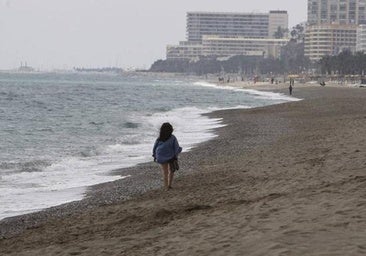 Enrique Miranda / Europa Press
According to Aemet, rainfall over the next few days will be locally heavy in the Cantabrian Sea and northern Catalonia. Likewise, we could also see some showers in mountain areas in the centre and south of the mainland, as well as in the north of the most mountainous areas of the Canary Islands.
The weather situation will remain similar throughout Tuesday and Wednesday, although the rains will be reactivated from Thursday, leaving above average rainfall in Catalonia, the Balearic Islands and the Valencian Community: «Although the probability of rainfall will be lower on Tuesday and Wednesday, again from Thursday showers could be recorded in much of the Spanish mainland and Balearic Islands,« warns Aemet.
ℹ️ ¡En la próxima semana el tiempo no será mucho mejor!
— Meteored | tiempo.com (@MeteoredES) May 4, 2025
Llegará aire polar 🧤 y las tormentas fuertes continuarán en muchas zonas, detalladas a continuación por @DuncanWingen.
🗞️ https://t.co/NhHLLVcLAZ pic.twitter.com/DCM5cYnUoC
Falling thermometers: Spain's areas with minimum temperatures below zero
The key feature of these days is the expected fall in the temperatures, which will drop sharply to almost wintry levels. Aemet has warned that next week will leave «low temperatures for the time of year» due to the arrival of a mass of polar air that will cause the mercury to plummet and leave frost in some cities of the Spanish mainland.
From this Monday onwards, minimum temperatures will drop to 5C in some areas of the country, especially in the north, centre and inland areas of Spain. This drop will be less pronounced in the southeast of the country, where we could even see usual minimum values for the season, above 15C.
Hablar de heladas a estas alturas del año comienza a ser raro, pero ocurrirán e incluso nevará ❄️, avisa @SergioEscama.
— Meteored | tiempo.com (@MeteoredES) May 3, 2025
🧊 La última hora de la inminente invasión polar. https://t.co/dTfW9O4Gak
ccording to warnings from Aemet, throughout the week temperatures could drop below zero degrees in some mountain and inland areas. In addition, in cities such as León, Palencia, Burgos, Soria and Teruel, thermometers could be around 0C and 1C . Likewise, in the provinces of Huesca and Lleida, thermometers could drop to reach -10C.
Throughout the week it could also snow in all mountain ranges in the northern half of the country. There will be light snowfall in almost all ranges, although in areas of the Pyrenees up to 5 centimetres of snow could accumulate between Monday and Tuesday. Frosts are also expected in high areas of the Central System and even in the Sierra Nevada in Andalucía's Granada province.