Weather
Aemet issues special warning for snow at low altitudes and freezing temperatures in Spain: these are the areas affected
The arrival of an arctic air mass will be responsible for the weather change in the coming days, according to the state agency

Marina Ortiz
Madrid
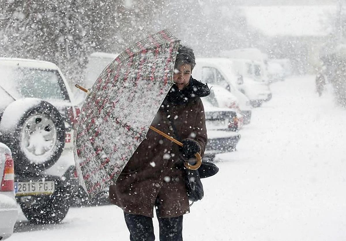
Winter seems to have come early to Spain. After a few days in which widespread rain has fallen across almost all the country due to the passage of storm Claudia, the arrival of an air mass of Arctic origin is due to introduce a new, wintry scenario.
This has been announced by the state meteorological agency (Aemet) in a "special warning for snowfall at low altitudes", in which it indicates that this front "will cause a sharp drop in temperatures and snowfall in the northern third of the Spanish mainland".
According to this warning, between Thursday 20 and Friday 21 November the snow level will drop to "300 to 400 metres in areas of the northern half: it will snow not only in the mountains, but also in low-lying areas from midday on Thursday".
⚠️AVISO ESPECIAL | Nevadas en cotas bajas.
— AEMET (@AEMET_Esp) November 18, 2025
➡️ Tiempo invernal, con heladas y nevadas a partir de 300 a 400 metros en el tercio norte.
➡️La nieve afectará a ciudades y vías de comunicación importantes. Mantente informado de la situación.
+ info 👉https://t.co/48Lsr8R9TN pic.twitter.com/O3el2v8ZvG
This mass of arctic air that enters Spain from today onwards also means that temperatures will drop and will be low for this time of year, according to Aemet. In addition, we will see frost and temperatures below 10 degrees during the day in many inland areas.
Snowfall and rain in these areas
For this Wednesday, the Aemet indicates that "a humid northerly flow will be established in the Cantabrian Sea with a long maritime route, which will give rise to moderate and persistent precipitation, especially during the second half of the day. It will be in the form of snow from 900 and 1,200 metres, exceeding a thickness of five centimetres in parts of the Cantabrian mountains and on the northern side of the Pyrenees".
The snow level will continue to fall on Thursday, remaining at 600 metres in general in the northern third of the country with snow which will not only fall in mountain areas, as it will also reach "surrounding low areas from midday, such as inland points of the Basque Country, Navarre and the north of the northern plateau. It will be especially heavy in the Cantabrian Mountains, where they may locally accumulate more than 20 cm in 24 hours", the weather agency points out.
Looking ahead to Friday, the early hours of the day will be "the peak", with a snow level of between 300 and 400 metres in the eastern Cantabrian and upper Ebro. Aemet warns that "the impact could be significant in this area, with accumulations likely to exceed 3 or 5 centimetres, affecting important communication routes. In addition, during Friday, accumulations of more than 10-20 centimetres could again occur in mountain areas in the northern third of the Spanish mainland".
In the Iberian and Central systems and the Catalan Pyrenees there may also be precipitation in the form of snow, but less significantly than in the above-mentioned cases.
Winter's own thermal downturn
As Aemet had already anticipated, the arctic air mass will lead to a drop in thermometers almost across the board in Spain.
Therefore, "it is expected that maximum temperatures will be below 10 degrees in large areas of the country, with the exception of the southwest quadrant and the coasts, where they will be slightly higher". On the other hand, frosts will gain prominence and coverage which could be heavy in the Pyrenees and moderate in the rest of the mountainous areas of the northern half and the Betic mountains. They will be weak in other inland areas, especially the northern plateau".
The lowest maximums will be found between Thursday and Friday, with between -3C minimum and 3C maximum in Burgos , -3 minimum and 4 maximum in Ávila and -2 minimum and 4 maximum in Segovia or Vitoria, among other provinces with similar thermometer variations.