Weather
Tail end of hurricane Gabrielle puts Malaga and Costa del Sol on alert for heavy rainfall
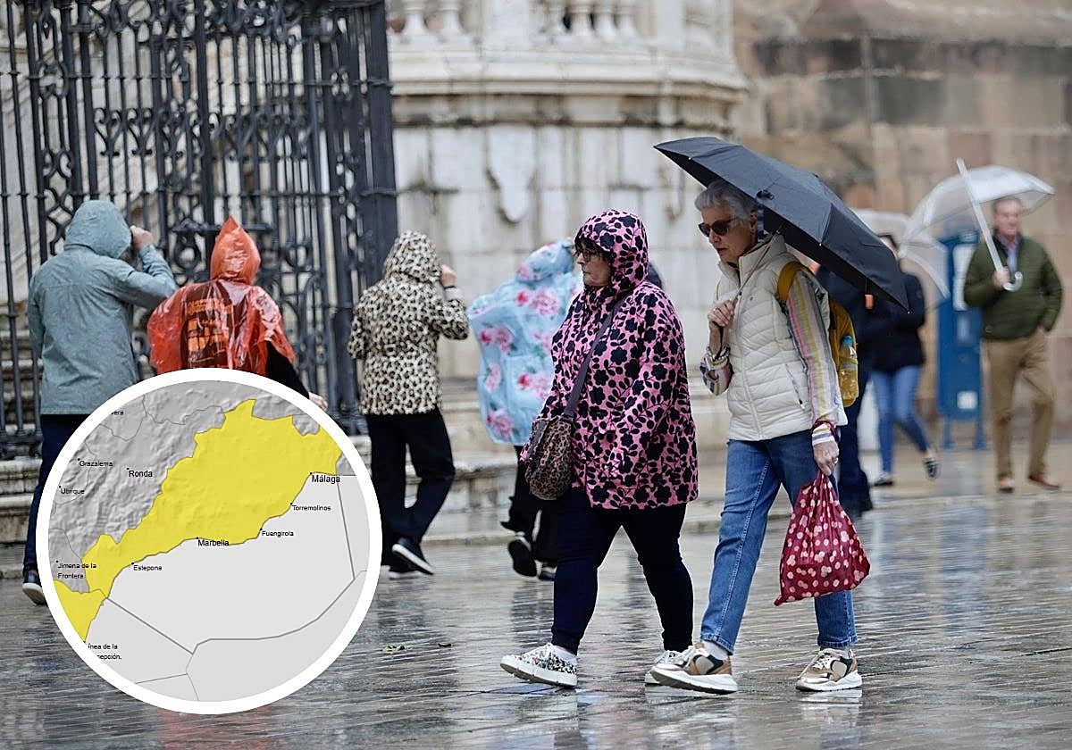
These are the areas of the province where Spain's state weather agency Aemet forecasts 15mm of rain falling in one hour and with 40mm accumulated, from late Sunday evening

Malaga
One of those epoch-making autumn Mondays is approaching. With pupils students heading back to school and colleges after the summer holidays, with all that this entails for morning rush hour traffic in the province, Spain's state meteorological agency (Aemet) is warning of the risk of heavy rainfall, especially in Malaga city and the western Costa del Sol during the early hours of the day on 29 September.
The former hurricane Gabrielle, so called because it was originally a tropical cyclone with that name, will approach the Spanish mainland this weekend and will bring with it very strong gusts of wind and rain in the west and south of the country
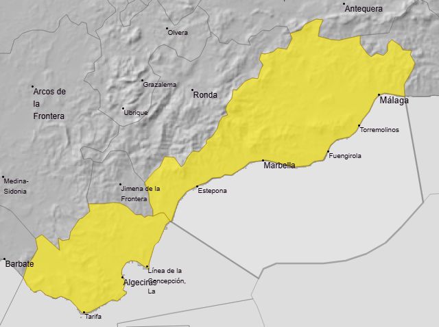
As a result, Aemet has activated a yellow (slight risk) alert for the western Costa del Sol, Guadalhorce valley and Malaga city . Between midnight on Sunday and 3pm on Monday, around 15mm of rain is expected in one hour, and accumulated rainfall of up to 40mm for the duration of the wet spell. The probability of it happening is high (40-70%).
25C
will be the maximum temperature forecast for Monday, although the minimum will remain high (21 degrees).
If the forecast holds true, this will be a distinctly autumnal day, with temperatures falling, after a weekend with still high temperatures - although far from the summer-like heat of the previous one. Therefore, the maximum temperature will drop from 27-28C to 25 degrees, although the minimum will remain high (around 21C).
Uneven distribution
It the Aemet forecast is correct, this will be the first heavy rainfall so far this autumn, after a light shower last Wednesday.
"With only a few hours to go before it arrives, the American and European weather models do not agree on the precipitation, there is a lot of uncertainty with all the models for tomorrow and Monday", said José Luis Escudero, local weather forecaster and head of the SUR blog Tormentas y Rayos (storms and lightning).
"At the moment, a weather warning has not been activated in the Axarquia area, but in new updates it is likely that it will be. And we will have to see if they are also activated in the Ronda and Antequera areas," he added.
Escudero predicts that it will start raining late Sunday night and early Monday morning in the westernmost part of the province (Manilva, Estepona, Marbella, etc.), but the rainfall will be very uneven in distribution and quantity: "If it doesn't fall in everyone's doorway, don't be upset, you've been warned," he joked.