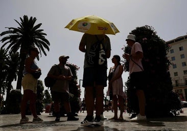
Stormy Monday: A complicated start to the weather week in the south of Spain
Aemet warns of "occasional storms and scattered showers" in the far west and mountains of the Andalucía region on a day when morning mists are expected on the coast and, once again, Sahara dust in the atmosphere
The arrival of a Dana weather depression that wasisolated off the coast of Portugal had threatened to leave "numerous storms" in various parts of Spain during this last Monday of July. And, finally, the meteorologists' warning has been fulfilled. Thunderstorms, accompanied by occasional strong gusts of wind, have started early this morning in parts of Malaga province and are likely to be the main feature at the start of the day.
It is not at all usual, and even less so in recent years, for it to rain in Malaga at the end of July. But it did rain lightly yesterday, Sunday, and it did again around 7am today in various parts of the city centre and eastern part of Malaga, among others.
It was a light sprinkling although with large drops of mud, due to the 'calima' Sahara sand dust haze that is still present in the skies of the provinec. The skies remain very cloudy and the wind is fresh , so today will not exactly be the best beach day of the summer.
The accumulated rainfall has been very low according to the data provided by the Hidrosur Network, from the Junta de Andalucía's automatic rain gauges: between 0.2 and 0.7mm, in areas such as the Limonero reservoir in Malaga city; as well as in the Sierra de Mijas, Los Montes de Málaga, El Atabal, Torrox and Torre del Mar. "It's raining pure mud, it's not much but it's something," said José Luis Escudero, an expert in local meteorology in Malaga.
"In the next few days, the meteorological situation in Spain will be conditioned by a small depression that will move out of the Atlantic and will reach the west of the mainland, before being quickly reabsorbed by the polar jet. This 'cold drop' will leave us with a number of weather phenomena on the cards. Among them, stormy showers in the west of Andalucía", Meteored announced in an update on Sunday. Spain's state weather agency (Aemet) agreed with the forecast for this 29 July, marked by "cloudy skies with cloudy intervals, predominantly medium and high clouds without ruling out occasional thunderstorms and scattered showers in the far west and mountains of the rest of the region", it detailed on its website.
Amber warnings for high temperatures activated
In addition, morning mist is expected today on the Mediterranean coast and, once again, a 'claima' (Sahara desert sand dust in suspension in the atmosphere) and strong gusts of wind on the eastern Mediterranean coast and in the Strait of Gibraltar. The heat will also play a leading role. In the Andalucía region, Aemet is maintaining active amber warnings for high temperatures in the provinces of Cordoba, Granada and Jaen (between 1pm and 9pm) and yellow warnings in Seville and Almeria. In addition, there will also be a warning for coastal phenomena along the Almeria coastline - due to winds from the east and northeast at 50 to 60 km/h (force 7).
It will be the appetiser of a complicated week in which the forecast, for the moment, warns of a new episode of the hot 'terral' wind, which could shoot temperatures in the case of Malaga city above 40C from Thursday.


