Hiking in Malaga
Montejaque hike: the short, but steep El Hacho trail
A head-spinning route under the watchful gaze of griffon vultures and more wildlife in the Montalate mountain range near Ronda

Malaga
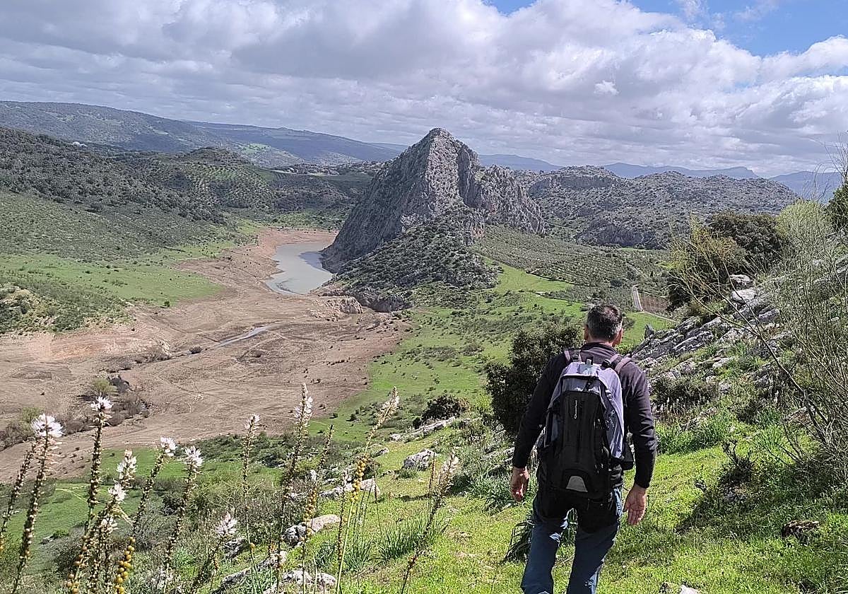
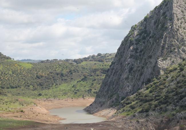
Circular path that can start from the village of Montejaque itself, passing over El Hacho mountain in the Montalate mountain range, with panoramic views that include Los Caballeros reservoir and a large part of the Grazalema mountain range.
-
Route data
Location: Serranía de Ronda
Municipality: Montejaque
Difficulty level: High. Despite being only about six kilometres long, this route is technically very complex in the middle part of the itinerary. Specifically, on the ascent and descent of El Hacho mountain, you have to climb between rocks, often using your hands to help yourself, following a path where you have to find your way around the few existing signs (mostly stone cairns). To this must be added the steep slopes on some of these sections. There is the option of doing the easier circular path along a wide track located in the lower part of the mountain, but there are no panoramic views as with this one.
Type of route: Circular
Approximate duration: 3 hours and 30 minutes
Length: 5.95 kilometres
Minimum elevation: 705 metres above sea level
Maximum altitude: 1075 metres
Nearby places of interest: Cueva del Hundidero (a well-known, local cave of huge proportions), Los Caballeros dam, La Puente, Llanos de Líbar (a flat plain hidden atop the mountain range), the Nasrid quarter of Montejaque, the church of Santiago, the Karst viewpoint, the Escarihuela hermitage, the old Fuente Vieja washhouse and the caving and potholing visitor centre, among others.
-
How to reach the starting point
To do this walk you have to go to the village of Montejaque in the Serranía de Ronda. Take the Líbar road to the area near Fuente del Pilar (a fountain). This road is the same as the one you would use to go to Llanos de Líbar, but in this case, you must first turn off to the right. There is some parking room around the fountain, but it is easier to leave the vehicle in a space provided for this purpose on the way out of the village from the signposted Calvary road.
-
Route description
1The starting point is a wide lane located to the right of a lean-to, a small shelter that has been christened by the locals as 'Marina D'or'. This is where many of the older village people hang out, and you can ask them for tips on this or other nearby trails. In this case, the path begins to climb slightly from that landmark. Little by little the path begins to gain altitude and you will be rewarded with panoramic views of the entranceway to the Llanos de Líbar mountain plain and the summit of Almendral. After almost a kilometre and a half of uphill walking, you reach one of the most important milestones on this route, the Canta pass. At this milestone, you have to turn off to the right onto a narrow and not very intuitive path to begin the hardest part of this trail. At this pass, however, you can choose to continue along the main track and follow the circular route of much less difficulty (but also with less vieews) through the foothills of this sierra.
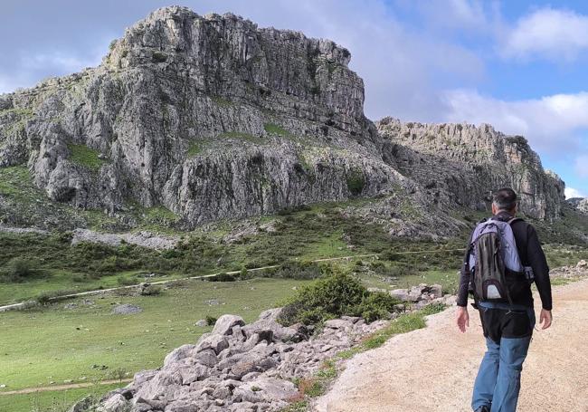
2The ascent on this part of the route can be quite difficult if you lose sight of the stone cairns that mark the trail. In this rudimentary but effective way, you can reach the different peaks of the Montalate mountain range, but not without some effort. For this you will have to use your hands on many occasions. You must also be very careful on the steeper and more rugged sections. Bear in mind that some rocks may be wet and therefore slippery. In any case, be mindful that it is better to take a short detour than to risk slipping or falling in this area.
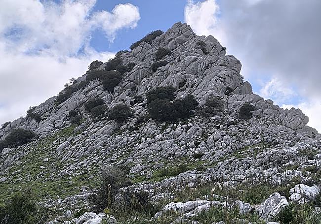
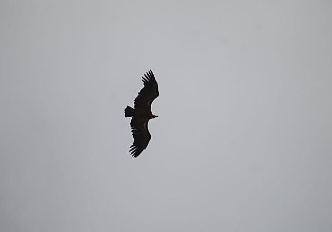
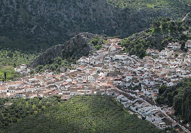
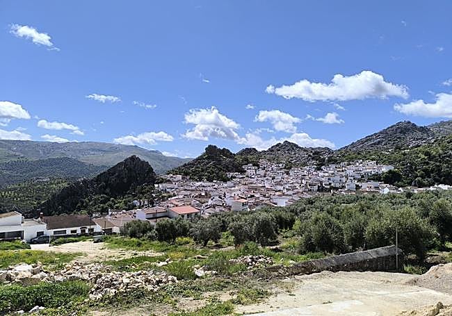
3All this effort will have its reward in the form of panoramic views because, once you reach the crest of these rocky mountains, you will get spectacular views of the village of Montejaque and also many of the surrounding places of interest, such as the entrance to Llanos de Líbar or the many mountain ranges heading over the Malaga-Cadiz border, part of the Sierra de Grazalema Natural Park. Another reward for the senses will be sightings of nearby griffon vultures and mountain goats.
4After the climb and walking along the ridges surrounding Hacho mountain, so begins the descent, but it is no less difficult. The way down during the first few metres is very steep on very narrow paths. You can occasionally lose sight of the trail. It is therefore advisable to keep in mind that you should head north, but also slightly east, to head towards the last stretch of this itinerary.
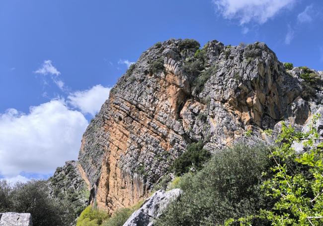
5On the descent you will have the dam of Los Caballeros, Tavizna hill and Campobuches river as a scenic backdrop, but the path does not head in that direction, instead heading slightly east towards the centre of Montejaque village. Before this, you will have to pass the foot of a spectacular rock face of this very steep mountain range that shelters the village. Afterwards, follow the path at the foot of the sierra, passing by an old lime kiln. Once you pass that, there are only a few metres left to reach the starting point. The village, in these last few metres, will be on the left.
Flora and fauna
Griffon vultures, some large birds of prey and different types of corvids are frequently seen flying over this landscape of limestone and karstic rock that surrounds Montejaque. Also taking advantage of these steep mountains are some varieties of mountain goat that take the almost vertical routes in this area in their stride. Some of these mountain goats can pop up at the highest altitudes. In terms of flora, there are holm oaks, cork oaks, wild olive trees and even carob trees.