Weather
Aemet upgrades weather alert for storms and heavy rain on Costa del Sol to amber
As well as warning of the risk of tornadoes forming in parts of Malaga province this Wednesday, Spain's state meteorological agency is forecasting up to 30mm of rainfall in an hour in a number of areas

Malaga
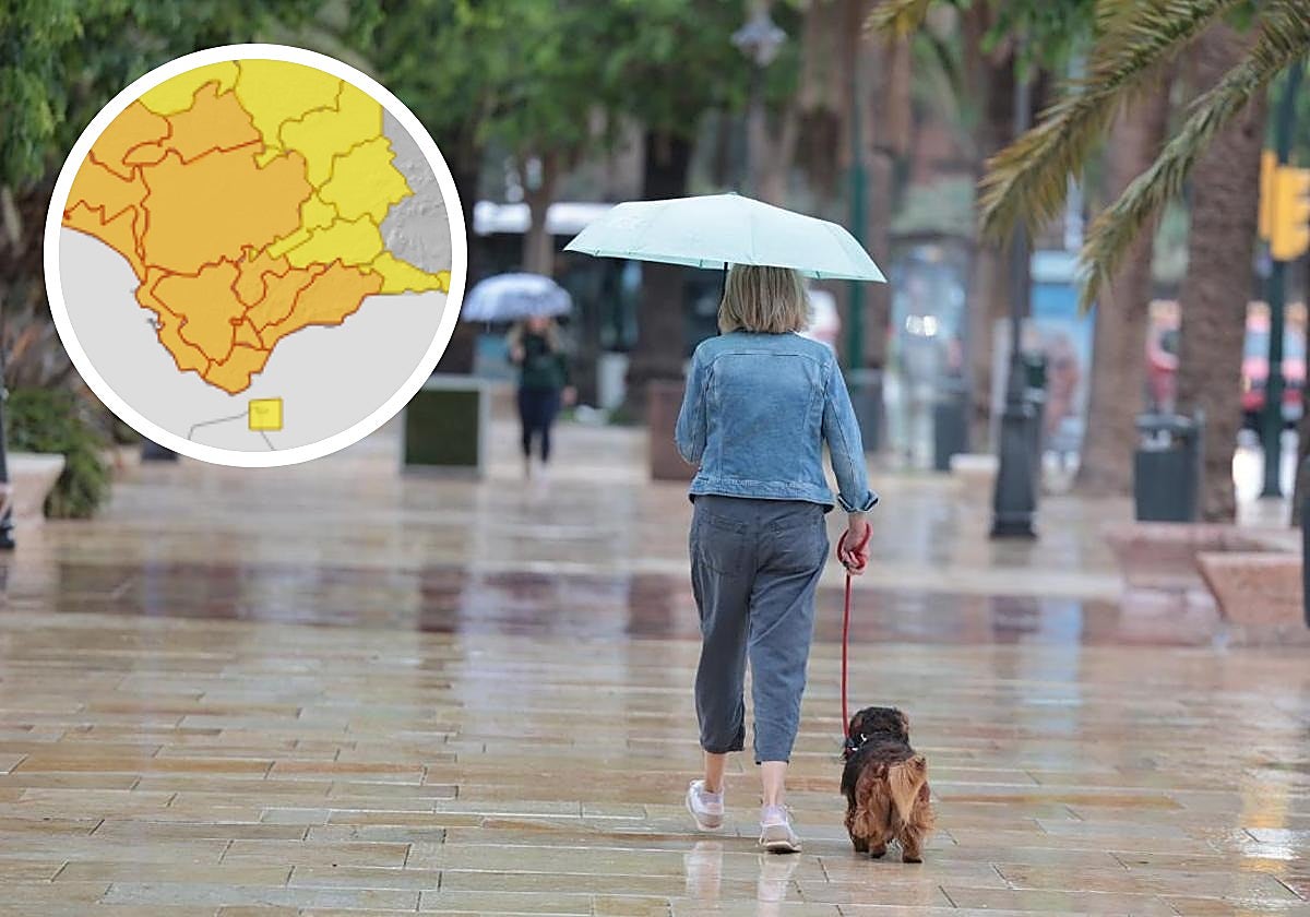
The arrival of a weather front from the Atlantic will mark the beginning of this first week of November, when heavy rainfall is expected to affect Malaga province this Wednesday. Spain's state meteorological agency has raised the probability of showers accompanied by thunderstorms in Malaga to 100%, mainly from 6pm onwards, although in municipalities such as Ronda, Marbella, Estepona and Manilva it could start earlier from 12 noon. According to the state agency the rainfall will be widespread. In its latest update, Aemet has raised the warning to amber serious risk level in the Costa del Sol, Valle del Guadalhorce and Ronda areas where accumulated rainfall of 30mm in one hour is expected. Aemet maintains the yellow warning in the rest of Malaga province, where accumulated rainfall of up to 25mm is expected, with storms and "the formation of tornadoes is not ruled out".
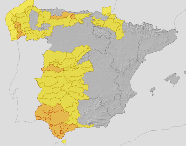
"This Wednesday, an Atlantic trough will affect Andalucía with an associated front, leaving locally heavy rainfall with storms and very strong gusts in the western half of the region,", the state agency highlighted in its official account on the social media network X. For now, Aemet in its latest update has also activated amber warnings in Huelva, Cadiz and Seville - where accumulated rainfall of 30mm in an hour is expected There is also a yellow alert in Cordoba. In addition, another warning will be in force in parts of Cadiz, Huelva and Seville for maximum gusts of wind of 70 kilometres per hour.
For this 5th November, the state agency forecasts "cloudy skies with high clouds, increasing to overcast, with weak to moderate rainfall that will spread from west to east from midday onwards, more intense in the western half where it may be locally heavy and accompanied by storms".
"This Wednesday an Atlantic trough will affect Andalusia with an associated front, leaving locally heavy rainfall with thunderstorms and very strong gusts in the western half of the region"
"Weather models show that the frontal system will cross the Spanish mainland from west to east. This phenomenon will be reinforced by a trough at high altitude and by a river of humidity arriving from the Atlantic. In view of this, the maps for Spain show heavy rainfall in Galicia, extending to the Castilla y León, Extremadura, Cantabrian regions, the western part of Castilla-La Mancha and the west of Andalusia on Wednesday", warned Samuel Biener, researcher, climatology disseminator and editor of the specialised website Meteored.
As for temperatures, the minimum daytime temperatures will fall on Thursday "by five or six degrees in general", according to Aemet. The state agency pointed out that the drop will be "more intense" around the Guadalquivir Valley and less noticeable on the coast of Malaga. The maximum temperatures will range between 23 and 26C in Seville and Granada. Minimum temperatures will be between 12 and 18 degrees in Malaga and Cadiz. The wind will tend towards the south with strong intervals during the afternoon and occasional very strong gusts in the western half of Andalucía.