Los Horcajos river trail
The start of this walking route begins next to the well-known spa in Tolox, a gateway to the Sierra de las Nieves national park

This semi-circular walking route, which is approved as a local footpath (SL-A-229), allows you to discover a good part of the municipality ... of Tolox, from the village itself to its forest areas and the fertile lowlands next to the Horcajos river.
-
Route data
Comarca: Sierra de las Nieves
Municipality: Tolox
Difficulty level: Medium. Due to its length, it cannot be considered of lesser difficulty. In addition, it may not be recommended for people with vertigo, as the second half of the route involves walking along narrow paths with a free drop. It cannot be done by bicycle.
Type of route: Semi-circular
Approximate duration: 3 hours
Length: 9 kilometres
Minimum height: 291 metres
Maximum altitude: 667 metres
Nearby places of interest: Balneario de Tolox, monument to the mountain goat, hermitage of the Virgen de las Nieves, Fuente Amargosa, church of San Miguel and Rinconada del Castillo (old town of Tolox).
-
How to get to the starting point
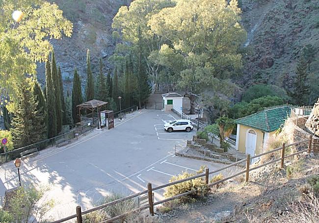
The starting point of this route begins next to the well-known spa in Tolox, located very close to the village of the same name. Therefore, to get there you must first follow the signs to this village in the Sierra de las Nieves, first on the A-357 and then on the A-354. Once at the entrance to the village, just follow the signs to the Fuente Amargosa spa. Next to this building, you can see the signposting panels for both this route and others that start here.
-
Route description
1This route is semi-circular, as it does not end exactly where it starts, but at the Plaza Alta de Tolox. From there, it would take about 800 metres to walk back to the starting point. Another option is to leave the vehicle somewhere in between the two points. In any case, it is advisable to start walking from the area around the spa, where you will also find the Cascadas path. In fact, the first few metres of both routes are the same.
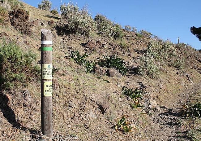
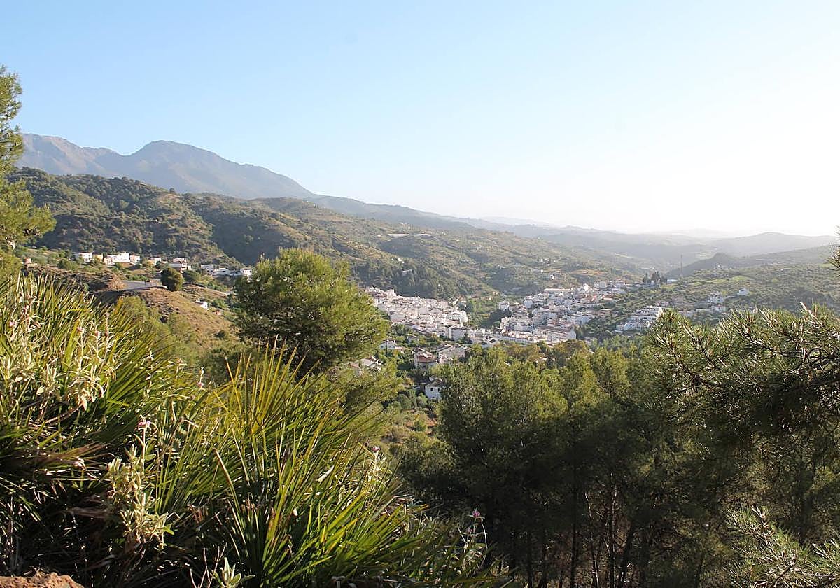
2The path leaves the asphalted track just a few metres after leaving the aforementioned information panels. From here begins an climb of just over a kilometre, which is one of the most demanding sections of the route. Although the climb is somewhat tough, it is mitigated by a zigzagging route. However, it is advisable to pay close attention to the various milestones and signposts so as not to leave the path under any circumstances. Thanks to the difference in altitude, there are panoramic views of Tolox and the surrounding area.
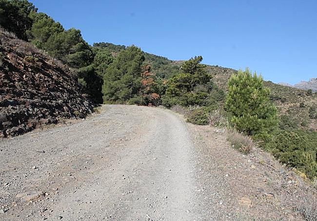
3After a kilometre and a few more metres of ascent, this path separates from the aforementioned Cascadas path. The first path turns off to the right to take an asphalted track known as the Golondrinas path. This path, which can be used by vehicles, also leads to the Cerro de Híjar hotel. It is necessary to go as far as this tourist establishment. Then continue along the same track, which becomes a dirt track, until you reach a sharp bend in the road (about 700 metres from the hotel). At this point, turn off to the right onto a narrower track.
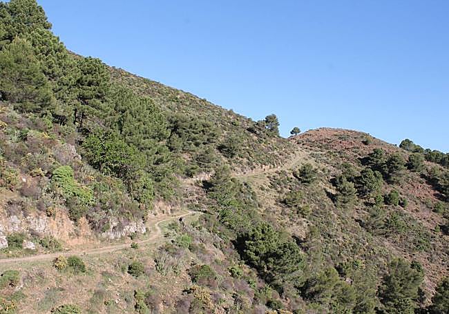
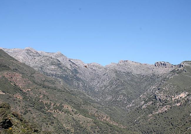
4After the previous detour, the path continues climbing slightly until it reaches the foot of the Híjar hill, which is to the right of the path. From the path itself there is a spectacular panoramic view of the highest peaks of the Sierra de las Nieves, with the Tajo de la Caína, the Peñón de Enamorados and the peak of La Torrecilla, from left to right. After contemplating this authentic postcard view, there is a stretch of descent that gradually becomes steeper. Before this you can see one of the most biodiverse areas of the route, with chestnut trees, Spanish firs, holm oaks and gall oaks, among other trees.
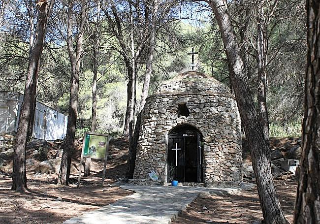
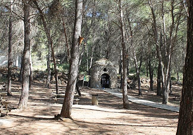
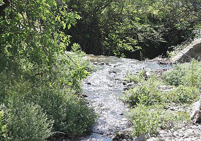
5The path becomes increasingly narrower and descends through the valley of the river Horcajos (and its tributaries). Although the section is downhill, it can be considered one of the most complex of the route, as the path is very narrow, has very steep parts and a lot of loose stones, which complicates the descent. This way, you first cross a stream that is a tributary of the Horcajos river, and then pass by the Piloncillo well. From there it is only a few metres to the Virgen de las Nieves hermitage , in the recreational area of the same name. This is one of the most important landmarks on this trail.
6From the hermitage, the only thing left to do is to descend and then turn off onto a path on the right, which allows you to walk along a narrow path that runs parallel to the Horcajos river. Next to it there is a plain where you can see traditional vegetable growing plots and avocado plantations. The path converges in the last kilometre with the path to the Ermita de la Virgen de las Nieves. Both pass next to Fuente Amargosa and arrive together at the Plaza Alta de Tolox, the official end of both routes. From there, the only thing left to do is to pick up the vehicle where it was left, either next to the starting point or somewhere in between it and the Plaza Alta.
Flora and fauna
Along this route you can see orchards with citrus and avocado trees, but also other unique botanical species, such as Spanish firs, chestnut trees, gall oaks, holm oaks, gorse, eucalyptus and palmettos. In addition, there is also riverside vegetation. As far as fauna is concerned, you can see some birds of prey in flight and sense the presence of some mammals, such as wild boar, mountain goats and foxes. Among the reptiles, the snub-nosed viper can be seen in spring and summer.
¿Tienes una suscripción? Inicia sesión