Weather forecast
Aemet issues a special warning for new storms that will bring rain, wind, rough seas and even snow to Spain
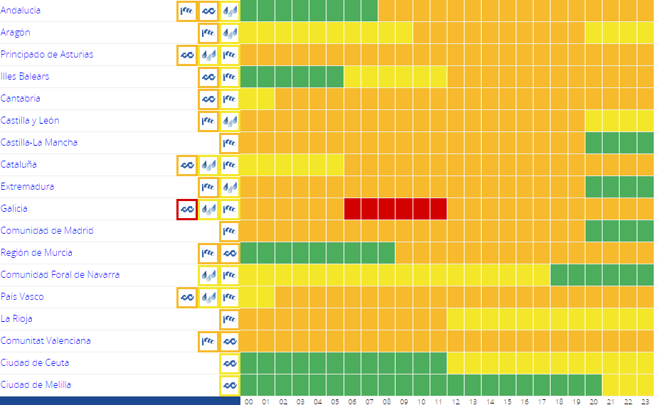
The state weather agency forecasts that the instability will continue from Thursday to Sunday
Europa Press
Malaga
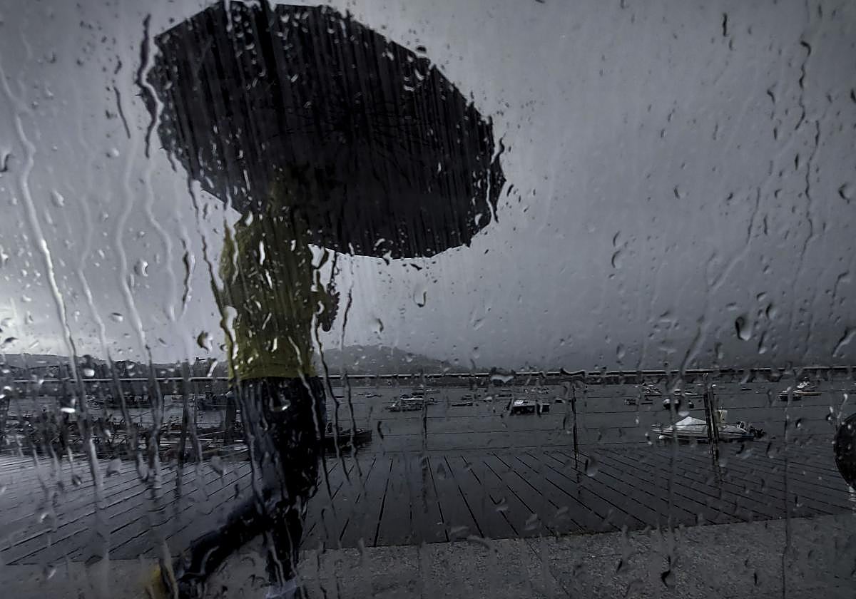
Successive Atlantic storms will once again bring weather instability to the Spanish mainland, mainly to the northwest quadrant, from Thursday 2 November until at least next Sunday. This is specified by Spain's state meteorological agency (Aemet) in a special warning issued on Tuesday for adverse phenomena of rain, wind and stormy sea conditions.
On Thursday, Spain is expected to be heavily affected by a "much deeper and high-impact" storm, named Ciarán, which will leave generalised rainfall throughout the mainland and the Balearic Islands, as well as very intense winds and a major storm at sea. Aemet warns that these last two adverse phenomena will be the most significant.
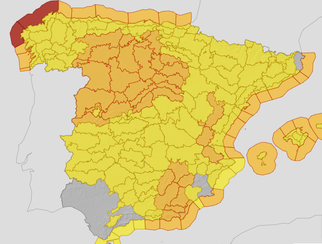
Aemet points out that from Wednesday morning and especially on Thursday, 2 November, the effects of Ciarán, which will be over the British Isles with its associated fronts, will be felt.
These fronts will enter through the northwest of the Iberian Peninsula, where locally heavy rain will arrive, occasionally accompanied by thunderstorms in Galicia, the Cantabrian area and the Pyrenees. Precipitation will spread to the rest of the mainland and the Balearic Islands, although with less intensity. The southeast of the mainland will be the area least affected by rain.
At the same time, a colder air mass will arrive, which will significantly lower temperatures and, with it, also the snow level, which will be between 1,000 and 1,200 metres in the northern half of the country. Therefore, the "first significant snowfalls of the season" are expected in the mountain ranges.
However, on Thursday the most significant phenomenon will be the strong westerly wind, with very strong gusts in large areas of the mainland and the Balearic Islands, being especially intense in mountain areas, Galicia, the Cantabrian area and points of the eastern third, where they may exceed 100 kilometres per hour.
On the same day there will also be a "severe" sea storm, according to Aemet, which stressed that it will be particularly severe on the coast of Galicia and the Cantabrian Sea, where significant swell could reach or exceed 8 metres in combined sea height, but that it will also affect the Mediterranean, where it could reach or exceed 5 metres.
From Friday
Friday will continue to be influenced by storm Ciarán with an unstable atmosphere and showers, somewhat more scattered than the previous day, which will affect a good part of the mainland and the Balearic Islands, and which could be locally heavy, with thunderstorms and hail in the northern third. The wind will continue to blow strongly and the sea will be rough at the beginning of the day, although it will diminish throughout the day. Snow levels will rise during the day.
Looking ahead to Saturday and Sunday, Aemet warns that it is "quite likely" that a new storm with similar characteristics to Ciarán and its associated fronts will again affect the mainland with similar effects.
The forecast predicts that, although it is early days and uncertainty is high, a gradual improvement in the weather is likely from Sunday 5 and especially Monday 6 November.