Hiking in Malaga
Climb up to Saint Anthony's cross: the easy hike that leads to the 'Tetas de Málaga'
A beautiful walk leads from the Pinares de San Antón residential area to one of the best viewpoints of the city's bay

Malaga
This is a circular route that starts from the Pinares de San Antón residential area in the El Palo district to the east of Malaga city and climbs up to the cross of the same name and then continues along the other hill.
-
Route data
Province: Malaga
Area: Malaga city
Difficulty level: Low. If you follow the signposted path, for the most part it is a relatively easy route. To climb the other hill, there is an intuitive path with a slightly steeper slope, on which caution should be exercised.
Type of route: Circular
Approximate duration: 1 hour 30 minutes
Distance: 3.5 kilometres.
Minimum altitude: 335 metres
Maximum altitude: 507 metres
Nearby places of interest: Peaks (east and west) and San Antón cross, Virgencita wall, Cueva Grande, remains of the old Airós castle (to be confirmed) and San Antón viewpoint (in the lower part).
-
How to get to the starting point
The starting point of this route is located in the upper part of the Pinares de San Antón residential area at the end of Calle Stradivarius. There is a sign pointing to the forest park, as well as the first sign indicating the path that leads to the cross. For parking, bear in mind that there are signs prohibiting parking near the starting point. It is advisable to look for a place to park a few metres further down. To reach this area, follow the main road of the residential area that goes uphill. Access to this area is from the Ronda Este ring road, at exit 246 (El Palo).
-
Route description
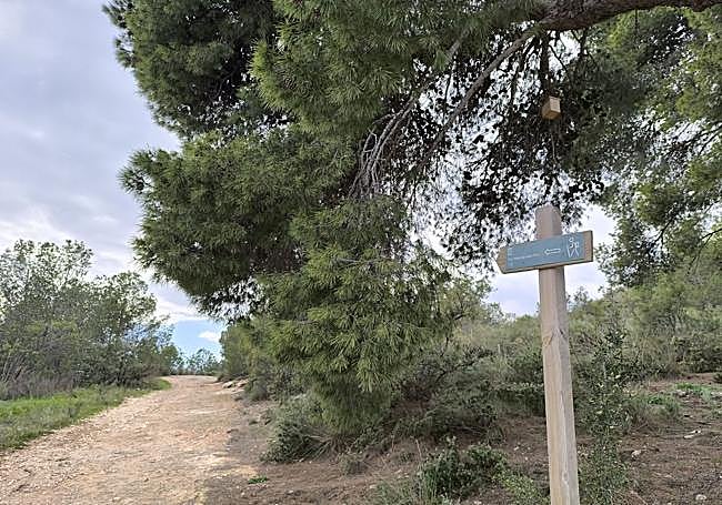
1From the signpost explaining where the Montes de San Antón forest park is located, take the ascending track to the north where there is a chain that prevents vehicles from passing. You have to go up a relatively steep slope on a dirt track and then make a sharp turn to the south. There you will see a signpost indicating the path to the Cruz (cross) de San Antón and another indicating the exit to a viewpoint. You need the first sign now and the second for the return journey.
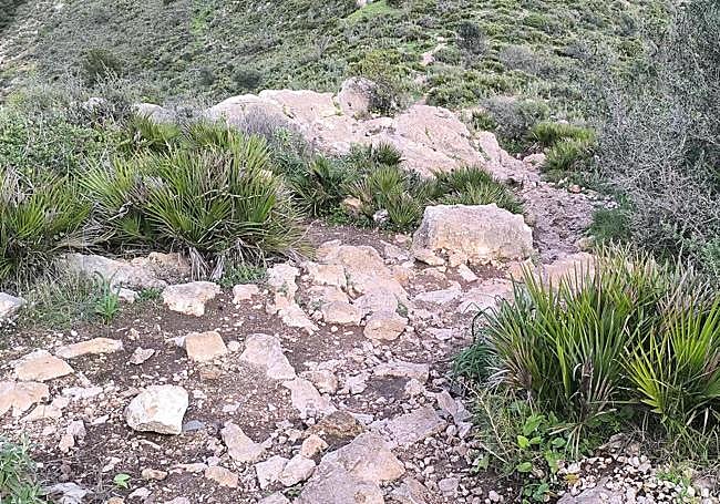
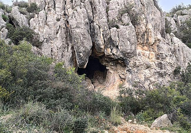
2The path here is relatively wide, but a couple of hundred metres further on you will have to leave it to take a narrow path with a relatively steep slope, which is well signposted with wooden markers with a white and green stripe. Shortly afterwards you will pass by an area known as Cueva Grande, a natural shelter between the rocks, and the 'paredón de la Virgencita'. From here the path starts to climb the area between the two hills. The first one to be climbed is that of the Cruz de San Antón, which is reached by a narrow path which isn't very steep.
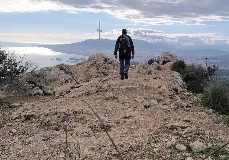
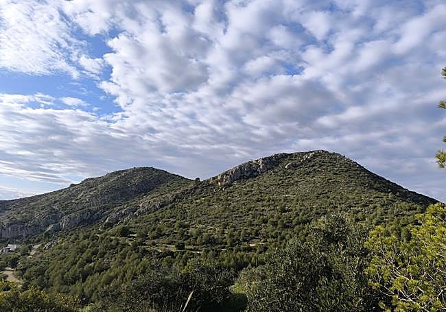
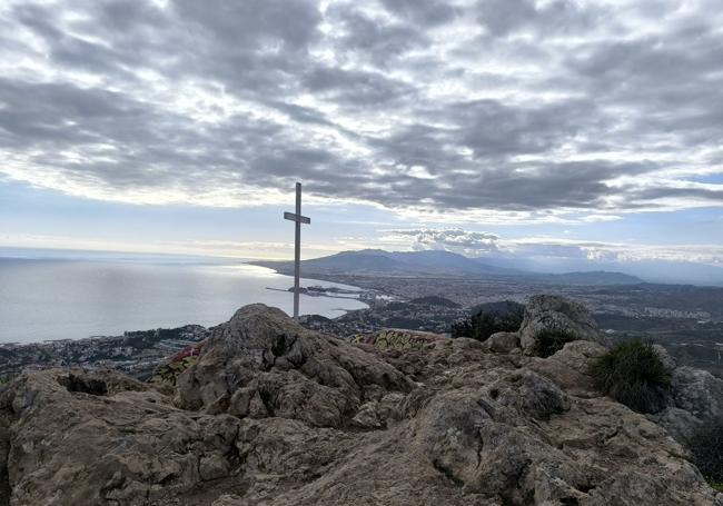
3The last few metres are rocky, but not complicated. After just over 500 metres you will reach the large cross that crowns this summit, from where you can see spectacular sunsets. Before that, you will pass some stone alignments that have led to speculation in recent years that this was once the site of the Airós castle, a fortress that served as a prison, which was thought to be located in Gibralfaro. This thesis has yet to be confirmed by Malaga historians and archaeologists. The views, on clear days, are impressive, as you can see not only Malaga but also the mountains that surround the city and the Mediterranean. You can also see an interesting perspective of Los Montes de Málaga. This peak, to the west, is the smaller of the two, at 491 metres above sea level, while the one to the east is 507 metres.
4Once you have enjoyed the views from the Cruz de San Antón, you can either return along the same path or descend a few metres and climb up to the east summit. Although this is higher, the ascent is not very hard, although, unlike the previous one, it is not signposted. However, there is no margin for error in getting lost, as the vegetation is low.
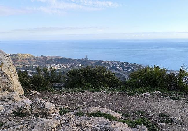
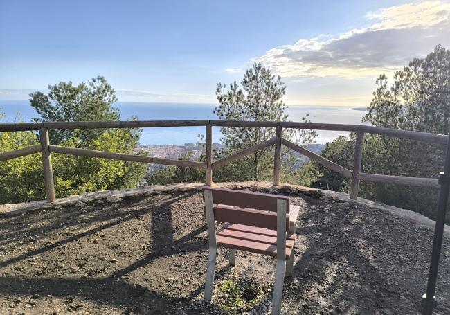
5On reaching the summit and enjoying the panoramic views, there are two options. The easiest option is to return to the place where you started your ascent and then continue along the signposted path. The other involves descending along a narrow path that drops sharply in the first few metres, where you will need to be very careful, especially if you are with children or inexperienced people. A few metres further down, it connects with the initial path that leads back to the starting point. Before reaching the starting point take a detour to the viewpoint that was bypassed on the first part of the climb, to enjoy a beautiful panoramic view of Malaga.
Wildlife
Although in the lower part of the San Antón mountains there is a thick pine forest, with some trees that are over 100 years old, the area around the summit is mainly scrubland, with aromatic species such as rosemary, thyme and rockrose. In addition, there are palmettos, lilies, orchids and poppies. Other species include the zahareña and the escobón. Among the trees that can be seen, apart from the pine there are carob trees and holm oaks. The most common birds are the blackbird, the robin and the goldfinch and among the reptiles, as well as lizards and snakes, chameleons can sometimes be seen, which unfortunately are becoming increasingly rare. Some of the mammals that can be seen in this area, although sightings are rare, are rabbits, mice, foxes, badgers and wild boar.