Hiking in Malaga
The Barranco Blanco trail, a path that takes you to a series of large waterfalls in the Guadalhorce valley
This is a medium-difficulty hiking route along the Alaminos river

Coín
A linear route that follows the path from the mountain pass called Los Pescadores to Barranco Blanco in the municipality of Coín in Malaga province's Guadalhorce Valley.
-
Route information
Location: Valle del Guadalhorce
Municipality: Coín
Difficulty level: Medium. Although the first part of the route runs along a wide and comfortable lane, the section that runs alongside the Alaminos river can be technically difficult any time of the year, especially when fording the river if it has recently flooded. It is advisable to wear comfortable footwear with a very good grip.
Type of route: Linear
Approximate duration: 1 hour 30 minutes (one way)
Length: 3.8 kilometres (one way).
Minimum elevation: 205 metres
Maximum altitude: 341 metres
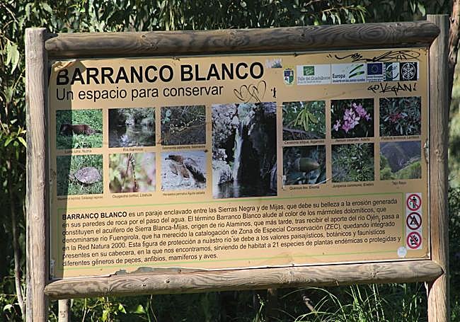
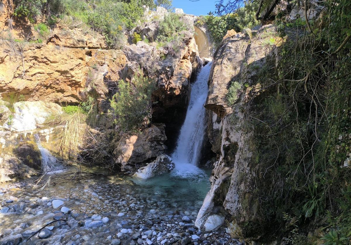
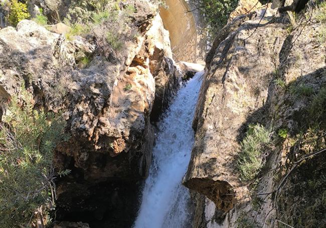
Nearby places of interest: Puerto de los Pescadores, the Barranco Blanco waterfalls, the two pools (charco del Infierno and poza de los Huevos), viewpoint of Alaminos hill and the fake castle of Alaminos.
-
How to reach the trail's starting point
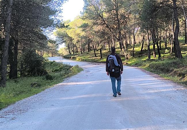
The starting point for this river route is currently to be found next to the MA-3303 road, coming from Puerto de los Pescadores where there is a turn-off (approximately 5 kilometres from Alhaurín El Grande in the direction of Coín) that continues along a dirt track. Once on this track you will come across signs indicating a ban on motor vehicles proceeding further between 1 June and 31 October. From here you must walk down a path that runs mostly in the shade of a pine forest.
-
Route description
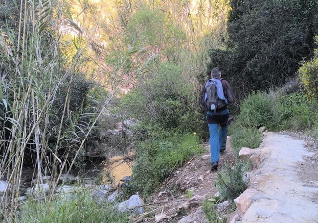
1 This trail can be shortened between November and May with direct access to the car park near Barranco Blanco but, if there is time, it is advisable to leave the vehicle at the official starting point, very close to the road linking Alhaurín El Grande with Coín. There, the first few metres run through a thick pine forest, which offers shade for most of the day. From there it is approximately 2.2 kilometres down a dirt track that leads to the banks of the Alaminos river.
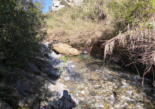
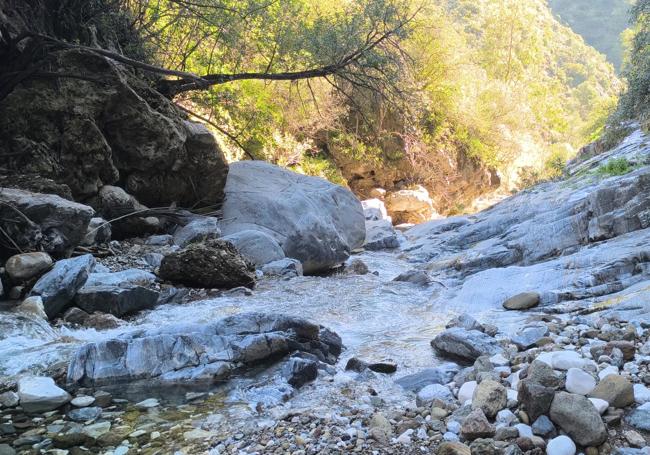
2Once this path meets the river, turn right to reach the bridge over the river. From there, start climbing alongside the course of the river. Just below the bridge, however, there is a large waterfall that can be visited on the return leg of the hike. For the first 300 metres the trail follows the river bank - preferably stay on the left bank - through dense riverside vegetation. This leads to the best known and most frequented spot on the Alaminos, which is known by various names, among them the 'charco de la paloma' or 'charco del Infierno' - you choose which pond name you prefer, pigeon or hell. It is a pool of crystal-clear water that is partly shaded by a limestone wall. On the other side there is also a slippery, stony bank. For many it may be the moment to turn back as it is not always easy to cross this spot. Now that last month's heavy rains have thundered through, the pool is much shallower again, but it is still a spectacular spot.
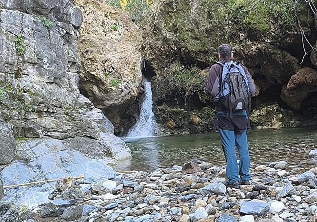
3From this point you will have to retrace your steps, having reached the trail end. The way back follows the same riverbed until you reach the bridge mentioned earlier. At this point, before leaving the site, it is worth heading further down the river - from either bank - to see the dizzying waterfall in another of this river's surprising sights. From there, it's time for the return journey.
4Be especially careful with any items that can be damaged if they get wet, such as cameras, mobile phones or car keys, as there are pools of water that can only be conquered by entering the water and swimming in them. It is therefore advisable to carry watertight containers to avoid any unpleasant surprises for your personal belongings. It is essential to wear suitable clothing and footwear for this hike, things that can get wet, do not cause chafing and, especially for the feet, something with a flexible, but firmly gripping sole.
5 Unfortunately, this area has dipped into the darker side of Malaga's history because it was the site of the wildfire that devastated a large part of the surrounding sierras in September 2012. Despite this, the area is gradually recovering. However, special attention must be paid to the cleanliness of both the riverbed and the nearby paths.
Flora and fauna
In this area known as Barranco Blanco, both flora and fauna were severely affected by the 2012 forest fire. Despite this, valuable biological species can still be found, demonstrating the tenacity of nature in the face of a disaster of huge proportions. Among the trees that withstood the flames, a number of surviving carob and pine trees feature. Around the river you can also see different species of tree and bush, like oleanders, palmettos (low-growing, fan-shaped palms), mastic trees and rosemary bushes. As far as animals are concerned, there are those who claim that otters have been seen in the area, which feed on some of the fish, primarily chub, that live in the waters of the Alaminos. There is also a wide range of amphibians and colourful insects, in particular, various types of dragonflies.