Hiking in Malaga
A great hike for all the family in the mountains of Malaga province
This circular route passes through spectacular sites such as the Malinfierno pass in Alfarnate

Malaga
This circular hiking route, which is approved as a short route (PR-A-268), starts in the centre of Alfarnate in the Axarquía, on the eastern side of Malaga province, and passes through enclaves such as the Malinfierno pass, the Olmedo winery and the Morillas forest.
-
Route data
Region: Axarquía
Municipality: Alfarnate
Difficulty level: Low. Except for the first kilometre and a half, which is uphill, the rest of the route is practically downhill or flat. It is advisable to take a map or an app with you as the path is not very clear at the point where you leave the dirt track and turn onto a path.
Type of route: Circular.
Approximate duration: 1 hour and 40 minutes.
Length: 4.8 kilometres.
Minimum height: 860 metres.
Maximum altitude: 1059 metres.
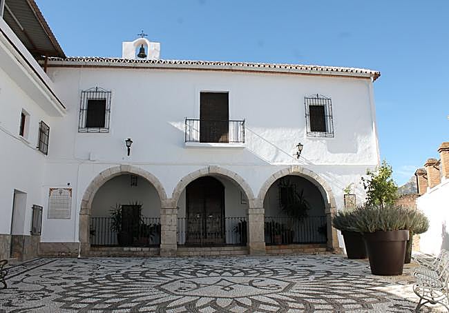
Nearby places of interest: The Morillas forest, the Malinfierno pass, the Olmedo winery, Santa Ana church, the Monsalud chapel, the antique toy exhibition, the Santo Cristo viewpoint and the old Venta de Alfarnate.
-
How to get to the starting point
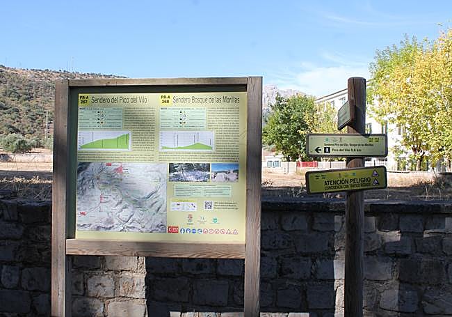
To start this route, head towards the centre of Alfarnate and specifically to the municipal El Ejido sports centre. Opposite the entrance to the sports centre you will see the signs for the start of both this route and the Pico de Vilo route (PR-A-267). The first few metres of both routes coincide. There is usually space to park your vehicle in the area around the sports centre, which is near the school.
-
Route description
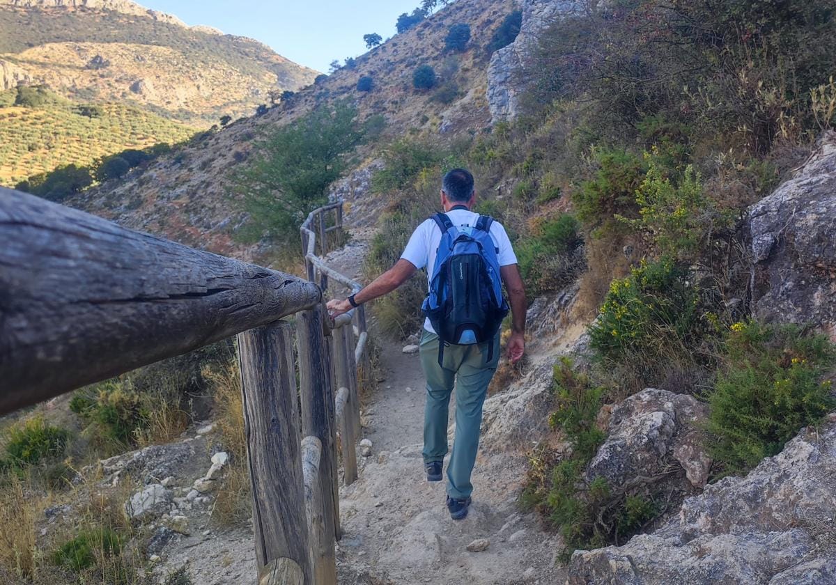
1From the panel describing the route, start to climb towards the south of Alfarnate, leaving the village centre behind you. This initial ascent will allow you to get some distance from the centre and then give you a nice view of it. For the first kilometre and a half this stretch coincides with the route to the Pico de Vilo. This is the case until you reach the highest point of the route, when you pass some telecommunications antennas on your right. The path to the Pico de Vilo continues ascending, while the path to the Morillas forest leaves the wide track to take a narrow, stony and descending path. Be very careful to follow the official route, as it is easy to miss some confirmation signs.
-kdkE-U200307812870YJI-650x455@Diario%20Sur.JPG)
2The somewhat stony descent becomes easier and more comfortable as you soon reach a dirt track again. The track zigzags to ease the descent. After about 700 metres of descent you reach one of the important landmarks on this path: the old farmhouse or Olmedo winery, which still preserves part of its structure. Here there are signs indicating that the descent continues, with a clear turn to the west. This will give you a nice view of the neighbouring village of Alfarnatejo. Part of this route will coincide from here with the stage of the Gran Senda de Málaga which links Alfarnate with Riogordo.
-kdkE-U200307812870YJI-650x455@Diario%20Sur.JPG)
3From the Olmedo winery, the path descends and climbs again until it reaches what is known as the 'rodadero' or Malinfierno pass. This is a narrow path that runs parallel to the river Sabar. Part of the path is secured by a wooden fence. Even so, it is not difficult to pass through this section, which is practically downhill or flat. The route along this pass is approximately 400 metres long and can be done early in the morning in the shade.
-kdkE-U200307812870YJI-650x455@Diario%20Sur.JPG)
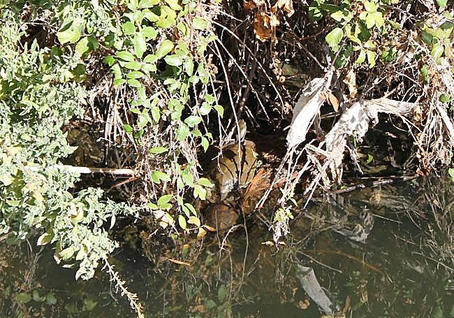
4After leaving Malinfierno behind, you start walking next to the Sabar, but this time much closer and at the same level. This leads you to the so-called Morillas forest, where there is a great diversity of flora and fauna. After passing through a dense grove of holm oaks and gall oaks, the centre of Alfarnate comes back into view.
-kdkE-U200307812870YJI-650x455@Diario%20Sur.JPG)
5The last section of the route leaves the Morillas forest behind and enters Alfarnate along Calle Pozo Rincón. To reach the starting point it will be necessary to cross a large part of the centre, which is ideal for getting to know its most important sites better.
-kdkE-U200307812870YJI-650x455@Diario%20Sur.JPG)
Flora and fauna
Along this route you can see many trees, such as the reforestation pine forest, but also native species such as olive trees, gall oaks, holm oaks, almond trees and carob trees. Mediterranean scrub is also abundant and there are large areas dedicated to cultivation that can be seen from a distance. In addition, you can see shrubs that show their fruit in autumn, such as blackthorn and sarsaparilla.
As far as fauna is concerned, there is an interesting diversity of birds thanks to the existence of different habitats such as the rocky areas of the limestone cliffs that surround the route or the olive groves. Scavengers, such as the griffon vulture and birds of prey such as the booted eagle, can be seen.
Other birds that can be seen include partridges, blackbirds, turtle doves, thrushes and sparrows. There are also some mammals, which are more difficult to spot, such as badgers, wild boar, foxes and weasels, among others. In addition, we should not rule out the possibility of seeing some tortoises in the Sabar riverbed.