
Weather
Meteorological autumn begins in Malaga province with very high temperatures, high humidity and calima dust
The Aemet state meteorological agency has issued a heat warning for maximum temperatures of up to 36C in Antequera and Coín

Málaga
Inland heat warnings and North African air mass at a glance
-
Unseasonable heatwave: Meteorological autumn started on Tuesday, September 1, with above-average heat, humidity reaching 70%, and Saharan dust (calima) affecting Málaga province.
-
Temperature peaks: Coastal areas will feel like 34–35°C due to high humidity, while interior zones (Ronda, Antequera, Coín) are projected to hit 36–37°C. Peak provincial heat is expected on Friday, September 4.
-
Wider regional context: A hot air mass moving in from North Africa has triggered Aemet special advisories across Spain, with temperatures in Andalucía's Guadalquivir Valley expected to cross 42–43°C under amber alerts.
-
Secondary impacts: Sea surface temperatures have bounced back to 22–23°C following August's record lows of 15°C. High uncertainty remains toward the end of the week, with potential storms approaching.
Meteorological autumn began on Tuesday, 1 September, but the start was hotter than expected. Not only are temperatures above normal, but high relative humidity and ... airborne dust (calima) are further creating a heavy summer sensation in Malaga city.
Maximum temperatures in Malaga and the Costa del Sol are around 30-32C, although the atmosphere feels hotter due to the 70 per cent humidity level, as measured at 1pm on Tuesday.
Therefore, those 30-32C feel more like 34-35C. Nighttime lows will also remain very high this week, between 22C and 24C. They are likely to rise as the weekend approaches.
Related story
Meanwhile, the highest temperatures in the interior of the province will be in Ronda, Antequera and Coín, where they will reach 36-37C this week, with nighttime lows also reaching tropical levels. The hottest day will be Friday, 4 September.
According to local weather expert José Luis Escudero, this is "bad news for Malaga and the province".
"Firstly, the calima is back in the spotlight. We'll no longer see those blue skies we've been enjoying over the last few days. The sticky, sweltering heat is back too and we'll be sweating more than usual again. Gone are the days of stepping out of the shower, drying off and staying dry. Once again, we'll be taking a shower and, before long, that unpleasant feeling of dampness and sweat will return."
For those who don't like swimming in cold water, however, this is good news, as the sea temperature will rise to between 22C and 23C, which is normal for this time of year (after hitting record lows of 15C at the end of August).
Heatwave warning
The rest of Andalucía will also experience calima, but the most notable feature will be the high temperatures from Wednesday onwards in the provinces of Jaén, Cordoba and Seville, as well as in the interior areas of Granada and Huelva.
Temperatures in the Guadalquivir Valley could exceed 42-43C, with several parts under an amber warning.
"This change in the weather will be due to the arrival of a mass of very warm air from North Africa," Escudero said.
In fact, the Aemet state meteorological agency issued a special advisory on Tuesday regarding "high temperatures" on the mainland and in the Balearic Islands. According to the warning, "the arrival of a mass of warm, dry air, combined with partly cloudy skies, will lead to a spell of very high temperatures for this time of year".
Aemet warns that temperatures will exceed 34C in large parts of mainland Spain and 35C in Mallorca. Meanwhile, temperatures will reach 40-42C in the valleys of the southern half of the country.
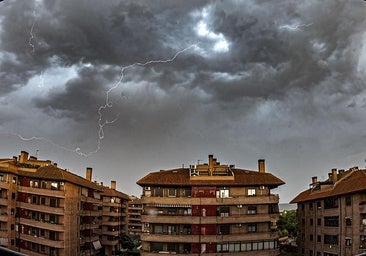
"This spell of hot weather will be accompanied by the arrival of airborne dust and uncertainty is set to increase from Friday, 4 August, with possible storms."
![[]](http://static.vocstatic.com/voc26/latest/assets/images/favicon/surinenglish/apple-touch-icon-57x57.png)