Nature
Cueva de la Herrera: the Malaga trail that leads to a secluded spot among the caves
This easy, popular, though not official, route leads visitors to a series of caves and rock shelters in the woodland surrounding Fuente del Acebuche in Alhaurín el Grande
Javier Almellones
A linear trail connects the area around Parque de la Libertad in Alhaurín el Grande with Herrera Cave, on the northern slopes of the Sierra de Mijas, within the Fuente del Acebuche forest complex.
Despite its proximity to the town centre, the route passes through a little-known landscape dotted with caves and rock shelters.
Route information
Area: Guadalhorce Valley
Municipality: Alhaurín el Grande
Difficulty: Easy. Apart from one gently sloping section, the route requires little physical effort. The main challenge is locating the narrow path that leads directly to the Herrera cave.
Type of route: Linear
Approximate duration: 45 minutes (one way)
Distance: 1.9 kilometres (one way)
Minimum elevation: 274 metres
Maximum elevation: 369 metres
Nearby attractions: Parque de la Libertad, Fuente del Acebuche, the Nuestra Señora de la Encarnación church, Arco del Cobertizo, the Museo del Pan (Museum of Bread) and the Urique tower, among others.
Related story
Getting to the starting point
The walk begins near Parque de la Libertad, in the southern part of Alhaurín el Grande, on the upper edge of the town centre. Several car parks are available nearby. Visitors can reach the park easily either from the town centre or via the A-404 road, which passes through Alhaurín el Grande.
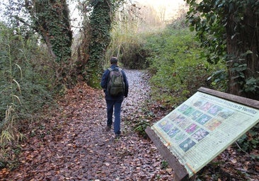
1. From Parque de la Libertad to Camino de las Peñuelas
The route starts at Parque de la Libertad. Walk northeast towards Camino de las Peñuelas. Signposts for one of the stages of the Gran Senda de Málaga already appear here, and the route briefly follows part of that long-distance trail. The surroundings still combine residential properties and farmland, while offering the first views of the extensive pine forest covering the northern face of the Sierra de Mijas.
2. Follow the asphalted road
After approximately 400 metres along Camino de las Peñuelas, leave the main route and turn right onto a paved lane that runs almost parallel to the foot of the mountains. This section is comfortable and largely flat, passing old rural properties, Mediterranean vegetation and the first panoramic views of the Fuente del Acebuche woodland.
3. Find the narrow path
After about 600 metres, look out for one of the key points of the walk. Just beyond a sharp 90-degree bend, a narrow path climbs uphill on the left-hand side. The easiest landmark is the wall of a private property, which stands almost beside the entrance to the trail. Although the turning can be easy to miss, it becomes straightforward to identify once you know what to look for.
4. Climb towards the caves
From here, the route begins its first noticeable ascent, although the gradient remains fairly gentle. The path initially follows the property wall before gradually entering denser vegetation. The landscape quickly takes on a more mountainous character, with Mediterranean pine woodland and limestone outcrops becoming increasingly prominent.
After around 400 metres along this narrow trail, some of the caves and rock formations that characterise the area start to come into view in the distance.
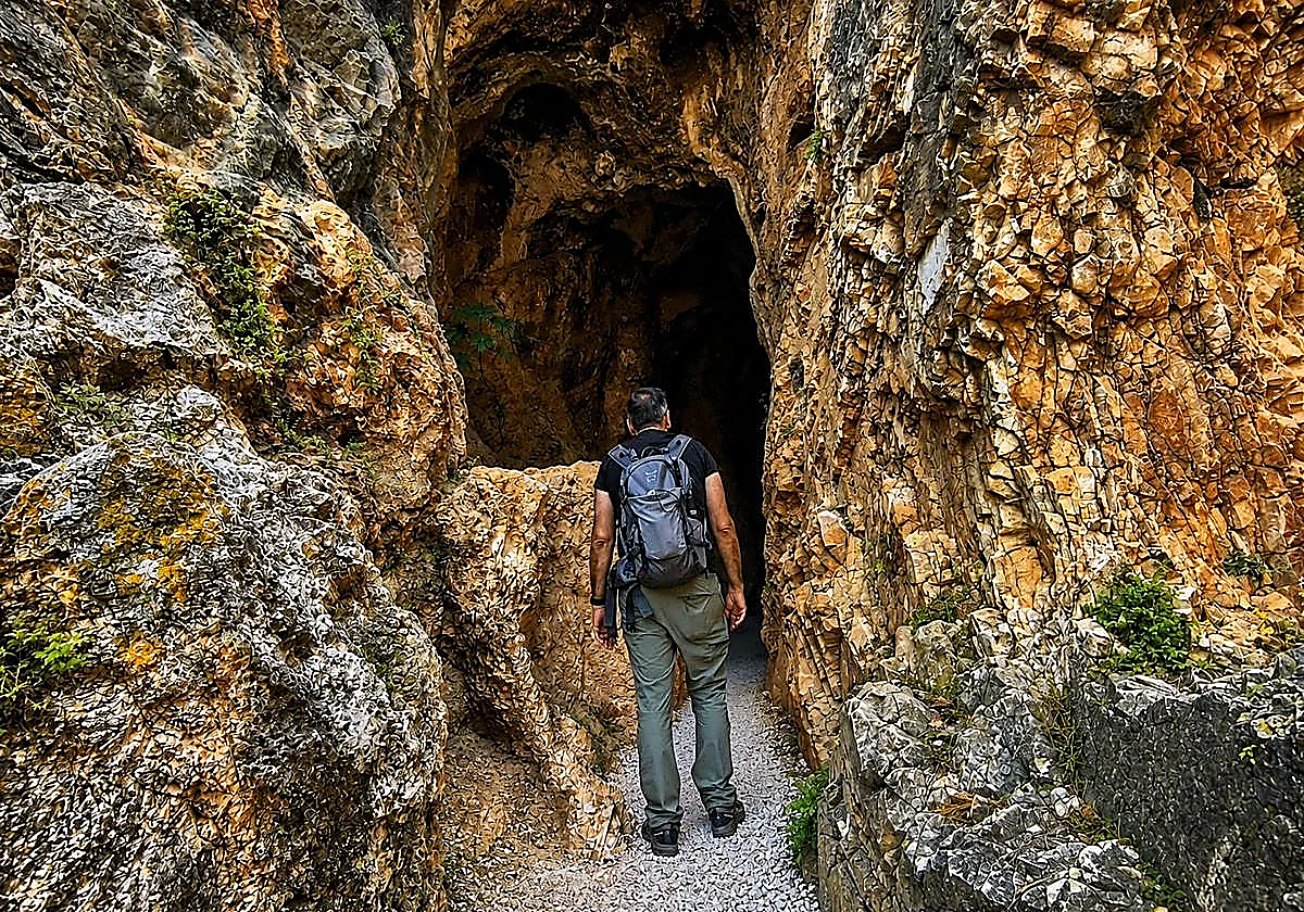
5. The Herrera cave and the Sendero de las Siete Cuevas
After walking approximately 1.6 to 1.7 kilometres from the starting point, the route reaches its most striking section. Here, several rock shelters and caves carved into the limestone appear on both sides of the path.
The most impressive feature is the Herrera cave itself. Its large entrance and considerable depth make it particularly striking, especially given how little known it remains despite being so close to Alhaurín el Grande. Visitors can explore a short distance inside, although the passage gradually narrows until further progress becomes virtually impossible.
Some walking guides also refer to this area as the 'Sendero de las Siete Cuevas' ('The Seven Caves Trail'), a reference to the number of caves and shelters scattered across this part of the mountainside.
Hikers wishing to extend their outing can continue climbing and connect with other trails within the Fuente del Acebuche forest complex, a network of paths crossing pine woodland and various sections of the northern slopes of the Sierra de Mijas.
Flora and fauna
The route passes through one of the densest forested areas on the northern side of the Sierra de Mijas. Mediterranean pine woodland dominates much of the landscape around Fuente del Acebuche.
Alongside the pines grow many species typical of Malaga's Mediterranean scrubland, including wild olive trees, mastic shrubs, dwarf fan palms, rockroses, junipers and carob trees. Aromatic plants such as rosemary, thyme, fennel and Mediterranean sage are also common.
As the trail approaches the Herrera cave, the scenery becomes increasingly rocky due to the abundance of limestone formations and natural rock shelters. Vegetation in this area has adapted to steeper, stonier terrain.
Wildlife is equally diverse. The Sierra de Mijas supports numerous woodland birds. Visitors may spot sparrowhawks, kestrels and booted eagles soaring above the slopes, along with smaller species. Mammals in the area include foxes, hedgehogs, Iberian ibex and, in quieter parts of the forest, wild boar.