
Summer escapades
Ten fascinating facts about Malaga province's Maro cliffs
A waterfall overlooking the sea, a mysterious sanctuary, watchtowers and an old barracks converted into accommodation reveal the other side of this protected area on the border with Granada province

Málaga
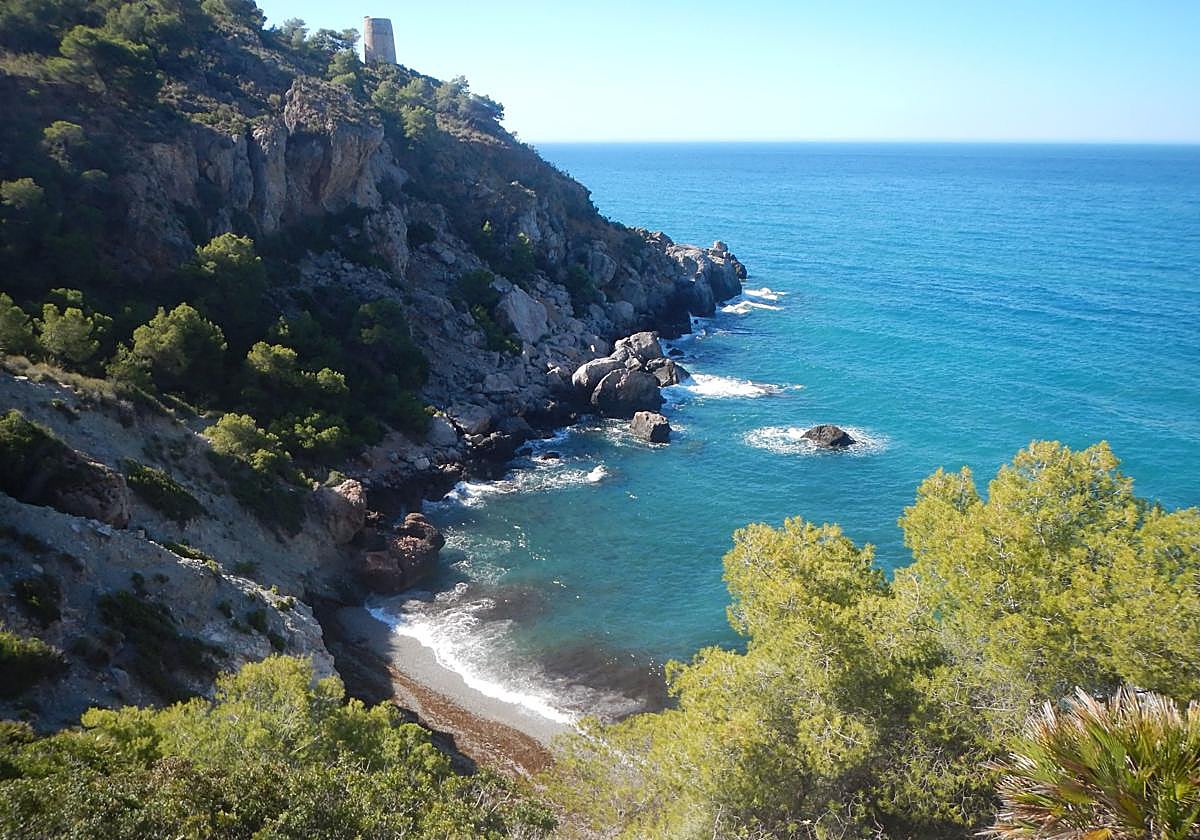
A waterfall plunging into the Mediterranean or a mountain goat descending at sunset right down to the water’s edge. These are just two of ... the captivating images that can be seen at the Maro-Cerro Gordo Cliffs, on the border between the Costa del Sol and Granda province's Costa Tropical. These protected cliffs also conceal a cove with three names, a small chapel of uncertain origin, ancient watchtower paths and an old Guardia Civil barracks which has been converted into holiday accommodation.
This enclave is not just a succession of beaches with crystal-clear waters. Its ravines are the final foothills of the Sierra de Almijara before the mountains plunge into the sea, while beneath the surface lies an ecosystem of immense richness. Added to this biodiversity are centuries of history, ranging from the watchtowers erected to detect pirate raids to the facilities used in the post-war period to monitor the movements of the maquis.
During the summer, access by private vehicle to its coves is restricted, and visitors must use authorised shuttle buses. Another option is to put on your walking boots and explore the footpaths, always during the cooler hours of the day. You can also paddle out in a kayak, admire the view from the lookouts or take a dip in waters that preserve much of the area’s natural heritage.
-
1
A landscape that stretches beyond the province of Malaga
Its full name already gives the first clue: the Maro-Cerro Gordo Cliffs Nature Reserve. Maro belongs to the municipality of Nerja in Malaga province, but Cerro Gordo is situated in Almuñécar, in the province of Granada. Both sides form a single stretch of coastline some twelve kilometres long, with no visible boundary between their cliffs, seabed and ravines.
The Malaga section includes beaches such as Maro, Las Alberquillas, El Cañuelo and Cala del Pino. Heading eastwards, you reach Cantarriján and Cerro Gordo, which are already in the province of Granada. Some routes even allow you to set off from El Cañuelo, pass by Cala de la Doncella and continue on to Cantarriján.
Malaga and Granada share the same protected landscape, which stems from the Almijara mountains, a continuous range that forms part of both provinces, stretching all the way to the Mediterranean.
-
2
The greatest wealth lies hidden beneath the waves
The cliffs and coves are its most visible features, but a key part of the area lies beneath the sea. The protected area does not end at the shore, but extends approximately one mile out into the Mediterranean Sea. This underwater strip explains many of the restrictions imposed on navigation and certain recreational activities.
Fish, crustaceans and molluscs can be seen in the crystal-clear waters. Species found in the area include moray eels, conger eels, groupers and gilthead seabream, as well as animals that can venture into more open waters, such as the loggerhead turtle. The submerged walls and numerous cavities provide shelter for much of this wildlife.
A simple pair of diving goggles is all it takes to appreciate some of this natural wealth close to the shore. Scuba divers can explore some truly amazing places. Protecting this area, therefore, is not just about the beauty of its beaches: much of its true treasure lies hidden from view on land.
-
3
A freshwater waterfall over the Mediterranean
The Cascada Grande de Maro originates in the Sierra de Almijara mountains and flows through the Sanguino or Campillo ravine and eventually plunges from a height of around fifteen metres straight into the sea.
Its appearance changes significantly depending on rainfall and the agricultural use of the Nacimiento de Maro spring. In 2024, it barely maintained a low flow throughout the summer. A year later, it regained a much more spectacular appearance, and this summer of 2026 it continues to flow strongly.
Large groups of kayaks and stand-up paddleboards regularly gather beneath the waterfall, passing through the curtain of water to experience an shower of fresh water right in the middle of the Mediterranean. It is worth noting that this is a natural phenomenon determined by the availability of water and by the traditional agricultural practices of the Maro and Tetuán floodplains.
-
4
Another landscape, stroke by stroke
The cliffs look completely different when viewed from the sea. From a kayak or a stand-up paddleboard, you can appreciate the true height of the cliffs, the entrances to small caves, the ravines that lead down to the coast, and the coves that are barely visible from the road.
The most popular walk starts at Burriana beach in Nerja. From there, it is approximately two kilometres to the Maro Waterfall, one way. At a leisurely pace, the walk can take around an hour each way. A less demanding alternative is to set off from Maro Beach, situated about five hundred metres from the waterfall.
Before setting out, it is essential to check sea conditions and the wind forecast. The terral and other onshore winds can quickly push boats away from the coast. It is also advisable to paddle parallel to the coastline, protect your mobile phone and never leave your kayak or paddleboard behind if you get into difficulty, as these are your main means of flotation and visibility. At present, both kayaks and stand-up paddleboards can be hired from active tourism companies operating in both Burriana and Maro. They offer guided tours lasting two and a half hours, which also take in other unique spots, such as the cave known as Cueva del Lobo.
-
5
A small, idyllic cove known by three names
Cala de la Doncella, Cala de las Doncellas, Cala de la Vaca or Cala de los Genoveses. The small sandy cove situated between the Peñón del Fraile and the Torre de la Caleta has several names, although in recent years the most romantic of them all has become the most widely used.
It is just fifty metres long and about four metres wide. Its size, however, is not its most distinctive feature. The real challenge is reaching the shore. It can be seen from the upper footpaths, but the descents from El Cañuelo or Cantarriján involve narrow passages, steep slopes and terrain with loose stones. It is not a walk recommended for children, people who suffer from vertigo or inexperienced walkers.
The most sensible option is to reach it by kayak from one of the nearby beaches. As it lies within a protected area, motorised boats are not permitted to approach it. Its remote location also calls for a sense of responsibility: given its small size, it cannot accommodate large groups or behaviour that disturbs the environment.
-
6
The towers that watch over the coast and a recent absence
The ancient watchtowers dot the skyline of the cliffs. From these towers, the arrival of ships was monitored and signals were relayed to other defensive posts. Towers such as those at Maro, La Caleta, El Pino and Cerro Gordo are still standing, some of which can be reached via paths and trails.
The Maro Tower, built in the 16th century, is the westernmost tower in the protected area. Its surroundings now serve as a viewpoint from which visitors can see the waterfall, Maro beach, Las Alberquillas and much of the Nerja coastline.
Related story
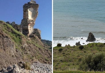
Since 5 February 2026, however, a piece has been missing from this system. The westerly storm associated with Storm Leonardo toppled the last remaining parts of the Molino de Papel tower, also known as the Torre del Río de la Miel. It had been rebuilt in 1751 on the site of an earlier 16th-century fortification and had been in a state of serious disrepair for decades. Its physical disappearance has altered the landscape and meant that the tower can now only be recognised in photographs.
-
7
The small chapel, the origins of which remain a mystery
Next to the path leading down to El Cañuelo stands a modest building dedicated to Saint Jude Thaddeus, popularly known as the patron saint of difficult or desperate causes. Its small size means it could be described as a chapel, a niche or a small house of prayer.
Many visitors pass by without even noticing it. It isn't as tall as other towers and many are distracted by the spectacular waterfall and the famous coves, but that is precisely where much of its appeal lies. It appears unexpectedly amongst paths, pine forests and ancient defensive structures.
The available documentation does not clarify who built it, on what date, or why that particular spot was chosen. Nor does it appear to be linked to any historic parish or major pilgrimage. This seemingly anonymous origin adds yet another small mystery to the Maro Cliffs. Whilst other features can be explained by military, agricultural or surveillance needs, this simple token of devotion remains without a known history to account for its presence.
-
8
Sleeping in a former barracks that used to keep watch over the Maquis
El Delfín and El Velero are amongst the most unique places to stay on the Malaga coast. They are currently two separate holiday cottages, but for much of the 20th century they formed a single Guardia Civil barracks situated almost right on the beach at El Cañuelo.
The barracks were established during the 1940s. In the immediate post-Civil War period, various outposts were established between Torre Macaca and Cerro Gordo to control the rugged coastline and monitor the movements of the anti-Franco guerrillas, known as the Maquis. When that role became obsolete, the facilities were abandoned or dismantled.
The Cañuelo property was put up for auction in the 1970s, having already been divided into two separate properties. Its poor condition, difficult access and the lack of basic utilities at the time made its restoration a challenge. Over time, it was refurbished and converted into rural accommodation. Today, you can spend the night overlooking the Mediterranean in the very same rooms and on the very same terraces from which, decades ago, one of the most isolated stretches of the coastline was patrolled.
-
9
The mountain goat that seeks the sea
Not all surprises come from the water. The mountain goat, a common sight in the Sierra de Almijara, also roams the slopes and pine forests that slope down towards the beaches. It can be spotted during the day along some paths, and in the late afternoon, it is not uncommon for several goats to make their way down to the coast in search of water.
The scene helps one to understand the geography of the area. Although the peaks of Almijara may seem far away, the cliffs are in fact their final foothills before plunging into the Mediterranean. That is why an animal normally associated with high mountains can end up walking just a short distance away from sunbathers, kayaks and beach bars.
The encounter should be enjoyed without disturbing the animals. You should not approach them, chase them to take photographs, or offer them food. Silence and keeping your distance allow you to observe them without disturbing their behaviour. As the sun sets, when the temperature drops and there are fewer people around, your chances of witnessing one of the most extraordinary sights on the Malaga coast increase.
-
10
A spot that can also be explored on foot
Exploring the area on foot allows you to take your time discovering its viewpoints, towers and coves, while also turning your visit into a day of physical activity.
One of the easiest options is the Torre de Maro circular walk. It is about two kilometres long, can be completed in around forty minutes and runs largely along relatively easy dirt tracks. From the watchtower, you can enjoy one of the most sweeping views of this stretch of coastline.
You can also take a downhill path instead of taking the shuttle bus to El Cañuelo. It is a relatively easy path with some shade. Returning via this route is not usually as appealing as it involves an uphill walk, but there is always the option of taking the shuttle bus.
The circular route linking the aforementioned El Cañuelo beach, Cala de la Doncella and Cantarriján is more challenging. It is around 6.7 kilometres long and takes about two hours and forty-five minutes to complete. Some sections are narrow, poorly signposted or run alongside steep cliffs, so the route requires experience, suitable footwear and a head for heights.
In summer, you should always avoid the middle of the day. There is little shade, slopes make it feel even hotter, and you need to carry plenty of water. Walking early in the morning or in the late afternoon is not only safer: it also makes it easier to experience the landscape when it has regained its tranquillity.
![[]](http://static.vocstatic.com/voc26/latest/assets/images/favicon/surinenglish/apple-touch-icon-57x57.png)